
Our resolve to be safe, distanced, masked and non-contaminated/contaminating remains firm, but our sanity is wavering. It’s time to seek some distance from the mask-less hordes at home and the senseless noise from the White House, out in wide-open nature.
The first few days took us quickly through Iowa, Nebraska and Colorado, on the way to pick up our stored Moho north of Denver. Though we don’t think of Colorado as home to crazies, we encountered what was an ultra-rightwing Proud Boy while grabbing supplies in Boulder. He pulled up as we were on the sidewalk and accused George of throwing him stink eye. Not the case, btw. A thick stream of obscenities, spit and vitriol followed from him, and we walked away as he drove off, still screaming. Was it our face masks? Our geeky hiker-looking clothes? We’ll never know, but it was a fresh reminder of why we need to get away from polarized society at this moment. We know things will get worse by November and probably thereafter. Good grief, we’re in for a bumpy ride.
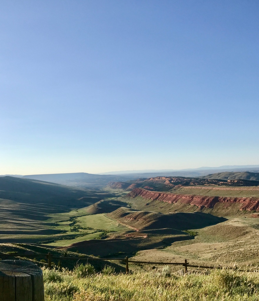
The drive north from our storage spot went on to Laramie, WY over a green, rolling landscape. This time of year, the state looks lovely. Our first true camping destination is westward: Lander, in the middle of the state and right next to Bridger-Teton National Forest. Without knowing, we’d selected one of the world’s top crag-climbing spots. And it is gorgeous here. No crag-climbing for us, but we’ve been driving some of the scenic roads to get altitude-acclimated, and we cannot believe Lander is not more popular among hikers and outdoors people. The hiking trails are plentiful, and scenery is top-notch.
Last night we followed a recommendation to drive down Red Canyon Road, 5 miles of sheer visual bliss. This valley features a unique river-eroded cliff of deep dark red sandstone on one side, many, many large sandstone chunks which have tumbled from the cliffs into the fields around the remaining riverbed, and a set of grassy/brushy table-slopes on the other side of the canyon. The table-slopes resulted from eons of geologic force which moved the earth crusts of Nevada, Utah and Wyoming sideways into bizarrely slant-uplifted hills and mountains. You’ve heard me refer to the “table and range” mountains that predominate in these three states – well, here they are again, but this valley presents a very strange effect – like the top of a crooked mesa. A bit dizzying, but oh-so-beautiful. Interspersed are also many glacial moraines.
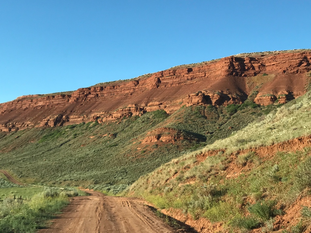
Red Canyon is managed jointly by the state of Wyoming, the BLM, the Nature Conservancy, the National Outdoor Leadership School (NOLS) and the Leave No Trace Foundation. The valley is winter range for 700 elk, as well as moose, bighorn sheep and pronghorn, so alfalfa is raised for the animals’ forage and there is abundant bitterbrush and sage for them to feast on, as well.
Also tucked away in the canyon is the NOLS Wilderness Medicine campus, where students are taught how to render emergency aid in the middle of nowhere. Striking setting.
So far, our pronghorn sightings are around 100, many more than we’ve seen on previous drives through Wyoming. Locals say that the herds are in very good shape this year. So good to hear! Pronghorn are an interesting species, not antelope at all. They are intensely shy and ignore the lush green grasses available, preferring to browse on brushy shrubs and sage. Their range doesn’t seem to overlap with that of the mule deer. They’re mostly seen in small groups of two to 10, but one night we saw 25 of them on a ridge – what a thrill!

Today we drove down to South Pass, a concentration of old gold mines and the communities that supported them. The state has done a great job of preserving 30 original buildings from the 1865-1890 period, all on one of the mining town’s main streets. What a harsh life they lived. But there was no stinting on saloons, alcohol, card-gambling or the world’s oldest form of entertainment for men with fresh cash in the pocket.
The landscapes in this area remind us a bit of Washington’s Palouse region (a great expanse of rolling high hills), but even if they are still green from spring rains, Wyoming’s hills will soon be a scorched tan or white. Most of the precip. WY gets per year is snowfall. Greenery not lucky enough to be next to a river will soon be burned into dormancy by the sun.
Our last hike in the area was a 4.6-mile outing in the Sinks Canyon State Park, a 500-million-year old gorge comprised of sheer cliffs of dolomite limestone, grey sandstone, metamorphic gneiss and granite. We walked along the Popo Agie river, a very lively tumbling river of snow melt and spring water that forms a unique trapped pool for native trout after it flows through karst (limestone) caverns. The trout are huge, and they cannot be fished at this location. Good for them!
Tomorrow is onward to Dubois, WY and then West Yellowstone!
————————————————–
This was a short commute down the road to our next overnight, because we’re just shaving off the miles to West Yellowstone in 24 hours. Dubois was on the list because it is a stone’s throw from the north end of Grand Teton National Park, but it is not highly populated and has lots of promising territory for hikes…. or so we thought.
We pulled into the campground around 9:30, got the Moho docked and set up for the day/night, and promptly took off for Union Pass Road, a 70-mile dirt road over Union Peak (9500’).
From the summit, you can see three different mountain ranges in the Bridger-Teton National Forest. The drive was gorgeous, but there are NO marked trailheads on this road. We followed it in/up for 20 miles, and nary a hiking trail in sight. Our typical online guides also displayed no reviewed or charted trails, either. Now maybe 20 years ago I would have been fine to strike out overland and way-find on my own, but not now. Especially knowing that this is Grizzly Territory. Nope.
So, we had a lovely drive at 9,000’ instead, and a short walk up to the Union Pass Memorial Marker, which informs travelers of the history of this pass going back 10,000 years.
Union Pass is where four national rivers meet (the Saskatchewan, the Snake, the Yellowstone, and the Green/Colorado), and from where you can see the Gros Ventre Range (with Doubletop Peak at 11,720’), the Absaroka Range (with Frances Peak, at 13,153’) and the Wind River Range (with Gannett Peak, at 13,804’ the highest mountain in Wyoming).


We were totally gaga over the wildflowers, which are making the most of their short summer and densely carpeting the meadows and riverbanks. The mountain streams all look cerulean blue and crystal clear, and fly fishing is cherished by many up here. No grizzlies were spotted, just a couple of mule deer and pronghorns.

Sorry to say, Union Pass Road up to the US Forest Service land boundary is being developed for and by ORV enthusiasts. Big weekend getaway log cabins are pretty thick halfway up the mountain, and since today is Saturday, the ORV traffic is pretty thick, as well. The Forest Service has posted warnings that if people cannot respect nature and stay on trails/roads, they will have to close the back country to ORVs. Take your pick, folks.
We won’t be back to Dubois. Not our jam. Few marked trails, lots of ORVs (and more Trump 2020 signs than we’ve seen anywhere else) is not what we are seeking. But the mountains are divine.
——————————————
It’s Sunday morning and we’re headed westward across scenic Togwotee Pass. It crosses the Continental Divide at 9650’, built on a historic trade route for the Shoshone tribes.

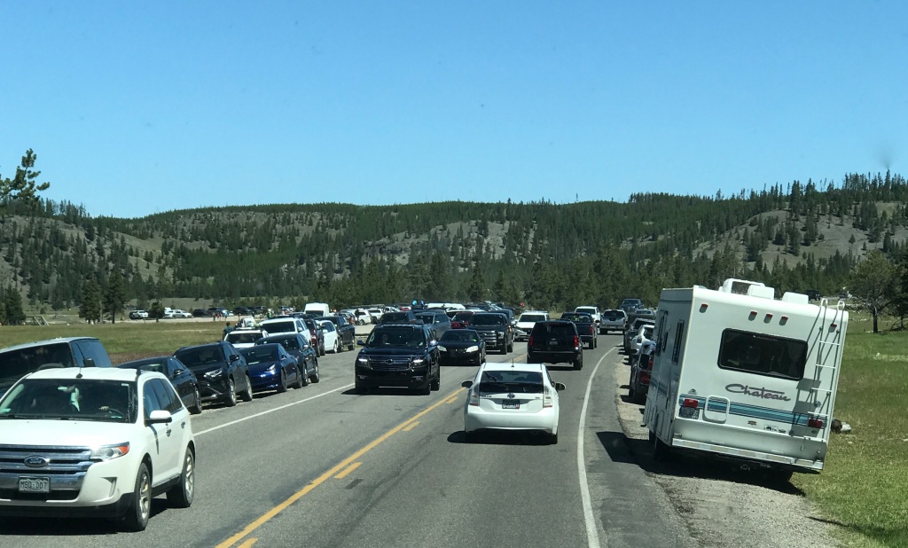
This highway leads to Moran Junction on the boundary of Grand Teton National Park. We want to see how crowded the area is, once we get to two of North America’s most beloved National Parks (Teton and Yellowstone). Will there be room for us to enjoy them with social distance and some semblance of nature being dominant?

Well, on a beautiful, sunny Sunday afternoon, the answer is: not really. In a normal year, Grand Teton and Yellowstone National Parks get over four million visitors. This year, even without the usual international visitors and large tour busses (in 2020 there are neither), the parks are overflowing. Traffic seems very heavy, but we have to keep in mind that we are not normally traveling the US in summer months. We’ll see about tomorrow when we hit the trails at 7:30am, before most folks are up.
We’re staying 40 minutes away from our target trails, at a USFS park on Hebgen Lake, MT. It’s gorgeous over here, smelling of spruce and blessedly quiet. We love it.
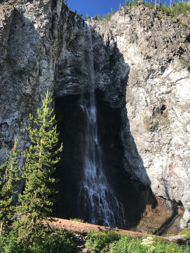
OK, it’s Monday, and we practically had the park to ourselves at 7:30! Very few souls around. Perfection on the trail (except for some hungry mosquitoes). We tooled around Biscuit Basin to see the Sapphire Spring and quite a few geysers, then headed up to see Mystic Falls, a round trip of 3.75 miles. Shorter than usual, but still getting our altitude tolerance built up. We’ll double that tomorrow.
OK, it’s Monday, and we practically had the park to ourselves at 7:30! Very few souls around. Perfection on the trail (except for some hungry mosquitoes). We tooled around Biscuit Basin to see the Sapphire Spring and quite a few geysers, then headed up to see Mystic Falls, a round trip of 3.75 miles. Shorter than usual, but still getting our altitude tolerance built up. We’ll double that tomorrow.

By the time we finished our hiking and viewing today, crowds were building to a level even higher than yesterday. We won’t be able to move easily around the park or see the major attractions if not out and ready by 7 – 7:30AM. It’s pretty nuts. Crowds are 50/50, masks and no masks. Yes, the early birds stay safe!

Second day of early-bird hiking proved that others have caught on to our 7am start time, and we’ll have to improve on our early start tomorrow! This morning’s hike passed Grand Prismatic Spring at the Midway Geyser Basin, for 5 miles to Fairy Falls. Totally flat terrain (easy hike). George had his bear spray and I had my bear bells, as signs indicated bears do frequent that neighborhood. No sightings of them this time.
Fairy Falls is lovely, airy and wispy — just what you’d imagine from the name. Apparently, the many pines in the forest along the way don’t mind the various chemicals in the ground from the geysers, hot springs and steam vents. On the way back to the car, we ascended the Grand Prismatic Lookout Trail – and joined 35 other people on the viewing platform — to see the famous landmark from above. The colors in the basin are spectacular, but the springs are very foggy in the 45-degree morning air.
We crossed paths with a mid-40s father and his teenage son who were avid hikers. The father wanted to tell us about their exciting foray down the Boiling Springs Trail, and I was making mental note of it when he let slip that the trail is officially closed, but they sneaked down it anyway. The next thing he enthusiastically described was the cleaned carcass of an elk or deer, with the femurs scraped clean. To my ears, it sounded like a relatively fresh kill. This is likely the very reason the trail was closed, to keep hikers out of a region where one or more large predators are guarding and feasting on a carcass. It’s wise to keep in mind that trail closures are more often than not done for hikers’ safety. Don’t risk becoming a grizzly’s next meal.
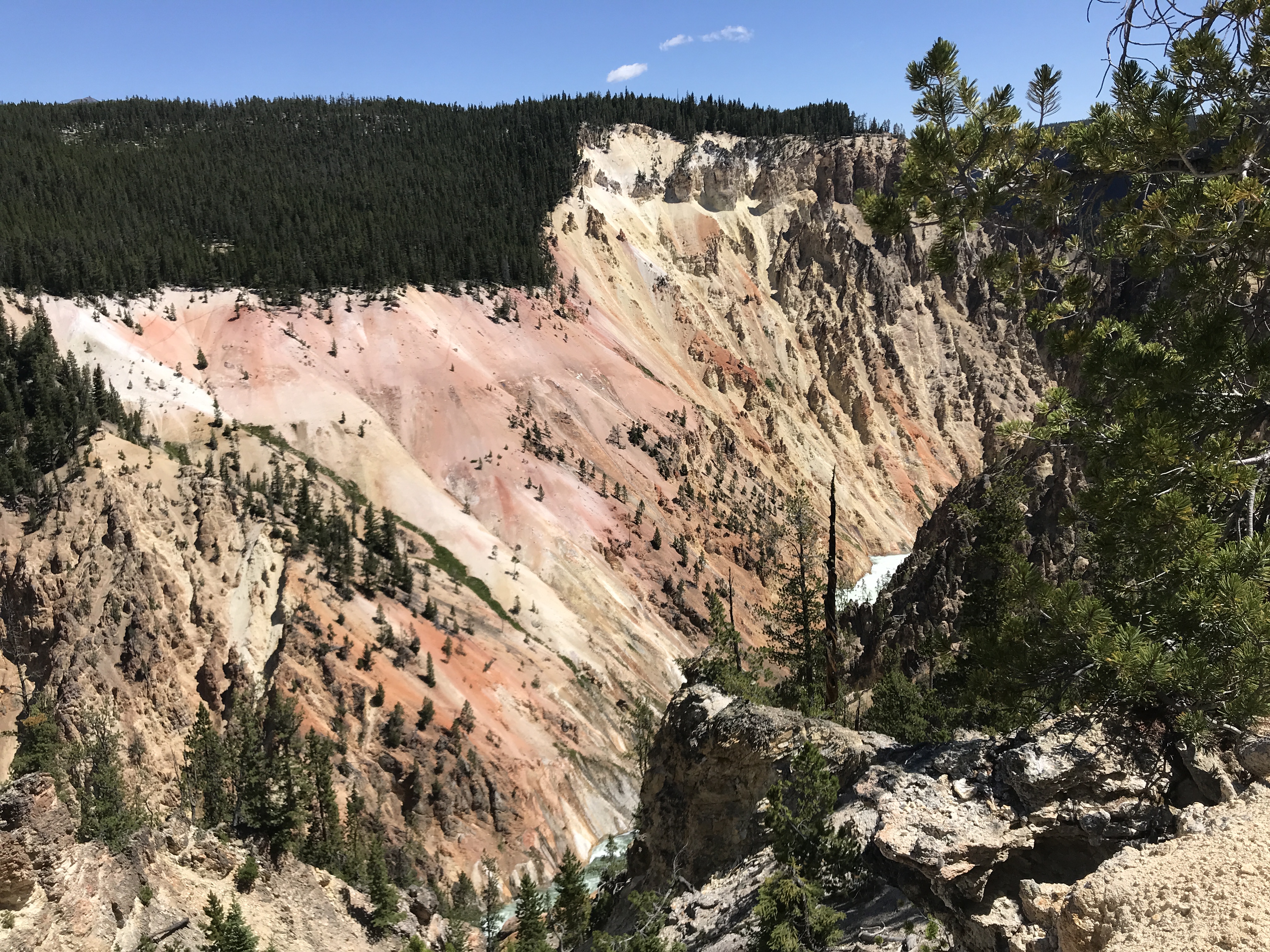
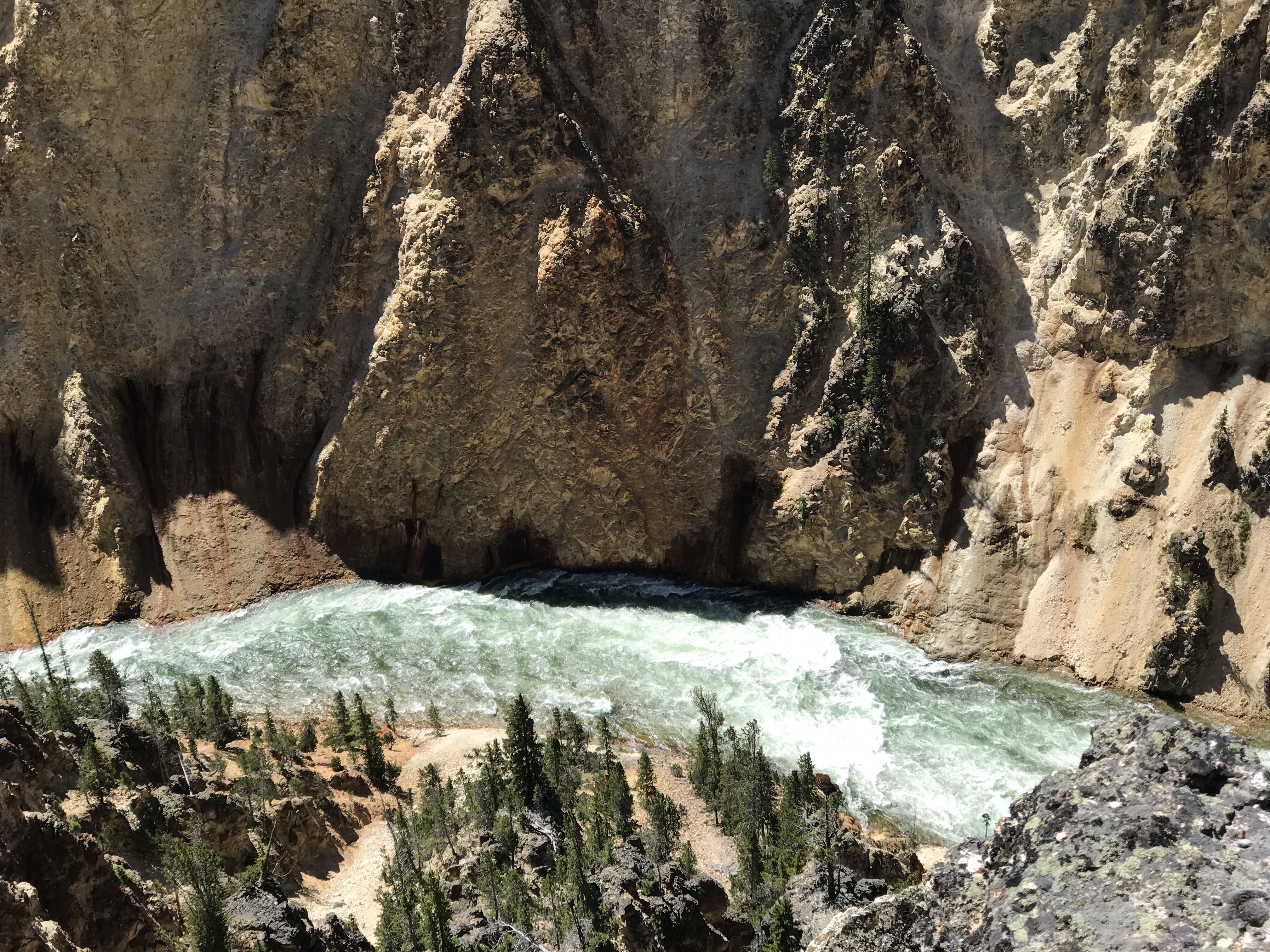
We drove to Canyon Village where the Lower and Upper Falls in the “Grand Canyon of Yellowstone” can be viewed. Very crowded walk, but how resplendent the falls are!!! These are the iconic images (along with Old Faithful) of Yellowstone. Speaking of which, the area’s tribes named it Yellowstone Valley because the ground chemistry had turned the red rhyolite along the banks of its main river to pale to vibrant yellow colors. One sees it in the now century-old Headquarters Building and Visitor Center in Mammoth Hot Springs (northern gateway to the park), where the yellowed rhyolite was used exclusively in their construction.


Half of the world’s geysers and geothermal features are found here in Yellowstone National Park! They are fueled by the ongoing vulcanism just under the surface of the park’s gigantic caldera, which has violently erupted multiple times in the past two million years. A great deal of hot magma remains close to the surface, and many rivers, streams and underground water flows enable the vertical tubes of the geysers and springs to be continuously full and erupting.
——————————————–
Today was our last day in Yellowstone National Park, and we enjoyed it, taking in a five-mile hike to Bunsen Peak, an 8,600’ rhyolite mountain near Mammoth Hot Springs. We managed a 1300’ elevation gain with no altitude issues, so we must have our high elevation legs by now. The lookout views over Mammoth’s geologic features and the nearby Gallatin Range, as well as the Golden Gate Valley with Gardiner River flowing through its canyon, are breathtaking. Evidence of the 1988 fire can be seen on the mountain’s northeast slope, while looking northwest you can see the limestone hoodoos. What a great view 360-degrees around at the summit.


We decided to take in the Lower Mammoth Basin as a final stop, once again very crowded by 11am. Fully masked and protected, we struck out on the boardwalk to see the pools and cascades. Less than half of the other visitors had masks, and it seemed that the ones without masks were a grumpy, non-communicative lot, as most couldn’t be bothered to respond when greeted with a “good morning.” Disappointing to see so much stress and malcontent evident in the crowd.


Stopped at Obsidian Cliffs and Roaring Mountain on the way back to our campground – two great sites for geology. The former is a singular spot where lava from a volcanic eruption cooled so quickly that the slopes became entirely covered in black obsidian. Of course, over the millennia the cliffside has broken up during earthquakes and the obsidian is now cracked into enormous boulders, but the site is still very impressive. Roaring Mountain is an ash and clay-covered, unvegetated slope where Sulphuric acid is present in the underground water and as it rises to the surface and escapes as steam, it breaks down the rock present into clay and ash particles. This part of the park smells of nothing so much as Sulphur, but it’s not choking, just a strong reminder that you are in the presence of magical chemistry!
As we prepare to depart, our observation is that currently, we (and a whole lot of other people!) should not visit Yellowstone in the summer at all. Despite its compelling geology and spellbinding nature, it is simply too crammed full of people on short vacation schedules, rushing from one park feature to the next with little information in hand and making traffic flows so heavy and slow, it’s a wonder that they can experience any peace and quiet at all. Furthermore, whenever a wild animal appears on the landscape, a virtual parking lot immediately materializes on the road and people run all over to see and photograph the creatures. Feels very zoo-like. With a US population of 325 million people and only one Yellowstone, there is simply not enough park to go around during the summer months. We are fortunate to be free to visit in the Fall, and if we come back, we will limit ourselves to that timeframe.
We often wonder how much longer the major parks can fulfill their mission of preserving unique landscapes and wild species the way they have always existed together, while offering the ever-growing public a chance to safely experience them in a sustainable manner. It’s often been said that the public is loving the National Parks to death, and most people know that the NPS is hideously underfunded. We all need to work much harder to push for more NPS funding, and to make the lesser known parks, monuments and natural spaces as loved, visited and appreciated as the “Top Ten” are now. Altogether, national parks, national monuments and wildlife preserves (and spectacular state parks, which we’ve seen everywhere) number into the high hundreds. Part of the promotional budget of a fully funded NPS should make all citizens familiar with their appeal, and perhaps we need a lottery system to prevent the overcrowding that threatens the parks and depletes the full experience for their visitors.
———————————————————
Today is the first of three days at Craters of the Moon National Monument. As done previously, we sing the praises of NMs. They are less well-attended but generally really well managed and fun/interesting to see. This one is no exception.
But first, a bit of boondocking fun. I frequently read the blogs of rock-hounds like myself to get ideas of where to legally hunt for specimens on public lands, and recommendations for this area included the skirting around Fish Creek Reservoir north of the Craters Monument. So often one need go no further than the washes (runoff gullies) and roadsides nearby. As it was today. The recommender stated that there were jaspers, agates and petrified wood specimens to be found. We located and collected some jasper, some agate suspects, and some super-cool lava embeds (conglomerates that look as though tiny shells/pebbles are caught in a lava matrix). Some of this should tumble up into very interested polished rocks for our collection and be really fun to show kids when we do the next grade-school rock talk.
After rock-hunting, we went to the National Monument and did orientation to see what we want to return for over the next two days. By the time we arrived, temps had hit the 90s, so no further hiking today. But we have 4 – 5 nice hikes around the monument for tomorrow early AM and one nice hike up Arco Peak across from the monument the day after, which will give us an elevated lookout over the lava fields and Great Rift. Looks to be very engrossing!
————————————————
Up and at ‘em at 6AM this morning, we tackled the North Crater Trail at the Craters of the Moon. This 3.5-mile hike takes viewers past eruptions, flows and/or volcanic cinder cones that occurred/resulted every 2,000 years over the past 15,000 years. The most recent eruption happened just over 2,000 years ago, and rangers tell us that we’re 200 years overdue for the next one!
We could not have enjoyed this path more…. well, if we’d had our grandkids along, it would have been even better, but someday we’ll have them with!


North Crater path tells the story of the entire area, starting with The Great Rift, a 52-mile long crack that split open in the earth, through which tremendous amounts of lava flowed (as described above, every 2,000 years an upwelling would occur). You can see the flows on this trail. The magma pressure from underground also caused point explosions and eruptions, creating over 25 large cinder cones in the monument. Fifteen of them are visible on this hike.
The entire length of the path was compressed cinders, a bit like walking on pop rocks and rice krispies, with about 400 feet of rising and falling as we went from cone summits to crater bottoms. It was very easy to tell which side of the cones suffered the greatest blowout damage from their eruptions, as most were lopsided and the blast zone/direction is still evident today. But the lava flows were the most fascinating phenomenon of all.
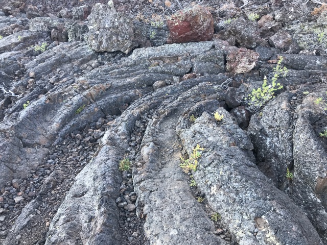
The temperature and flow characteristics of lava fall broadly into two categories: fluid, easy-flowing rope-like lava is called pa-hoe-hoe (hoe rhymes with OK), and when it solidifies, you can see the flowing lines and curves, and easily walk on its surface. It’s beautiful and organized.
The other category is thicker and more viscous (sticky), and it results in crusty, rubble-like, sharp-edged chunks. Quite chaotic looking. It is called ‘a’ā (I think of it as ouch-ouch, as you cannot walk on it without serious injury).
Pahoehoe lava looks a lot like saltwater taffy being pulled, or like a river of thick oil. It’s beautiful, sinuous, and somewhat lustrous. ‘A’ā lava looks like great hunks of black river bottom land just turned over by an excavator. Broken, matte, jagged chunks. Completely different textures.
So many other textures to observe: pumice rocks from coalesced airborne ash; glassy obsidian-like bubbly chunks from unusual concentrations of silica in the basaltic rock; dense chunks of solid gabbro or basalt that were at or just under the surface of the land before the eruption, and then flung by the explosion into heaps surrounding the lava flows; and strangest of all, perhaps: the empty tubes through which lava often flowed from the underground fissures. As the volcanic gases subsided, the pressure on the lava ceased and the tubes ran dry of lava. So now there are cave-like openings wherever there were previously gushing tubes of lava. So weird.
Two other trails were tackled before the day’s high temperatures made hiking impossible:


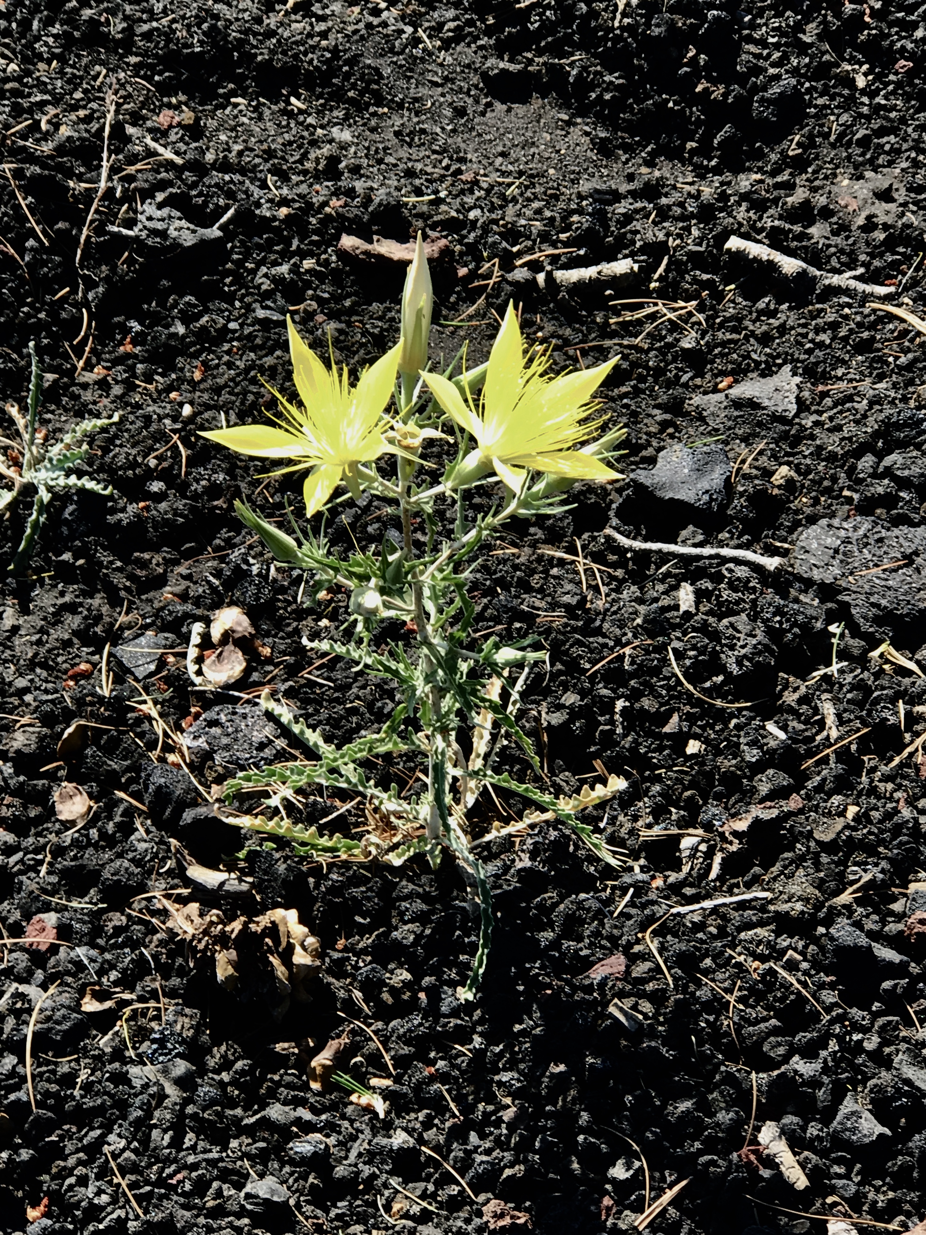
A one-mile hike to Inferno Cone, a 6200’ peak which offered a 360-degree view of the Great Rift crack and almost all cinder cones and lava fields in the near vicinity, and a 2.2-mile hike down Tree Molds Trail – showing us a paradise of blooming blazing star thistle, rabbit brush, syringa and Sulphur buckwheat plants, which had attracted millions of butterflies and unleashed a lovely mélange of floral and grassy scents for their enjoyment and ours. We also saw baffling imprints of lava which had flowed around both vertical and horizontal tree trunks and formed casting molds of their shapes. How this came to be without the trees themselves spontaneously combusting before the lava had cooled, we have no idea. No explanation was given. But they are there. Again, so weird.
And then there were the strange blue stains on the pahoehoe lava on Tree Molds Trail. These colorful light blue streaks look like they might be desert varnish. We were unable to find any reason on-site as to why they are seen only on this trail, but after some research, it turns out that they are probably desert varnish with residue of cyanobacteria (blue-green algae). PS desert varnish is formed by manganese accumulating from airborne clay, over a period of millennia. Why this happens, no one knows.


By the end of all three morning hikes, we were quickly transitioning from medium-rare to well-done, so we had lunch in the shade and then made for home, where we enjoyed Klondikes (ice cream slabs coated in chocolate!) in our Moho’s air-conditioned dining nook. Perfect!
Tomorrow we start our hike at 5:30am, to beat the heat!!!!
————————————————-
There’s only one thing I can say: anytime a hiking trail exists on top of an ATV roadbed, you’re going to get some very steep ascents and descents. Damn, this hike kicked our butts!!!!
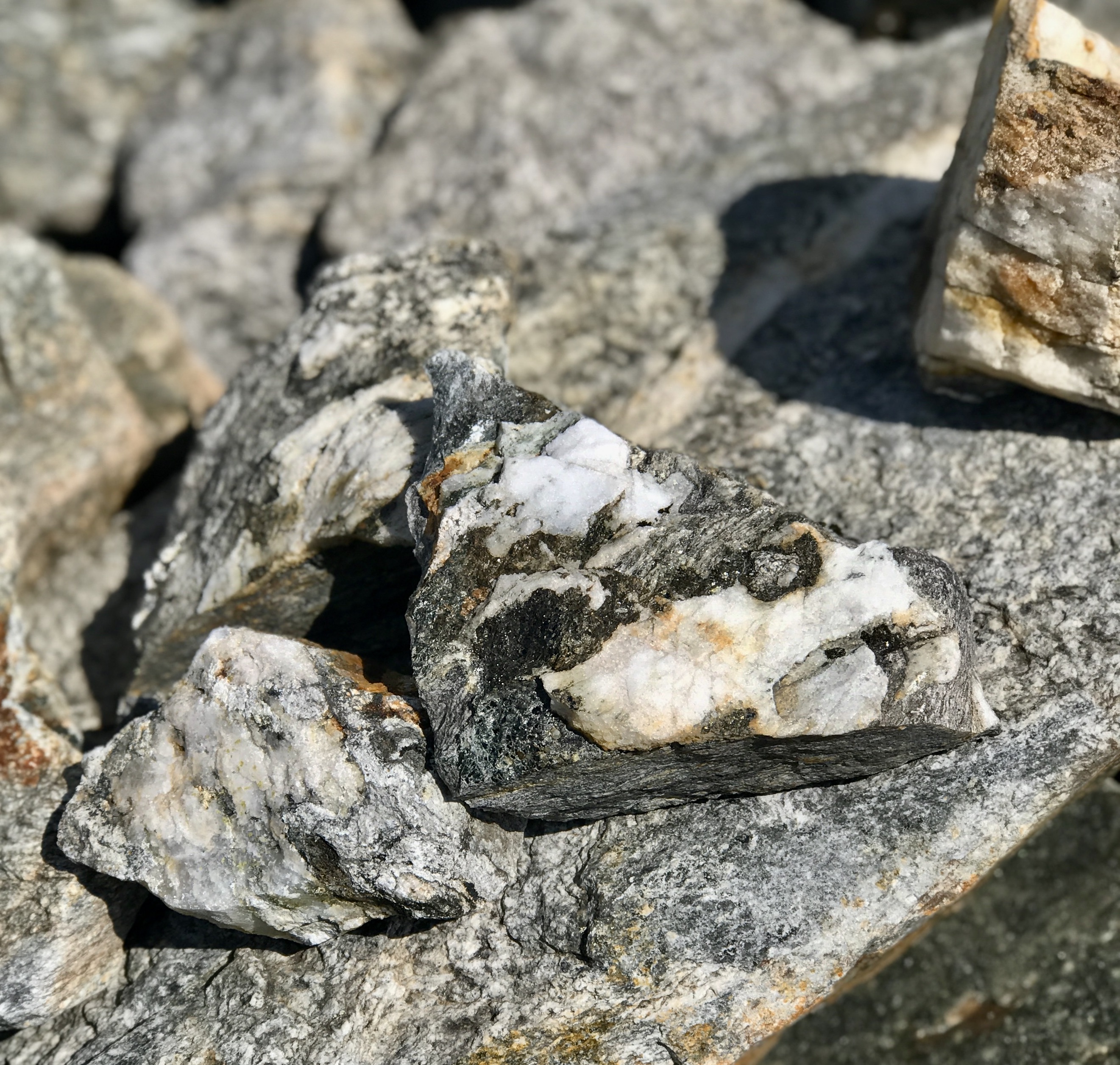
We definitely did start out at 6am to climb Arco Peak, part of the Lost River Mountain Range, and a very good thing we did. Temps were high 50’s, perfect for us, with a good southerly breeze. Lots of ups and downs going over the foothills, but the hike was overall a very quick ascent (2200’ over 2.3 miles). The slopes are a mass of slate and shale fragments, together with limestone and dolomite outcroppings and some evidence of hard quartzite layers that have been uplifted. I was geeked to see some of the same rocks we’d seen in the eastern range of the Alps in Valais, Switzerland. There even seemed to be some marble-like chunks that had resulted from the metamorphism of limestone. A few piles of calcium carbonate powder along the path.


Spectacular views of the surrounding valley (and irrigated crop circles), distant Mount Borah (Idaho’s highest peak), the Salmon River Range and the lava beds of Craters of the Moon could be seen from our eventual summit. Our pace today was probably the slowest on record for us, as we had to dig in on our tiptoes up the steep slopes…. That will do a number on your calves and thighs, for sure! The entire four-mile hike took 5 hours, what we normally expend on a 10-mile trail! No rodents or four-legged wild animals, but a magnificent red-tailed hawk on the hunt, and hundreds of swifts who nest in the quartzite crags. One flew by and the rush of air was audible. Man, they cut through the air like a sword!
The town of Arco (where our current campground is) has a strange tradition. Each HS graduating class paints its year on the side of the foothills in white paint. To our eyes it’s pretty unsightly, given how gorgeous the rocky slopes are. But it’s been going on since 1929, so I don’t think it will stop anytime soon. Thank goodness you cannot see them from above!
Post-hike we dragged our sorry butts home for lunch, shower and a 90-minute nap. Hiking liniment will be liberally applied tonight! We’re outside in the shade at the moment, and two Swainson’s hawks are hunting above the campground. What a treat!
————————————
Today we arrived at our Glacier National Park campground just outside the park western boundary, and then set out for a reconnaissance drive up the Going to the Sun Road.
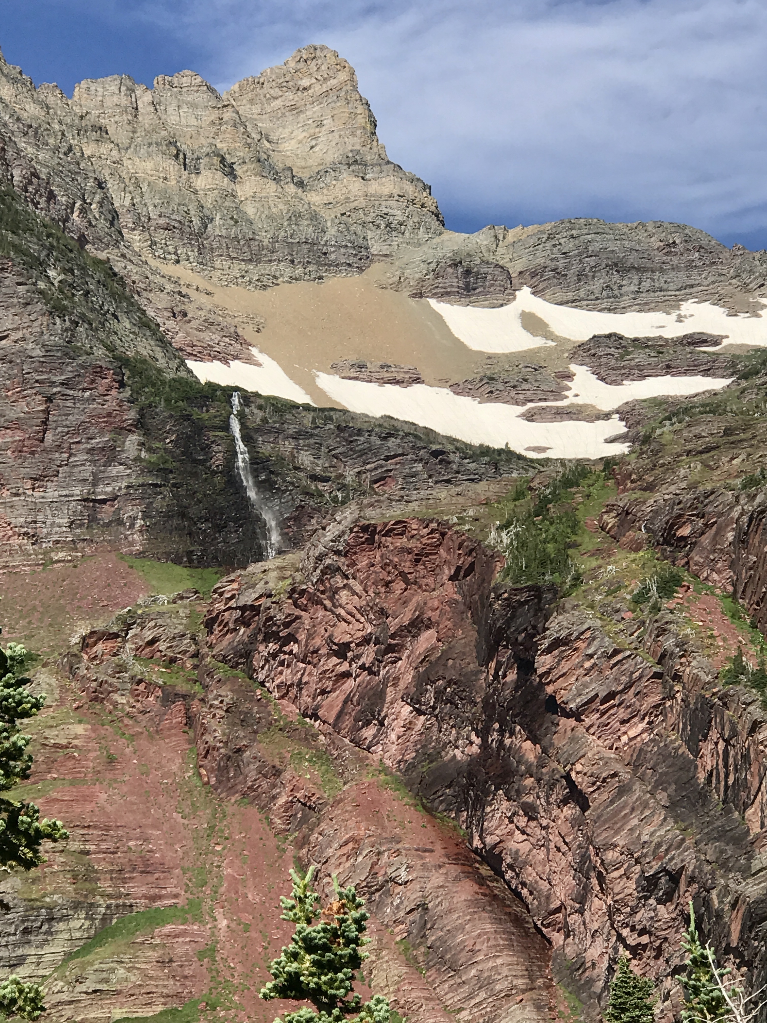
The experience was probably our most eye-popping intro to a National Park. Ever. We really had little idea what awaited us on this narrow highway, all the way to Siyeh Bend (30 miles from west to east). The Park is closed on the east side due to concerns about potential exposure of the Blackfeet Reservation to the COVID virus from tourists visiting Glacier this year, so Siyeh Bend is about as far east as one can drive.


Superlatives fail to adequately describe the majesty, power, scale and beauty of Glacier. From the clear Caribbean blue of Lake MacDonald to the lush brilliant greens of Glacier’s grassy slopes and firs, to the impossibly profuse flowering vegetation to the blindingly white glaciers and snowpacks, it’s a one-of-a-kind, otherworldly environment. The mountains are so densely packed and breathtaking, and the glacial rock features are so unusual for this continent (the arêtes and cirques are seldom seen in North America), that your heart and mind just tell you this is a place to be treasured forever.
We slowly progressed over the Going to the Sun Road, along with hundreds of other day-trippers, and got the lay of the land as well as hundreds of lovely photos of Glacier’s landmarks (Heaven’s Gate and Clements Mountains, Bird Woman and Haycreek Falls, The Garden Wall Arête, The Weeping Wall, Sacred Dancing Cascades and The Loop). The drive helped confirm that we need a super-early start to beat the crowds and the sun’s heat for all subsequent hikes. Even though we are missing access to two-thirds of Glacier’s attractions due to road closures, we’re already certain that this park will be on our top five list of beloved National Parks.


This morning we rose at 5am for arrival at the Siyeh Pass Trailhead at 6:30. At a starting temperature of 50 degrees, we knew we had a good chance of not overheating. The trail was billed at 9.4 miles RT, and there were only a few cars parked at the trailhead, so far so good.
The hike wound past a lovely stepped creek and then into a deep fir forest for several miles. Off in the distance we heard a bear grunting and were glad for our bear bells and spray. Many Pika were chirping to alert our presence, not at all shy but busily gathering food for their burrows. We did also spot a couple of hoary marmots, but they are much more reclusive and wary of people. The altitude gain of 2,000 feet occurred over 4.2 miles, unlike Arco Peak where we had the same gain over only 2 miles. What a difference. Today felt like a walk in the park!

The flowers are a riotous explosion of color all along this trail, but most prolific in Preston Park (wide meadow), 3 miles into the hike. Anemones by the millions, Glacier Lilies likewise, Paintbrushes in vibrant fuchsia, Lewis Monkey Flower, Western Bistort, Bracted Lousewort (!), Sitka Valerian, Willow Herb, Mountain Arnica and several kinds of Alpine Heathers. Heavenly. Once we got to the switchbacks taking us to the top of the pass (last half-mile to the saddle), all of the flowers became miniaturized in size of bloom and length of stem. They hugged the gravel slopes and hung on despite the gusty winds. Up to the end of the tree line, all firs were more or less krummholz (short, stunted growth trees with very dense branches and lots of deformities). The path was very well engineered to ensure that hikers kept their footing and enjoyed both the up and down slopes.


Near the summit we saw numerous glacier remnants, including a gigantic cirque with a tiny glacier, slowly giving up meltwater to the U-shaped scree slopes so typical of glaciated mountains. All naturally flowing waters throughout this park are various shades of turquoise due to the minutely-ground rock flour suspended in the meltwater. So gorgeous.

All in, you can see more than five glaciers along this trail. And many, many vertical faces of mountains displaying the U-shaped carving out and gouge marks caused by millennia of glacial scraping.
At today’s summit, we settled down upon some rock fragments (and out of the gusty wind) to eat a protein bar and drink some water. My hat blew off from behind, so George gallantly ran after it and disappeared over the edge of the snow field. Thank goodness he promptly returned, hat in hand. My hero.

Another couple joined us in taking a break, about 100 feet further on at the summit. Suddenly we heard one of them call to us, “Look, a mountain goat!!” and I had just enough time to set my camera and capture a lone goat buck bounding over a large ice field from one side of the mountain pass to the other, 400 feet, lickety-split, with compressed snow flying in large clods behind him. What a thrill!! Not unlike a racehorse dashing for the finish line. Now that’s a once-in-a-lifetime experience!


The return hike back to the car was wonderful—of course, the downhill momentum was welcome, if not the many, many hikers just venturing out on the path. It is so tedious to fiddle with facemasks this year, we do look forward to not having to mess with them in the future. But who knows when that will be.


A stop at the Ice Cream Parlor at West Glacier Village was welcome today, as we had worked hard over the 5 hours of this hike. Compare that to the four hours we labored at Arco Peak two days ago, for only four miles round-trip!! Same altitude gain. We much prefer longer distance to spread the gain out, without the butt-kicking exertion!!
———————————————-
Today was an 8.8-mile hike to a high glacial lake (Snyder Lake), with the first mile through old-growth and recovering wildfire forests above Lake McDonald. The forest section was lovely, then came the bushwhacking through shoulder-high wildflowers and brush. That was less pleasurable, but it allowed us to see the unusual flowers and undergrowth that populates the high valleys. A hiker we encountered yesterday advised us to avoid another trail because it “had weeds up to your armpits, and you’ll have deerflies and mosquitoes bangin’ off your head the whole way!” Well, thanks to effective bug repellent, we didn’t have the latter. But for the claustrophobic at heart, it could have been anxiety-inducing. No animals along the way but did see a couple of large scree fields and thank goodness the trails across them are nicely packed down – no slipping and sliding downslope as we did occasionally in Colorado several years ago.
Once we reached Trail’s End at Snyder Lake, the path went right past tent-camping sleepers, so we had to whisper and try not to wake them. Yes, this was another hike where we’d gotten up at 4:30am to get out before the crowds. It’s fun to see the park and trails wake up and come alive. And when we get back, we have at least 1/3 of the day left for other things (like getting ice cream!!)
Comparing this hike to yesterday’s EPIC hike to Siyeh Pass, we realized that we need to seek out more hikes that take us above the tree line and offer long vistas. A closed-in trail down a narrow valley to a small, quiet lake is just not the payoff for 9 miles of effort that we are looking for. So, we headed back to the Visitor Center and asked the ranger for more hikes like Siyeh. Came away with some good suggestions.
—————————————————–
Our third long hike in a row came today, up to Otokomi Lake on the park’s east side. This is a fantastic 11-mile hike up through forests and meadows along Rose Creek. We hiked up the path of the creek as it cascaded and fell across boulders, rocks and fallen trees. The rushing of the creek is so loud at times, we were certain that the bears could not hear our bear bells. So, we called “Good Morning” to them repeatedly upon entering new terrain. A 2200-foot ascent meant lots of huffing and puffing, but it was certainly worth it to see the majestic mountainsides of this glacial valley. Above the tree line the winds picked up, blessedly blowing away all mosquitoes.
Flowers were prolific everywhere, but this valley is seasonally ahead of the others we’ve hiked, so a new raft of blooms is on display. We’ve discovered that there are wild versions of the most unexpected type, like clematis, potentilla, hollyhocks, spirea, strawberries, chives, mountain ash, gaillardia and hoya; the biggest bee balm blossoms ever seen; our favorite mountain flowers: calendula, forget-me-not, columbine, along with the delightful native healing plants we’ve come to love: pearly everlasting, arnica, dwarf penstemon, a beautiful northern variant of the yucca blossom (but this one springs from bear grass); paintbrushes of every color, including white, big bouncing daisy-like balsam root, toadflax, saskatoons, and the gorgeous periwinkle and purple beard-tongue, which we cannot get enough of for its beauty. And way, way too many rock cresses to name!


We have been amazed to discover two very large bushy plants growing in moist areas that we have not seen elsewhere: cow parsnips (which look deceptively like the much-hated invasive hog weed growing elsewhere), and thimbleberry bushes – together these species account for a significant portion of the grizzly bear’s diet, because of their nutritional value. And then there are the huckleberries, which are everywhere!!
On every other slope is evidence of recent forest fires. We’ve experienced a change of heart toward these ravaging phenomena, not seeing them as purely destructive because we notice the emergence of wildflowers, tiny firs and pines, and lush carpeting of fireweed sprout in their ashes. The fallen and charred timbers provide nutrition, shelter and new beginnings for others. The endless cycle.
Almost forgot two splendid points about this hike: one, the geology!!! The rocks along the way are just stupendous, showing the crazy mixture of sedimentary and metamorphic rock types present in these mountains. Slates and cross-bedded quartzite yield an amazing sandwich, red and green argillite and siltstone are unusual to observe, bizarre mud patterns on rocks which look to be igneous. It’s thrilling and a challenge to try to puzzle out.

And the second point: Otokomi Lake, a perfect blue-green gem at the base of the once-mighty glacial head. It’s nestled in a gigantic bowl, but lest you think this lakeside is a verdant and gentle final destination, the water and its dwarf fir skirting are constantly buffeted by harsh winds coming over the mountain crests. Otokomi is cold and windy, every bit deserving of its arctic alpine classification.
The lake is home to a large number of cutthroat trout (and unfortunately some invasive trout which have mysteriously made their way into the population) and one can catch but must release the cutthroats. A troop of Boy Scouts was camped at the summit, catching plenty of the invasives and roasting them over the campfire.
We are now home, nursing our tired feet/knees/arms/backs with two scoops each of West Glacier’s best ice cream. Ah, the rewards! And today, we crossed the 1,000-mile total for hiking since we started our adventures in the Motor Home. Yippee!!!
——————————————————–
Last day in Glacier NP, and we are too fatigued to hike, so today’s a driving day up the west side of the park.
We started out on a dirt road straight up from Fish Creek on the north of McDonald Lake, where we saw how vast the Roberts fire in 2003 had been for the Park. It burned for over a month and took down a tremendous number of mature trees. The firefighters actually had to use “Ping-Pong Incendiaries” to back-burn acreage and deprive the fire of fuel to stop it. Never an easy choice.
The dirt road should/could have taken us all the way to Bowman Lake (35 miles), where we wanted to do a short stroll. But after 6.5 miles it was closed, so we backtracked to North Fork Road and drove to Pole Bridge Village, right across from the entrance to Bowman Lake. Closed again. Not our day. Decided just to drop in to Pole Bridge Mercantile for some eats. Half of Montana had the same idea. A hundred people and their cars in a town square about as big as a football field. Lunch take-out was delicious, and we headed home to wash the car, clean the Moho and get ready for tomorrow’s drive to Spokane. It’s good to take care of business once in a while.
Farewell till the next time, Glacier. You are stupendous, and we shall miss your awe-inspiring views. You are one in a billion in the galaxy!!
———————————————————–
On westward today toward North Cascades National Park, which has only been an NP since 1968. This vast expanse of jagged peaks holds over 300 glaciers and since Glacier NP primed us really well for rugged hiking terrain, trails above the tree line and howling winds, we’re champing at the bit to get there.
First a couple of hours’ driving through the arid rolling hills and mountains of Idaho and eastern Washington, to convince us that not all is evergreen in the Evergreen State.
Coeur D’Alene looks to be every bit as beautiful as Lake McDonald in Glacier NP, but it’s quite developed. Probably more like Lake Tahoe. Spokane is nice, with its rivers and old architecture. Had a lovely takeout dinner at Wild Sage, a fine dining establishment that has mastered gourmet cuisine in a compostable box. 36-ounce lattes this morning got us fully caffeinated and we are ready to roll!
West of Spokane the landscape looks quite like the Palouse, southeast Washington’s verdant rolling farm hills. Vast fields of beautiful grain lay out before us, followed by a strange patch of volcanic lands called the Channeled Scablands (named when people thought they were good for nothing). Then more vast grain fields combined with lava piles, then landscapes that look like southern Wyoming – nothing but sagebrush and lava. Going through Grand Coulee Dam area, with the gigantic reservoir, then the Chief Joseph Dam, where we cross the Columbia River and the road is flanked by thousands upon thousands of apple trees. The variety is a true treat for the eyes, even if somewhat challenging to drive.

We’ve now officially crossed into the Okanogan region, a mountainous fruit farming area that reminds one a little of the terraced Rhine and Mosel winegrowing valleys of Germany. I’d never asked myself where the vast apple orchards of Washington state are, but the answer is: here. Apples are doubtless the #1 crop and business of this entire swath of the state. Wow, what fruit riches! Cherries and pears play a supporting role. Plenty of migrant housing here, too, as the growers couldn’t survive without their labor.
It’s a very good thing that the Columbia and Methow Rivers are wide and deep, as the Okanogan is on the rain shadow side of the North Cascades mountains, and irrigation drawing on them is everywhere.
Despite the 90-degree weather, we did a 3.2-mile hike after arriving in Twisp, WA for the night. I had picked out a trail up Lookout Mountain, it appeared somewhat challenging, and George agreed to try it after negotiating the 8-mile approach on rough dirt road.
OMG, so glad we did!! We climbed at a slow 1.2 mph, resting every 400 yards in the shade. The summit at an old fire lookout was indescribably delicious. Views to the east over the Sawtooth Mountains of the Okanogan, views to the west over the North Cascades. You could almost forget how much we are despoiling the planet. Stunning topography. We must be close to the crest of the rain shadow, because everything west is green, while everything east (except next to the Methow River) is brown.


After dinner we ambled down to the Methow, as our campground is right on the banks of the river. It’s a stunning mountain melt-fed river, turquoise, fast and clear. The banks are filled with tumbled rocks, and two mother mule deer are feeding on the opposite bank with their babies, secure in the knowledge that we can’t get to them. How perfect an end to the day, with the evening’s golden light stroking the surface of the water <3.


———————————————–
Today was our long-awaited drive into North Cascades National Park, and on the way, we drove through the best spot for Old West character, history, a cute Main Street and lots of outfitters’ shops: Winthrop is the real deal if that is what you are looking for. Now, on Highway 20 through the North Cascades, the initial views were the thing. THIS is a hiker’s (and climber’s) park. And clearly, people who come here are serious about nature and physical workouts. Gotta love that. There are no amenities here: no shopping, no restaurants, no big fancy hotels, no museum-going, and you HAVE to get on the trails to see the most stupendous sights. The very best views are not on the through-drive, although you can see quite a few jagged peaks and mini-glaciers from the road. This is not Yellowstone or Glacier National Park, where the history is marked by a lot of old buildings and nice places to eat and fun for the whole family. Get your boots on here, grab your backpack and get ready to sweat your way up a BIG bunch of elevation gain!!!!

We are here for 5 days of hiking, including a weekend, so we will again be getting up at the crack of dawn to beat the heat and the crowds who may flood over from the Seattle-Tacoma area. It’s clear that there are hordes of hikers in that metro, birthplace of REI. We’ve got 5 great hikes picked out, adding up to over many miles of hoofing it up the slopes, maybe right up to glacier’s edge. We can hardly wait!!! And did we mention that North Cascades has over 300 active glaciers hanging out on its slopes? Wow. We’re going to see LOTS of eye-popping nature!!
Just a side note: every single trip we make has one blooper accommodation. Despite our research, one campground eludes our full scrutiny, and then we groan when we arrive. That blooper is in North Cascades. You’d think “Glacier Peak Winery and Resort” would be super-special, but you would be wrong. This place has been down on its luck for years now and may be mere months from being down and out. But we’re here, making the best of it, and only going to be sleeping here. No biggie, get on with it. This season has been hard on EVERYONE.
——————————————————–
Wow, was the hikers’ guide book wrong!! We tackled Sourdough Mountain today, but it really should be named (or at least described as) Steaming Inferno that will Trash your Legs. This is without a doubt the steepest climb we’ve ever attempted, and we made it all the way to Sourdough Camp, but no further. Got up at 5am to beat the heat, but the humidity was so high and by 11am temp was 85. Distance up to Sourdough Camp was 3.92 miles, ascent was 4,078 feet, and time to make the 7.95-mile roundtrip was 6 hours. Even without the full sun exposure we had at Arco Peak earlier in the trip, this climb was brutal and so sticky-hot. Rocks and roots in the path, very narrow footing, hornets and mud, and too many switchbacks to count.
Now for the positives: glorious views of surrounding mountain peaks, some with glacier caps, some without. Views down turquoise-emerald Diablo River, and the most inspiring old-growth fir forests ever. Douglas Fir, Mountain Hemlock, Western Red Cedar, Engelmann Spruce, White Bark Pine and Western Larch – it’s all there. Some of the trees are 400 years old, and truly majestic. Some are draped extensively with Old Man’s Beard, an airy lichen that does not harm the trees. Wish I could say the same for the pine bark beetle, which is killing/has killed over 1/4th of the pines.
We saw a hummingbird up near the summit, a delightful surprise. A young mule deer was rousted from its sleeping spot in the early morning and stood staring at us for a long while. And how fun is this? Right before finishing this most punishing hike, I saw one of the mountain’s most famous inhabitants right next to my foot: a Rough-Skinned Newt!!! Toxic, btw.


On the way home I insisted that George let me cool my feet in the Diablo River. He gamely agreed, even helping me get my boots off and my sandals on so that I wouldn’t slip on the river bottom. One foot in, I screamed at the cold (of course it’s cold, it’s glacial melt!!!) because I wasn’t really expecting pain to result. Dang, that’s icy. Got both feet in, though! And we picked a thimbleberry to taste!
We’re back at the campground now, nursing our blisters, resting sore knees and waiting for our potpies to finish baking. A little pampering after a rough hike never hurts!
————————————————————-
Today, we’re dialing down on the intensity of our exertion as temps are still in the high 80’s and our muscle fatigue from yesterday needs a little more recovery. A simple stroll down a 1.8-mile flat hike (Rainy Lake) and a half-mile walk around the Washington Pass Overlook on the park’s east side are on the docket.
There are no bad views in the North Cascades. And even though we started out much later than usual (9:00am), traffic was light. That would change by 1pm. It’s a partly cloudy day, great for picture-taking.
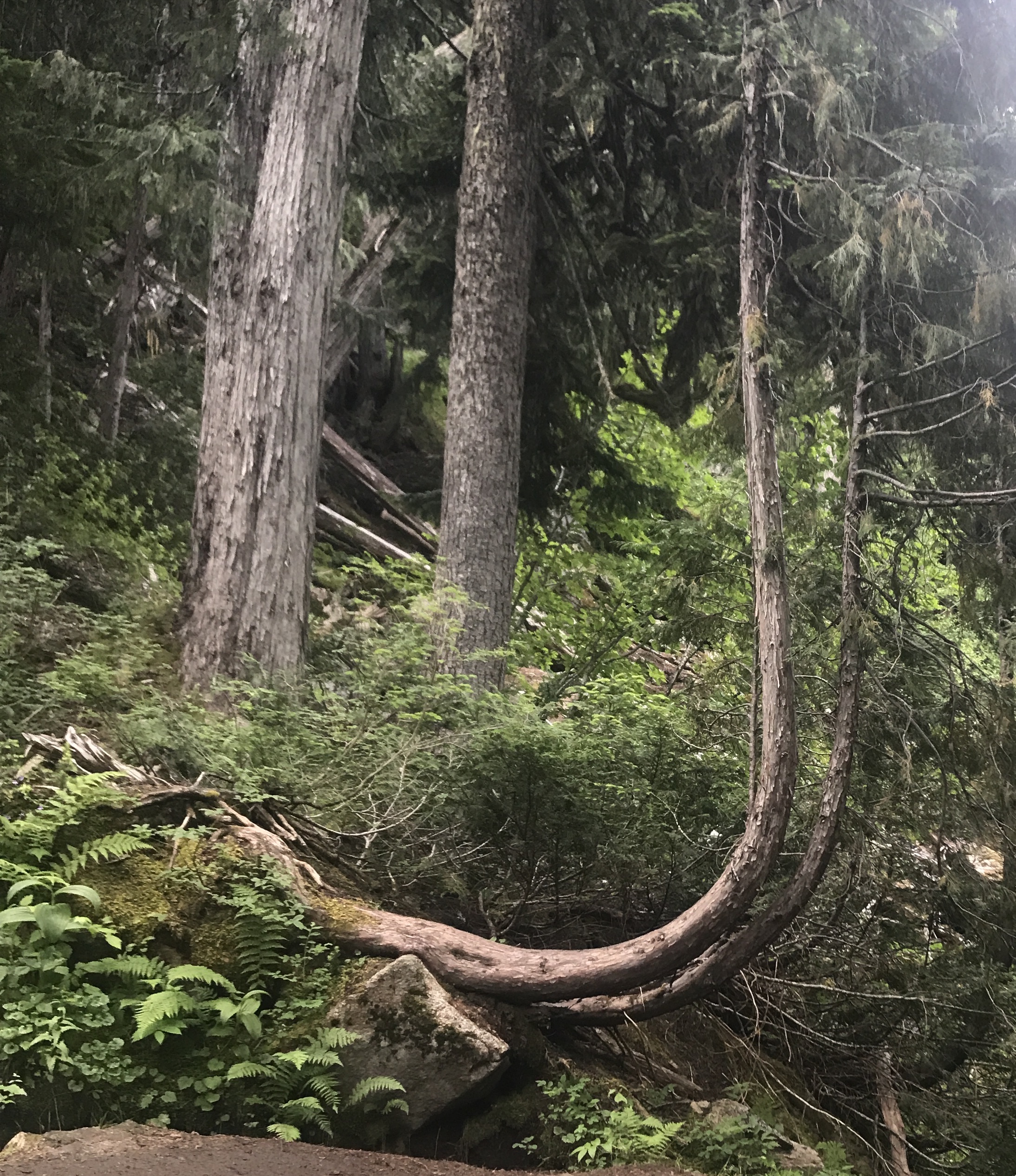
We reveled in more glimpses of the glaciers along Hwy 20 (the Pyramid-Colonial Creek Complex, with Colonial and Neve Glaciers, as well as Jerry Glacier on Crater Mountain), then took our stroll at Rainy Lake. It occurred to us then, now obvious, that what is so special about the North Cascades is that many forest sections have NEVER been logged off. On those trails you just don’t see stretches of sawn stumps or manually planted replacements. The forests are varied in age and species of trees, just as nature intended. The trees are so magnificent, so aromatic and unique – they seem to occur in partner groupings, closely spaced to help each survive. They often have a snow bend at the base, proof that in their early days, heavy snows or avalanches pushed them out of vertical alignment before they were able to “grow out of” the bend. This crook is also referred to as a pistol butt.


Engelmann Spruce, Mountain Hemlock and Pacific White Fir are dominant around Rainy Lake, which is a stunning glacial cirque lake surrounded by towering mountains and lacy waterfalls. A tranquil paradise.
The Washington Pass Overlook is close by, and at 5,477 feet of elevation, the visitor’s vantage point is already more than halfway to the peaks of Liberty Bell and Silver Star Mountains. These are very ragged peaks with sheer vertical rises, they rival the climbers’ mecca mountains at Yosemite. All in all, Washington Pass is a great tutorial on the scouring power of glaciers. Saw a Clark’s Nutcracker on the path, which we haven’t seen since visiting Black Canyon of the Gunnison. Also started noticing the beautiful Shuksan Greenschist and Skagit Blue Gneiss rock this area is noted for.
If you hike, North Cascades offers endless variety. You can start practically at sea level and hike to 6,000 feet and have a glorious time (or an afternoon of burning muscles!) Or you can start at 5,400 feet (as we will tomorrow) and finish at 8,700 (fingers crossed). You can do short or long hikes, the Pacific Crest Trail or Pacific Northwest National Scenic Trail, walk around the turquoise lakes or be above the tree line. The next time we come, we will approach from the northwest direction, as at least 40% of the hikes can only be reached from the Seattle-Bellingham-Mt. Baker side.
Woo-hoo! Two surprises as we drove back to our campground today. First, we thought we would stop by the “little farmstand” that advertises fresh berries on a small sign in Marblemount (nearby village). Imagine our surprise when it turned out that this small stand is the original homestead for Cascadian Farms, a major force in the organic cereals, snack foods and innovative food prep industry! Wow. Unassuming, not promoted or marketed, just there for the community, hikers and passers-by. Fresh blueberries, raspberries, ice cream, cherry tomatoes (I’ll have some of all of those, please!), as well as smoked salmon, baked goods, espresso, etc. A lovely pollinators’ garden on the grounds. Kept operational, we think, for sentimental reasons and community benefits.
Second surprise: on the way from the farmstand we spotted two MASSIVE glaciers looking southeast. These are no doubt Eldorado and Inspiration glaciers, which we will see more of tomorrow when we head in that direction for our hike. Biggest ice fields we’ve ever seen. No doubt they feed the fulsome Skagit River nearby.
————————————————–
Ok, today was EPIC, on Cascade Pass – Sahale Arm. Just the best hike since Siyah Pass in Glacier NP. Nine and a half miles in length, up half a mile in elevation, the skies were partly cloudy which is great for photographing glaciers, and billions of wildflowers greeted us. We hit the trail at 6am, and there were already 20 cars in the parking lot.
This is a trail for serious hikers, many of whom like to stay overnight at the summit. The slope of the hike was actually a bit easier than Sourdough Mountain, but at every switchback on this trail we got a payoff. Either a new vantage point for looking at the mountains above, across from or below us, or gorgeous rocks for us geology nerds to ogle, or the riches of a wildly colorful quilt of alpine wildflowers. And then there were the waterfalls!


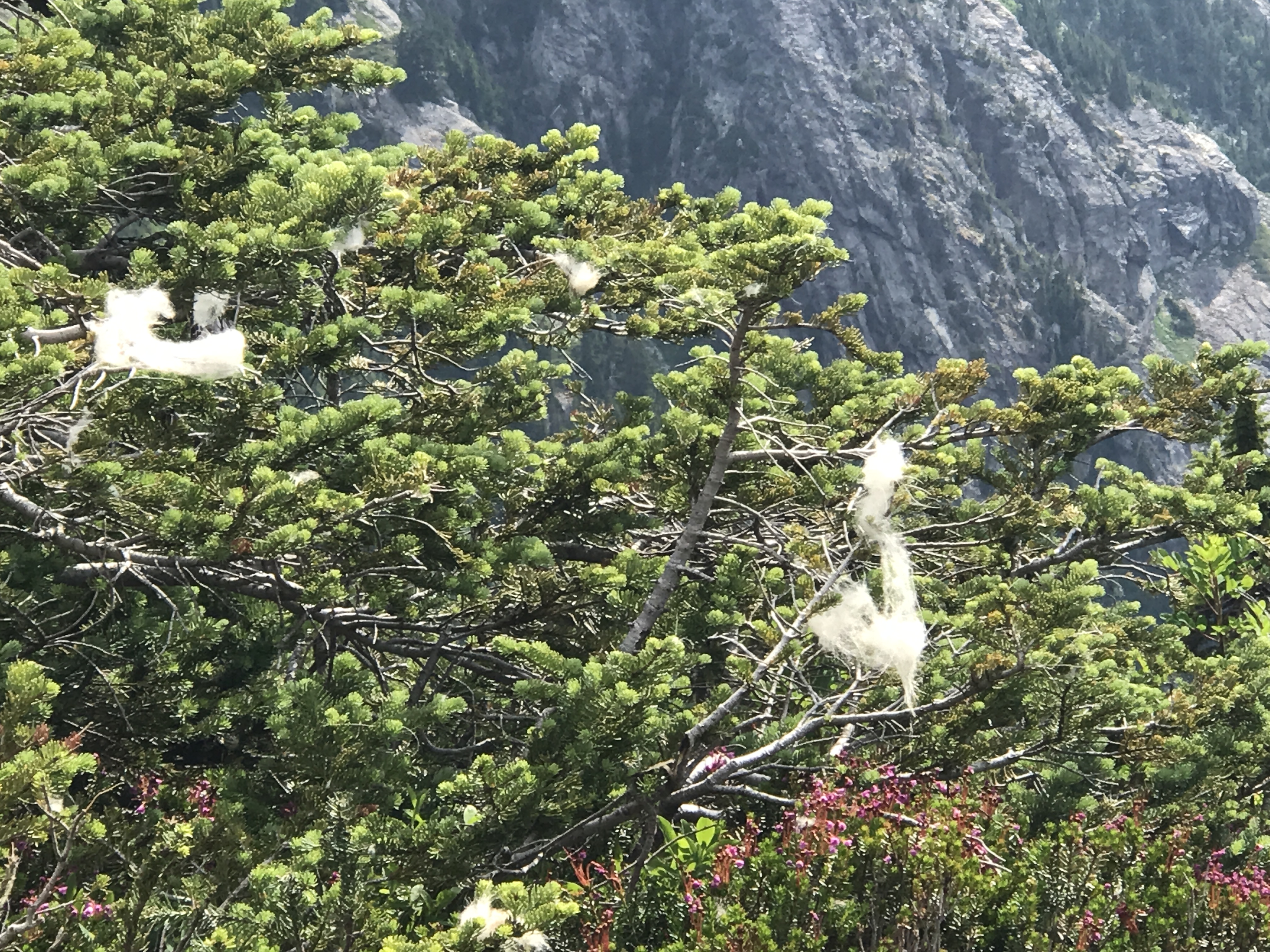


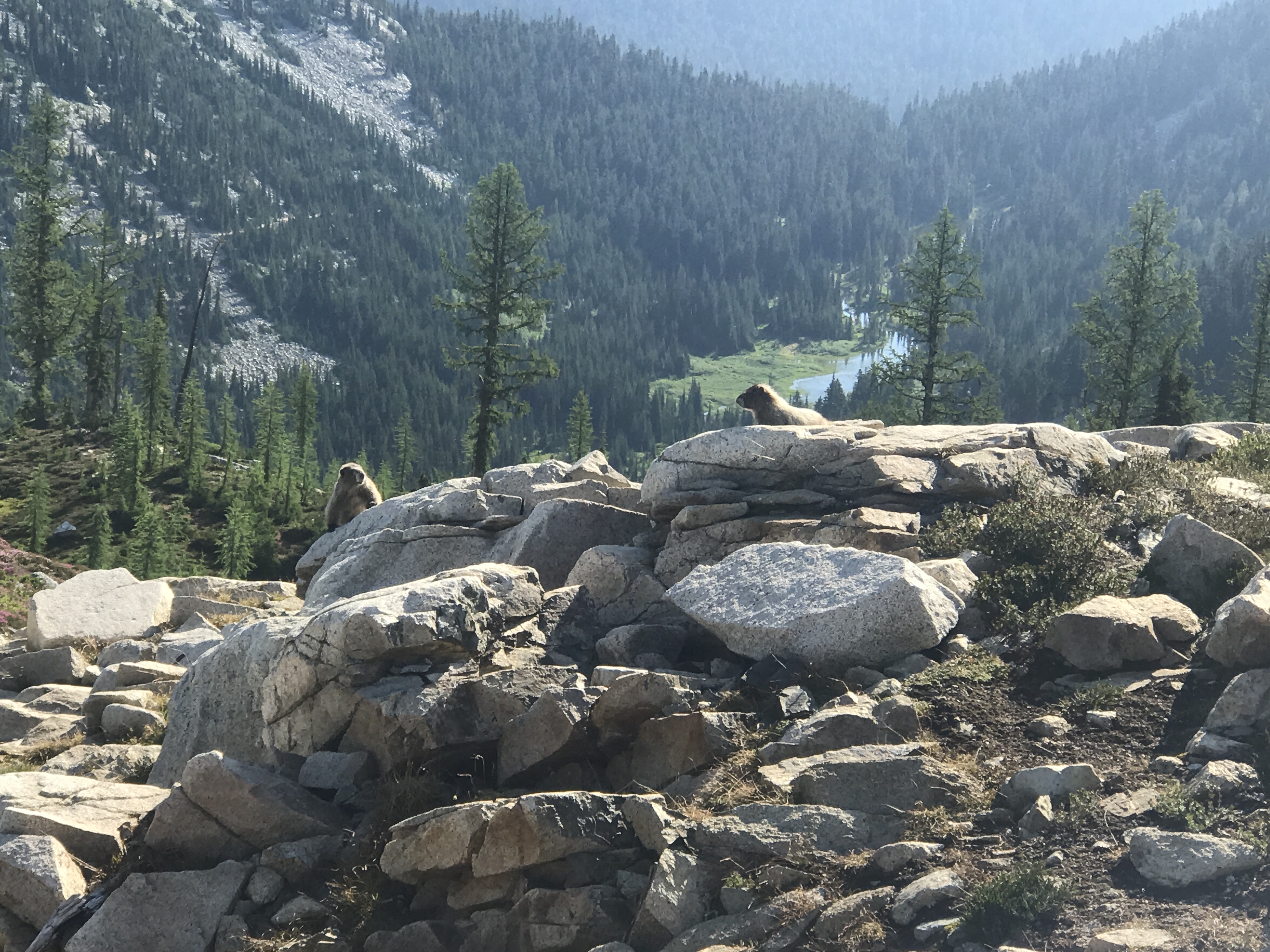
Halfway upslope in the early morning hours we thought we heard thunder. It was a small avalanche of snow cover letting loose and falling downslope, across the valley. You could also hear the glaciers groaning and cracking. A few pikas chattering at us, one of which had an enormous (for him) branch in his mouth, running to tuck it away in his food cache. Saw more hummingbirds, and all along the upper reaches of the trail we saw mountain goat hair stuck in bushes. Hey, they have to get their winter fuzz off somehow!! A hiker we met coming down the mountain said that he’d overnighted at the top, and at 7pm last night there were marmots and mountain goats all over the place right next to the campsite. So cool.
The true stars of today’s hike were the many glaciers and snow fields. Good heavens, they’re huge up there! We saw Eldorado and MacAllister glaciers on the drive out to the trailhead, and the hanging glacier remnants on Johannisberg Mountain, Cascade Peak and the Triplets while we hiked up the initial four miles. At the saddle on Cascade Peak, Magic, Trapper and Glory Mountain came into view. Then we tackled Sahale Arm, a more rugged and scree-laden trail, up to emerald-colored Doubtful Lake and a full-frontal view of Sahale Mountain with her multiple glaciers. What a thrill. Seeing for miles down the glacial valley where Stehekin River flows was just ethereal.


It was a great day. This one goes on the list of peak experiences.
—————————————————–
Believe it or not, today was nearly as good as yesterday. The beauty just keeps on coming.
At an acquaintance’s recommendation, we did Maple Pass Loop today in the eastern part of the park, on the slopes by 6am again. Supposedly this hike was only 6 miles, but ended up being 7.1 miles because of trail reconstruction, and we’re pretty tuckered out tonight. But it was worth it. Every step.
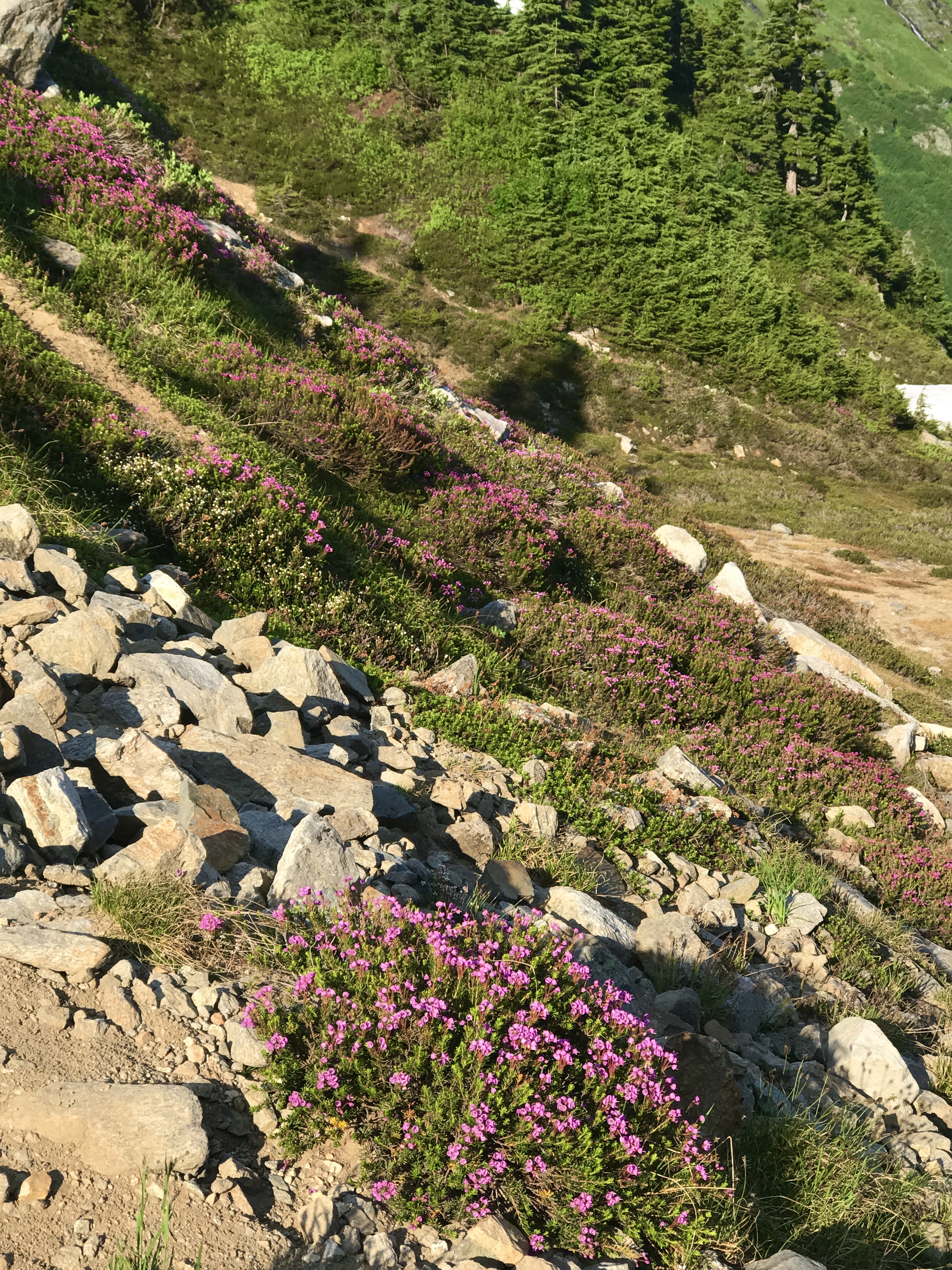
The loop gently builds to a crest on its northern side, giving us a gorgeous view of Lake Ann in the cirque below, as well as the incredibly dense heather meadows the trail is known for. Along the way, hikers see Corteo Peak, Black Peak, Cutthroat Peak and Whistler Mountain, as well as too many other slopes and peaks to name. The trail takes a ridgeline (which we love) and crosses over to a brand-new valley with more peaks and glaciers. As is now obvious to us, most Northern Cascades treks feature mountains, glaciers, cool rocks, waterfalls and either lakes or rivers. An embarrassment of nature’s riches.


Speaking of riches, we finally got a tip from a botany-astute ranger on a plant whose identity had been escaping us. It’s big and corn plant-like, with abundant tasseled flower blossoms on a stalk that can get as high as six feet. And it’s all over the alpine path edges, especially where the ground is moist. Stumped? So were we, until yesterday. Turns out it’s called the Green False Hellebore (Veratrum Viride), it’s toxic to animals and that’s why we don’t see it munched down.
It was quite thrilling to see a ptarmigan mama and five chicks along the north side of Maple Pass Loop. We wouldn’t have noticed them at all if it weren’t for a noisy chick peeping.
Once we got to the west side, we heard a loud, sharp whistle, and wondered if it was a hiker signaling a bear encounter. Nope. A male hoary marmot was calling his lady friend for a date. Scrambling upslope, George noticed her sunning herself out on a broad rock. In a minute, along came the male, bounding up to an adjacent rock. She took note and joined him, then offered a quick nuzzle to his neck and soon enough, they were nose-to-nose. Very touching (no pun intended).


We saw more Goode Glacier, as well as what we think were the triple-threat of Douglas, Fremont and Banded Glaciers, and beautiful Shuksan greenschist on this hike, as well as complex marble in a schist matrix. And lakes, too many to count. Vernal lakes, which disappear in the late summer, cold glacial runoff lakes, and small lakes which are really tributaries to rivers. Almost all were of the delicious color that can only be described as aquamarine-turquoise-emerald. Only nature comes up with these things!


We’re rethinking our plan to hike tomorrow. It’s been five demanding days of trekking, a total of 27 miles and 8,740 feet of elevation climb. Total moving time on trails nearly 18 hours. Northern Cascades hikes are rugged, full of challenging terrains, rocky paths and occasionally vertiginous (dizzy-making) precipices and ledges. Though we’d love to do more before we leave, there is such a thing as saving oneself for the next destination, which features several “can’t-miss” hikes. Tomorrow may just be a quiet prep day for travel on Monday, and to bake the banana bread that won’t wait. We’ll definitely be returning, to explore the Northern reaches of North Cascades NP.
—————————————————-
One final evening walk in the No. Cascades, along the Skagit River that flows by our campground. This walk deserves a comment because of the trees growing there.
The community of arboreal beings living along the Skagit River west of Marblemount, WA has a special spirit within it. This woods obviously suffered in the past, having been logged off perhaps 150 years ago. The enormous stumps of cedars, firs and deciduous trees are still to be seen, but curiously, there are in many if not most cases full trees (sometimes up to 8 trees!) that have sprung directly from the stumps, either rising from the center of the stump or from the side, often with four-to-six-foot air roots that have grown to be weight-bearing platforms to stabilize the trees. And we are talking TALL successor trees!! It is just extraordinary to see. Not only that, but because of the moisture in the air from the bubbling river, thick sphagnum moss grows prolifically on these trees, giving them a fuzzy-limbed appearance.


Some people attribute a wisdom and innate personality to trees, and I am one of them. Visiting in early evening, I felt like there was really someone or something living and perhaps even sentient in the woods. It was just wonderful. I wish we had more old-growth forests accessible in every state.
———————————————————
We’re in the Gifford Pinchot National Forest now, south central Washington state. Have been hiking in Mount St. Helens National Monument, for the second time. This time we’ve settled in the northeast quadrant of the monument/forest, so that we can see this side of the enormous mountain.
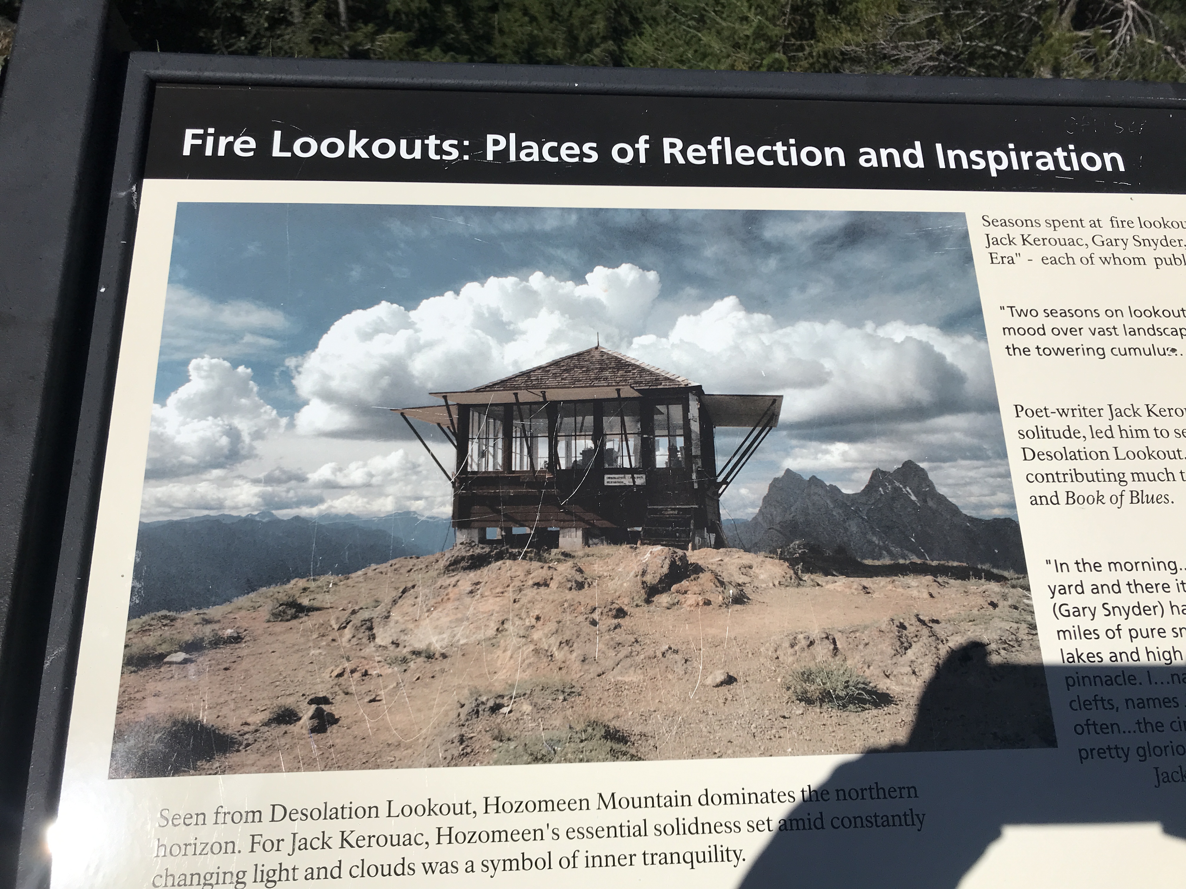
Our national parks and monuments are often so large that it takes moving around to various campgrounds to best take in the beauty, phenomena, geology and landscapes that are present. It’s always a bit of a guessing game first time in a place, to decide where to land. Because this is our second visit, we knew going to the northeast and southwest corners made sense. The first visit, with many details about the original volcanic blast in 1980, was in Adventure 7 and is available here https://birchbarkfarm.wordpress.com/2018/11/19/adventure-seven-into-the-great-wide-open-of-the-pacific-northwest/.
This time we re-attempted the Loowit Falls hike, which was not quite completed on the last trip. If hiked from Johnston Observation Center, it’s a 14-mile trek and you feel like you are crossing the Bonneville Salt Flats. Now coming from the NE side, it’s ONLY an 8.5-miler, and we easily finished it without sunstroke. That is to say, we succeeded in getting all the way to the falls flowing from Helens’ melting glacier, near the volcanic crater. Saw the Pyroclastic Flow region (river of burning lava/rock bombs!), the Pumice Plain, a gorgeous spring-fed oasis, and of course, the Falls. And it was all magnificent. The loveliest rocks greeted us at the junction of two approach trails: a whole ridge of copper-infused dacite rocks… those of you who know my fascination with green rocks can imagine my delight with these! Not only that, but we were able to see Mt. Rainier, Mt. Adams and Mt. Hood from the Windy Ridge approach. It really gives you a great appreciation for the Cascades volcanic chain that runs from the Canadian border to northern California and also includes Mt. Lassen and Crater Lake. And…. there is still steam rising from the crater of Mt. St. Helens! Wow. Didn’t get to see any of this last time.


On the last day at the northeast edge of Mt. St. Helens, we got up early (as usual in these summer climes) and hiked Norway Pass, which was supposed to be a more thrilling trail than it turned out to be. But every journey holds some learnings, and we did get to see the crater from across Spirit Lake, which was pretty special, and to experience the mother lode of berry bushes along the way. Thimbleberries, black caps, raspberries (red and golden), blueberries and strawberries, and almost everything was ready to eat. That is why we called out, “Good morning, Bears!!” loudly at almost every curve. Scat was there, but no bears.


Lunch was eaten at Windy Ridge and we also climbed the 400 stairs to atop the viewpoint. Gorgeous lookout, and eagle-eye George spotted a bald eagle winging its way across the sky with something shiny in its talons. At first, we wondered what manmade metal object it had stolen, then recognized the telltale curve of a big FISH!! How exciting to see him/her carrying lunch home for the family!!
On our way from the northeast monument campground to the southwest, we happened upon a large blueberry farm. Had to load up, and also snagged a bake-at-home raspberry-rhubarb pie. Tough duty!!

—————————————————-
Our last hike in the Mt. St. Helens southern district of the monument came today, at the Lava Canyon Trail. A 4.5-mile hike with 1,103’ of elevation gain, it was a sweet bundle of surprises along one of the main lava and lahar flows coming from the melting Shoestring Glacier off Mt. St. Helens’ south side.
There were abundant signs at the trailhead, warning folks who were greenhorns at hiking to proceed carefully. The river that now flows (“crashes” might be a better verb) down the canyon is powerful, very rapid, and ice-cold. Several naïve souls who thought they could get the perfect selfie by hanging over its walls have died trying. And the path was steep, slick in places, skinny as it wound along the high walls, and generally not for those with fear of heights. Having said that, it was magnificent. So many viewpoints along the way, showing the basalt columns and sinewy hardened lava ropes. Lots of gorgeous shots of the 35-foot falls sections, the 20-foot falls sections, the places where water has eroded deep chasms in the volcanic rock, and the massive collapsed wall sections.


We hiked all the way to the end of the trail as it evened out and slowed down its water flow. We wondered if we had missed something. The trail had promised a long view of Lava Canyon, showing multiple waterfalls, but we hadn’t seen it. On the way back, we noticed an unmarked side trail that went upslope and to the left. It was not on George’s GPS trail tracker app, but we took it anyway. We followed it up a rocky ascent and found an 11-rung ladder! Just like the 32-rung ladder that we’d descended earlier on the trail (another reason folks afraid of heights are warned not to proceed!). After a bit more rock-scrambling, we realized we’d been led out onto a high lava island in the middle of the water flow, to see…. the long view of Lava Canyon! Spectacular!!


This trail SMELLED so intriguing. The air was charged with oxygen from the surging, boiling, churning water, and the plants were so lush all along the path. It seemed sometimes to smell of cucumbers and herbs, sometimes of fresh salad greens, and sometimes vaguely of bear poop! Something new at every turn.
On the way home, we stopped at the Lahar Viewpoint to see the thick coating of mud, rocks and ash that covered most of the horizontal surfaces south of the erupted mountain. Nowadays a thick blanket of moss grows over the mud and ash-covered ground. But the trees are doing much better than anything else on this side, which is the opposite of what’s happening in the eruption path on the north side. Every part of this monument has its own story.
————————————————————-
Finally! We’re at the Oregon Coast, and this girl is HAPPY to be beachcombing around the Tillamook area! Been anxious for three years to agate-hunt along the coast. We started today with reconnaissance, as we always do in a new area: get acquainted with the lay of the land, find out where good things like handmade local ice cream, clam chowder, etc. are. Stopped at Seaside Nike Factory Store to get my soon-to-be-five-year-old grandson some spiff soccer togs. Then we hit a couple of beach overlooks, tried to walk Nehalem Bay Beach but got pummeled by a 35-mph wind, photographed some beautiful scenery, and settled our destinations for tomorrow morning.


I hadn’t anticipated quite the weekend throngs coming to watch and/or surf the rollers along the beaches north and south of Nehalem, though. Ended up in a 30-minute rush hour along 101 that just crawled its way north to Seaside. Picked up afore-mentioned clam chowder and doctored it with fresh tomatoes. Yum!! Postscript: we had chowder from both the northern end and about 1/3 down the coast (Newport). I much prefer the Nehalem version, as it’s the real NW chowder (brothy, full of scallions and clams and crab and baby red potatoes). The rest is just New England clam chowder.

—————————————————————-
Today we headed out in the AM, in time to catch the tide going out on Oceanside Beach. Lovely low-wind morning. It was a brisk 57 degrees, but with sun it felt marvelous. George is getting to be a great rock hunter, and he pulled in some zeolites with blue-green jasper inclusions. I was able to find some whole-jasper pieces (apparently, they call it Oregon Jade here), and we found lots of zeolites without inclusions. Lots of interesting two-tone stones that await identification. The area here looks like Laguna Beach did, 40 years ago.


Then we headed down-shore for some agate hunting at Cape Lookout, as that spot was reputed to have lots to find. Well, the recommender must have hunted in the wintertime, because it had been picked clean before we arrived. Little on the beach except for jellies, the occasional crab leg, broken shells and tide eddies. But we enjoyed the heck out of it anyway. Went over to the vertical tide pool of billions of mussels and barnacles (on the cape peninsula), looked at all the anemones and starfish waiting for the tide to come back in, and got caught by an exuberant wave that slapped at our knees and reminded us just how cold the ocean can be. Love this coastline.
This area is filled with Columbia River basalts, and we collected one spike just because basalt is so cool and it reminded us of the basalt along Mt. St. Helens Lava Canyon Trail, where collecting is off-limits. Also collected some iron-rich igneous chunks for their beautiful colors, and for their drusy inclusions.
—————————————————-
Today was a runaround day, driving an hour over to a small goat cheese maker, only to find that she no longer has her self-serve refrigerator in the time of COVID L. No goat cheese for us, just when we had our mouths set for it. It was another very windy day, so we scrapped plans to beachcomb on the shore. Just don’t like getting sand in my mouth, and it tends to be very chilly with 61 degrees and 30 mph winds.
We’re staying at the Newport Marina RV park, where people who are into deep-sea fishing come to spend the weekend or week on their boats, cook their seafood in a fish boil pot, meet fellow fishing friends, and sleep in their RVs. There are also canneries on the harbor, which attract many seals and sea lions. We can hear their barking and calling, waiting for the canneries to empty their trimmings. Postscript: after talking with a local, it turns out that they’re all sea lions, of the male persuasion. As he tells it, they go down to San Francisco for two weeks of fun with the ladies, and then come back up here to talk about it for the rest of the year. And their bellering is all about who gets to lie out on the concrete piers. You gotta be a pretty big honcho to get a choice spot, otherwise it’s the rock pilings for you.


You might think that going from one beach to another would be a bit repetitive and boring. Not so. Each one is different, and each has its own fans. There are flat sugar sand beaches, cove beaches, tidal flats, gravel beaches and rocky beaches. We love them all. Going out to Moolack Beach tomorrow to hike the 2.5 miles to Yaquina Point and back. Wind should be down in the AM.
—————————————————
The temperature today did not demand an early start. We set foot on Moolack sand at 9:30am when the air was a mere 57 degrees, with low wind, and we were alone. So nice. The beach yielded only one agate, but many teachings about the sediments and stone at the shoreline.
We walked 2 miles down to Yaquina Point and back, encountering a lot of pre-stone compressed mud walls and mud mixed with sand. The interesting thing about compressed sediment that has not yet turned to stone, due to inadequate time, weighted pressure, heat or some combination thereof, is that it can turn into something like stone in shape and nearly equal in durability….it can be rounded by the surf and look every bit like a river rock, but when you put force on it, it crumbles like a ginger snap dipped in coffee. We had fun testing samples, especially those that contained a lot of shells. Few of them were hard enough to ever produce fossilized invertebrates. But oh, the colors! So many different minerals in the soils to punch up the pre-rocks’ hues.


We also found evidence of silica-laden water dripping through the fractures, because some of the harder rocks had some drusy (crystalline) surfaces on them. We found one, in fact, where mud had originally swallowed up a clamshell, then developed fracture. Water then infiltrated the mud to create a void in the middle of the clamshell, which was then filled up with silica-infused water. The structure that results is a little like a stalactite, only it’s not a vertical cone, but rather a jewel-like surface on the inside of the shell, covered with tiny crystals. So much fun to find these!
After the beach hike, we drove to Depoe Bay, where the beach conditions are completely different from those of Oceanside, Moolack or Beverly Beach. Here at Depoe, the shoreline was rocky, craggy, steep and not at all hospitable for walking. This Oregon coastal town is famous for winter whale-watching. And here the seaside homes do not drop into the ocean because of erosion. It looks a bit like Big Sur, California. See what I mean? Every beach is unique.
I did a wee bit of reading on what makes a good ocean wave coming ashore different from a great wave for surfing. It certainly has to do with the prevailing wind and the underground sea floor structure (e.g, how big the drop-off, coral, rock or sand foundation), time of day (medium tide or near max tide), the sun, and the season (winter is just too brutal for surfing on many beaches). I was expecting the phase of the moon to have some influence, but none of my sources mentioned this. Surfers can decide ahead of time so that all environmental conditions are optimized.
But waves are also categorized by the type of break the wave has (point, reef or beach), the type of wave (plunging/tubular, spilling, surging or collapsing) and the angle of the wave’s refraction. Apparently, once in the water, surfers use those factors to assess which wave they are going for. It’s complex, indeed, but if you’ve been doing it long enough, it becomes second nature.
Looking at the official beach signage, it’s pretty obvious that Oregon’s surfers plaster them with surfing equipment stickers if the beach is a decent one for riding the rollers. Not something we’ll undertake soon, mind you. Even without surfing, though, I can still watch waves build, crest and crash for hours.
By the way, it smells so good here. We’ve all been in coastal towns that do not smell good – fish remains, food remains, funk in the sand, too much kelp washed ashore… not the case here. The coastal air in Oregon is clean, salty, oxygen-charged, just slightly vegetal, and wonderful. We hope to be back here in the winter for more shore hikes.
One last delight in Newport, OR: we went down to the old bay district where Newport still has four operational seafood and fish processing plants. As mentioned, we’d heard the sea lions barking for two nights and wanted to see them in person. Little did we know that this area has been revitalized by the city and now has lots of food, drink, chowder and fun to offer on the wharf. Saw the 25+ “top dog” lions in residence by the Clearwater restaurant, got another quart of chowder, and tried to avoid the crowds. Quite a lot going on here.


——————————————————–
We’re now in Crater Lake National Park, OR for two nights. This park is one of the smallest national parks, focused pretty exclusively on the central water-filled crater that is its namesake. Thirty-three miles in circumference, 1900 feet deep, with a rim road around it and many small volcanoes surrounding the central crater but only three that are available for hiking.

The lake is beautiful, but also otherworldly. Its deep marine blue color is unlike any other lake hue in the world, as it has the clearest water in the world (you can see hundreds of feet deep), but at certain times of the day it looks opaque and unnatural. Weird.
Crater Lake is the remains of the original volcano Mount Mazama, which swelled up with magma, released hellish fury in the form of eruptions around her rim, blew 25 cubic miles of mountain rock 5 miles high, and then collapsed into a giant caldera, approximately 7,700 years ago. You can still see signs of volcanic “violence” in the form of sharp shards stuck to the walls, large rocks expelled, and tons and tons of pumice, scoria and tuff stuck on the sides and slope of the volcano and surrounding land. Mazama did not explode and landslide sideways like Mt St Helens, it blew vertically, and then collapsed inward. Small eruptions continued to explode inside the crater/lake for years afterward, resulting in Wizard Peak (an island in the lake middle), Phantom Ship (a set of sharp peaks atop a submerged mountain in the lake) and various other submarine features in the lake.
Lots of visitors are here at Crater Lake, but far less than in the bigger, more popular parks. The park seems to us to be a little behind as far as upkeep, signage, and most likely, revenue. You really have to know the park is here to find it, as you’re not going to run across postings before or even in the park, pointing out the way or giving a lot of info on what you are seeing. Lots of services are shut down. But we are finding our fun anyway. And we are learning that the park probably doesn’t garner more than a couple days’ fees and purchases from its visitors as it is just too small to hold an audience for more than 2-3 days. Thus, the paltry revenue stream with which to make signage and infrastructure improvements.
Today’s hike went up Garfield Peak, only a 3.4-miler with 1,100 of elevation. But since the trail starts at 7,100 feet of elevation at the crater rim, it’s easy to get winded. Beautiful views of the lake and the gnarly lakeside geology thrown out at eruption.


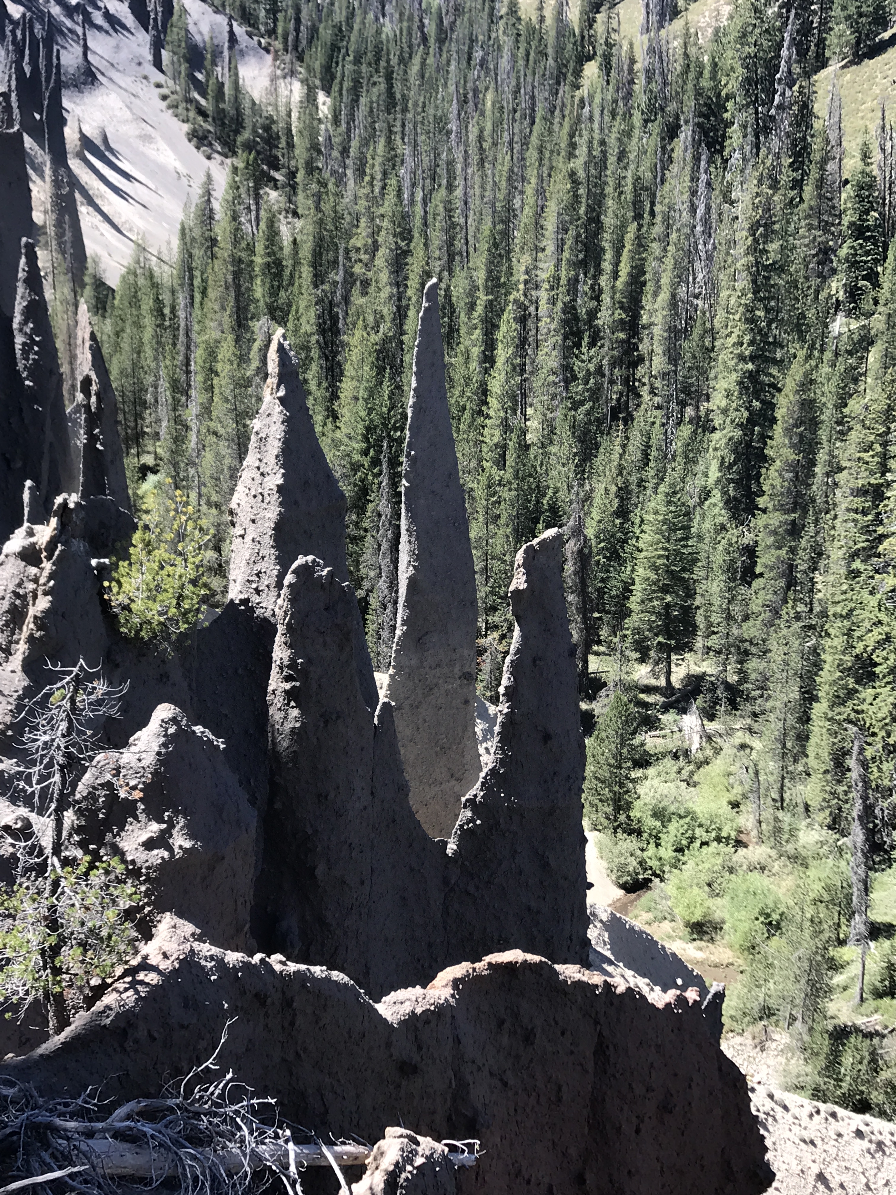
To round out today’s hike, we drove to see the pumice pinnacles on the south border of the park. These were actually pinnacle-shaped castings that occurred in a canyon, under 100+ feet of pumice. They formed as a result of fumeroles (steam vents) blowing gases up through the deep pumice layer, and those gases carrying minerals that solidified the pumice into a concrete-like substance. The winds blew away the loose pumice over time and revealed these 50 to 100-foot conical (pinnacle) shapes. Quite bizarre, and a bit eerie.

Tomorrow we tackle a harder conquest: Mount Scott. At 8,929 feet, it’s the highest mountain in Crater Lake NP.
——————————————————
Well, this hike was a relative piece of cake!
Every park has its own calibration on what is considered an easy, moderate or strenuous hike, and Crater Lake NP lists Mt. Scott as strenuous. Not so much, by our current standards, but it was lovely in every respect. We were on the trail by 7:30am, off by 9:30, enjoyed immensely the nearly 5-mile route and 1,250 feet of ascent, and really relished the views and minimal presence of other hikers. On the rain side of this mountain, the slopes are heavily vegetated with manzanita and beautiful firs and pines which tower over the trail. On the dry side, trees are much sparser and mostly pines. The top of Mt. Scott is graced by a now-defunct fire station, and the views from there are spectacular.


We felt like we could tuck in another short hike as an add-on and George decided he wanted to see the lake at the water level, so we stopped and did the Cleetwood Cove Trail, another hike rated by the park as strenuous. This trail was 2.2 miles with 750’ elevation gain, but hikers begin by descending to the lake and then hike back up to the parking lot.
Again, lovely trail. Beautiful shoreline at the lakeside, showing the Caribbean aquamarine we all associate with coral reefs. By this time the deeper part of the lake itself was displaying that bizarre opaque marine blue color that is present in no lake other than this one. And the creosote bushes were in bloom, the only time we’ve been able to smell them in their full, uh, glory.


Unfortunately, as we have found elsewhere, the later you hike a trail, the more likely you are to encounter unmasked hikers, some of whom are not friendly or respectful of others on the trail. It is a little distracting and unpleasant, but sometimes cannot be avoided.
Tomorrow we leave, bright and early, for our final national park visit of this adventure, to Lassen Volcanic NP in California.
——————————————————–
The southernmost national park that is part of the Cascades Volcanic Mountain Range in the Pacific Northwest, Lassen is a rangey, craggy, geothermal wonder. A little bit North Cascades, a little Mt. St. Helen’s, a little bit Yellowstone, it appears to be loved by hikers and vagabonds and families alike. And it’s only 4 hours’ drive from the San Francisco Bay area, 3 hours from Sacramento, so it’s pretty perfect for a long weekend.
We arrived on a day when the temperature had soared from 65 at Crater Lake to 103 at Lassen. There are no electrical hookups here in the park, so we worried about possibly not being able to run A/C as needed off battery. We did normal reconnaissance at the Visitors’ Center, studied the maps and guides, set our plan for all the hikes we wanted to slot into the next six days, and sat outside for dinner and evening reading until sunset. We came back into the Moho for bed, not knowing what to expect. It was 85 degrees and no wind. But within an hour, with help from a ceiling fan, it had cooled to 74 and was actually a pretty pleasant night for sleeping.
This campground is among the best of what the national park service offers, and it’s why we and millions of Americans love to stay in the parks. Very large lots, lots of tree buffer between spaces (our campsite trees are 100 – 120 feet high!), laundry, lovely Visitors’ Center, campgrounds away from the roads so you don’t hear traffic, bear boxes where needed, and helpful rangers coming through daily. Our neighbor is a single lady camper with a cat she brings out for sunshine and fresh air, nestled in her lap. Sweet.


We started the hiking lineup today with the hardest hike here: Brokeoff Mountain, the oldest peak here and formerly 11,500’ before it blew 2,000’ off its top. The trail is 7.2 miles with a 2,600-foot gain, and we did it in just under five hours.

Brokeoff Trail is a great combo of meadows, fir forests and open, narrow mountainside slopes with a few streams thrown in. We scared up two partridges and a bunch of chipmunks along the way, as well as hundreds of chickadees, sparrows and juncos feeding in the grassy swales. One lone black-tailed deer crossed our path. The flowers were enchanting (silver-backed lupine up here) and provided us with our first aroma-enhanced walk as their combined scents wafted upward from the meadows to our path.

About halfway up the mountain, we noticed dark nimbus clouds rolling eastward toward us, but knew that rain chances were very low. We kept watch and saw that the clouds were blowing north around the mountain, so figured we’d be pretty safe. Lots of white cumulus behind them. But the wind steadily increased to 30mph as we climbed (people told us it would be quite windy), and by the time we reached summit, we had to put our long-sleeved warmup shirts back on. By this time, we were above the rain clouds.

The top of Brokeoff shows pretty explicitly what happened during eruption, as the peak and northeast side are gone. Two thousand feet of rock and untold quantities of lava were blasted over the landscape in a variety of forms. Car-sized dense lumps of thick magma, mega-chunks of flaming lava, chocolate chip cookie batter lava containing all manner of aggregate and the usual pumice were thrown out of the magma chamber. This mountain seems not to have released much flowing lava, although others in the park have. But a secondary volcano, the namesake of the park (Lassen Peak), still standing at 10,542’, sent flowing lava up to 15 miles away. Shards of sticky lava too viscous to let go of the mountain grace her rim.
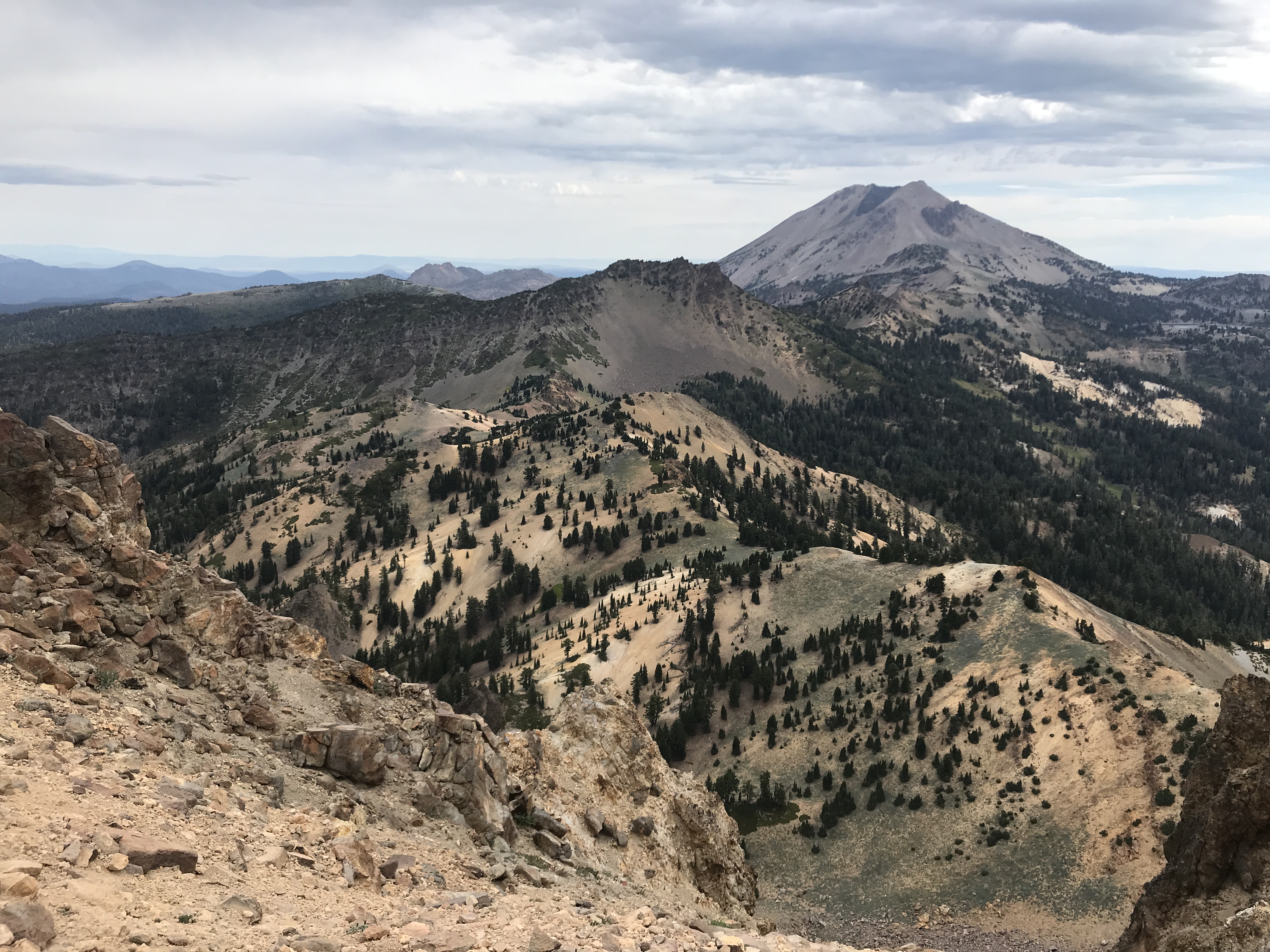


Each mountain is different. Brokeoff actually mixed its magma with sedimentary rocks that entered its underground chamber when Pacific Ocean crust subducted under the Cascade Range. It’s fascinating to see the combinations of rhyolite or dacite lava with embedded sedimentary rocks or layers from elsewhere. Pretty wild what the earth was up to, 400,000 years ago.
About halfway down the mountain trail, little droplets of rain began to fall. Nothing to worry about, no thunder or lightning, and it felt pretty refreshing. Every so often, it would stop and then start again. By the time we reached the car, though, it was raining steadily. Escaped a full soaking by the skin of our teeth! And it rained for the next hour. I felt pretty bad for the hikers who came after us, but they had to have seen the steadily darkening skies. One always has to watch the skies and try to judge what will happen over the course of a hike.
Today’s rain broke the back of the heat wave plaguing northern and central California for weeks. Now we expect daytime temps in the 70’s and low 80’s. That works.
——————————————–
Sore ankles today caused a switch in plans, so we took Bumpass Hell Trail instead.
The name comes from a 19th century cowboy who led hikes into the geothermal areas here. He had no boardwalk, so he carefully navigated from one mudpot to the next as best as possible. His unfortunate name was Bumpass. And he burned himself more than once, breaking through the delicate crust around the steaming hot features. He proclaimed he had visited Hell. On his last tour, he fell through again and burned himself so badly as to cause his leg to have to be amputated. Poor fella. We decided to stay on the Boardwalk, as directed.
This short 3.2-mile hike goes through the lushest meadows of lupine we’ve seen yet, as well as some very healthy hemlock groves.

The geothermal bits are at the bottom of a flowing streambed, where the clear spring water mixes with mud draining from the boiling mudpots and becomes milky grey.


Settlers tried hard to commercialize the steam vents (fumeroles), bubbling lakes and mudpots in the 19th century, featuring them as a healthful spa (pre-founding of the National Park). They also tried to mine Sulphur for industrial purposes, all to no success. The mudpots are as vigorous as those at Yellowstone, though not as numerous, and the vents and pools are interesting, one of them a bright blue and thankfully protected from projectiles thrown by children and/or childish adults.
During the return hike to the parking lot, again there were dark scudding clouds on the horizon and this time, thunder. The hike back was very quick. We sat in the lot and watched the storm approach and break over Bumpass Hell. Dozens of lightning strikes, some cloud-to-cloud but mostly cloud-to-ground, some started spot fires as we heard later. Heavy rain lessened to a nice soaker. We’ll see if the sun comes out this afternoon.

Lassen has abundant and gorgeous conifers, including Pacific Tamarack, Limber Pine, Sugar Pine, White Bark Pine, Engelmann Spruce and splendid Jeffries and Ponderosa pines. Sugar pines produce eight to 20-inch long pinecones, and Ponderosa’s are 4-5 inchers. Here’s the sad truth, though, about these majestic stands – they are being decimated by bark beetles, fungal disease and heat stress from climate change. Everywhere lie gigantic dead trees with completely crumbled innards. What will remain in ten years, no one can know.


Took two short hikes this afternoon, one to the “Devastated Zone,” where the 1915 eruption did the worst damage. Cabin-sized boulders are still present, along with a nice explanation of the different rock types that flew out of the volcano.

Later we walked around Lake Manzanita close to our campground. Swimming has been closed there, because aggressive river otters have bitten swimmers who inadvertently got too close to their pups.

———————————————–
Wow. Today we hiked Lassen Peak, at 10,547’ with 2,000’ elevation gain, in 4.5 hours. And it was awesome. Not so much for what we saw from the peak or along the way looking out to the valleys, but for the view back to Brokeoff Mtn, what we learned from Interpretive signs on the trail, and the unbelievable craters we crawled through at the peak. Just a peak experience.

So, it turns out that Brokeoff Mountain was only part of the gigantic original Mount Tehama, which probably blew up 400,000 years ago. That explosion birthed (or cleaved the remainder of Mt. Tehama into) Brokeoff and its neighboring 3 peaks. When Brokeoff exploded, it created a much larger Lassen Peak. Then when Lassen Peak erupted, same thing. Each time one of these mountains exploded, it transferred ENORMOUS amounts of rock and lava onto its secondary volcanoes. Then when one of them erupted, the process began again for its neighbors. Fascinating. Mount Tehama was originally some 15 miles in diameter. Twice as large as Mt. Mazama before Crater Lake was created.
Back to Lassen Peak. The trail is nearly all open to the sun, as the mountain has not significantly reforested since its latest 1915 eruption. We started at 6:30am, and climbed what seemed like hundreds of switchbacks, reaching the scant white bark pine stands about ¼ of the way up. These trees are rugged survivors of fierce winter alpine winds, and they remind us of jack pines for their gnarly appearance.
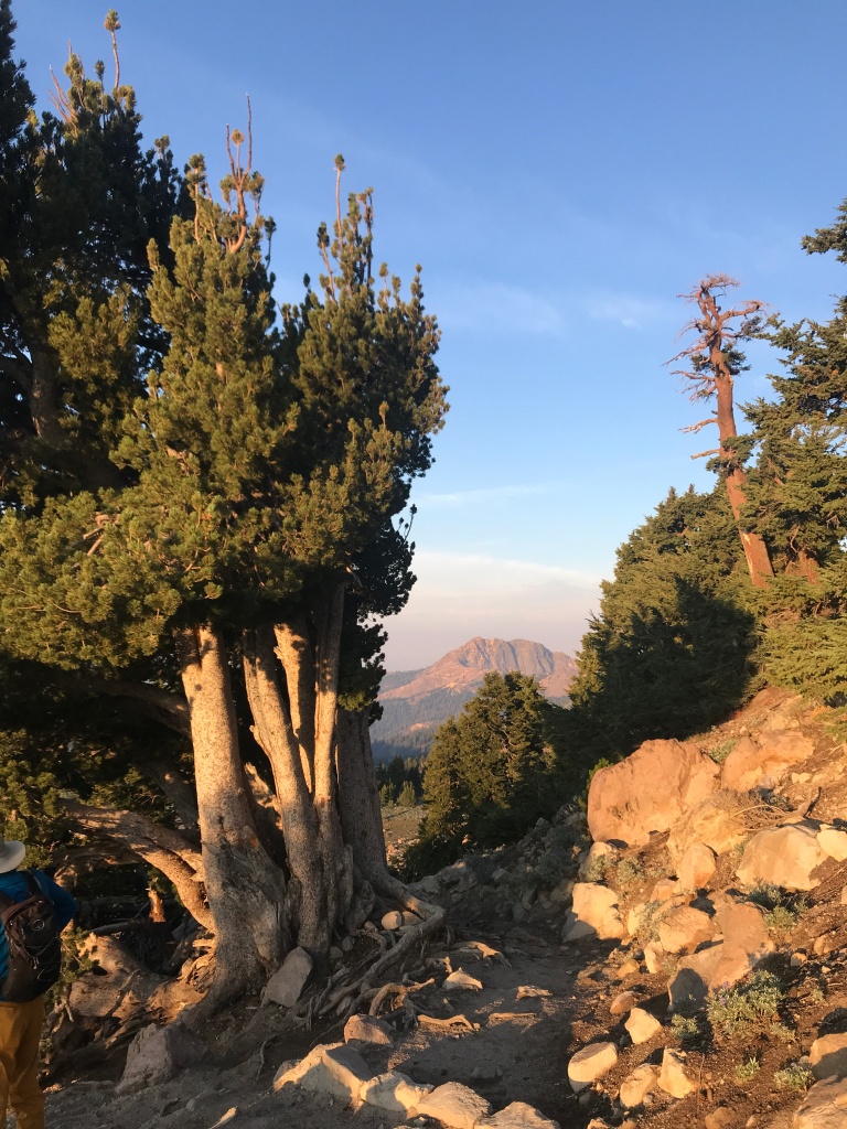


Because of the white bark pines, the mountain has hundreds of Clark’s Nutcracker birds. These crafty and industrious birds can bury up to 93,000 pine seeds in a season!! Clarks are responsible for almost 100% of new white bark pine starts. A win-win relationship – well played, Mother Nature.

We also saw at least one of the few wildflowers that grown ONLY on Lassen Peak, the white Lassen Peak Smelowskia, and the youngest volcanic rock in California, Black Dacite. This stone is flecked with prominent quartz crystals which shimmer in the sunlight. Eye-popping!

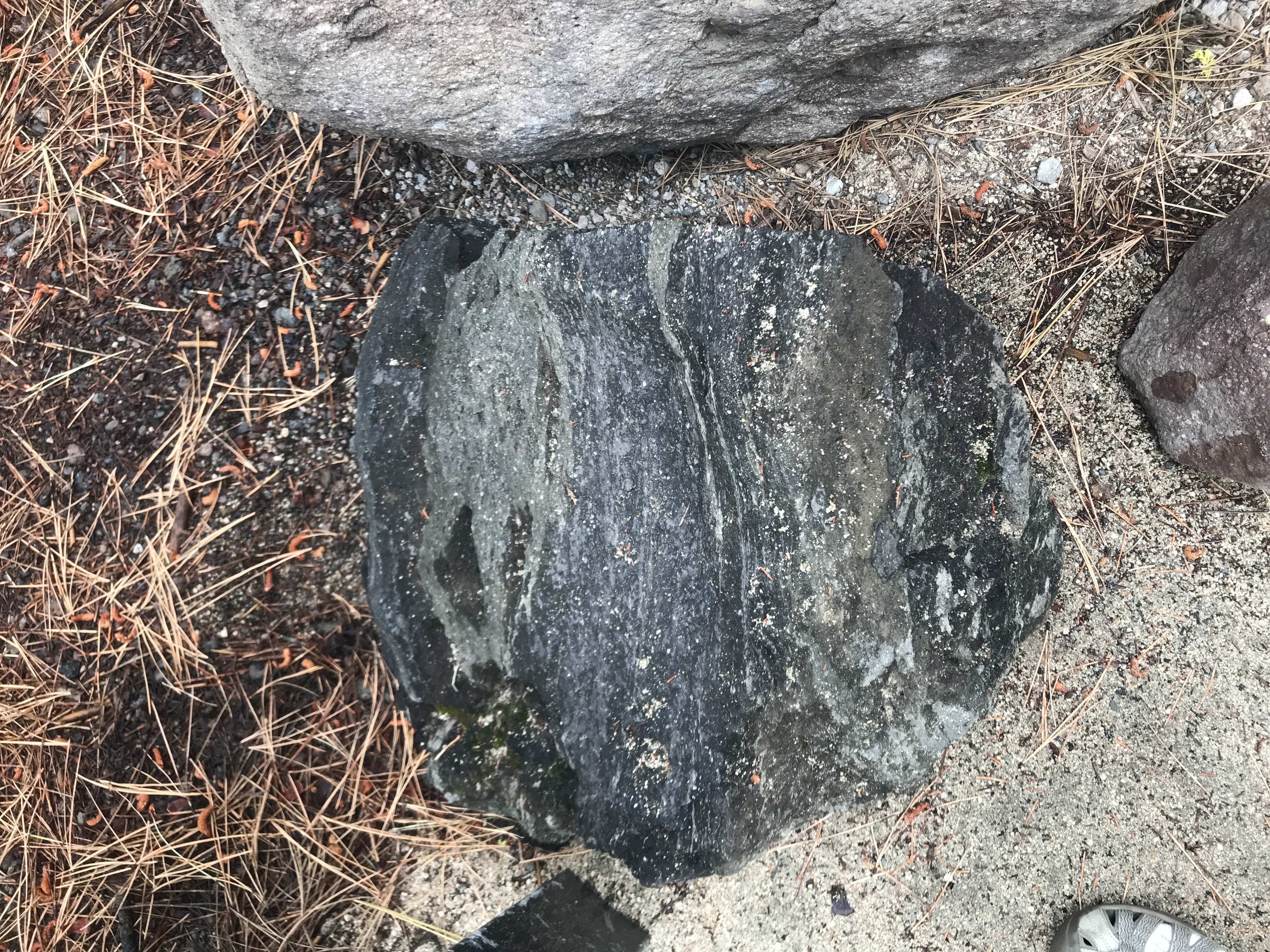
Upon reaching the summit, we marveled at the amount of permanent ice at the top, most of which displayed Watermelon algae which makes the surface look pink and allegedly smell like watermelon. Then the fun began in earnest.

There are at least four big craters atop Lassen Peak. But they are not what you might think of, not round or symmetrical or empty. These craters are full of angry, violent-looking shards, boulders and conglomerations of frozen-in-flight lava. So cool!! We have NEVER seen anything like it. We scrambled, ran and crept over razor-sharp rocks for an hour, enjoying the uniqueness of having access to something like the surface of the moon. Some rocks were like obsidian, so smooth and shiny, some were like A’a lava (the impossibly rough lava on the Big Island of Hawai’i), and some were like cast bronze (think of a Henry Moore sculpture and you get the idea). Totally engrossing.
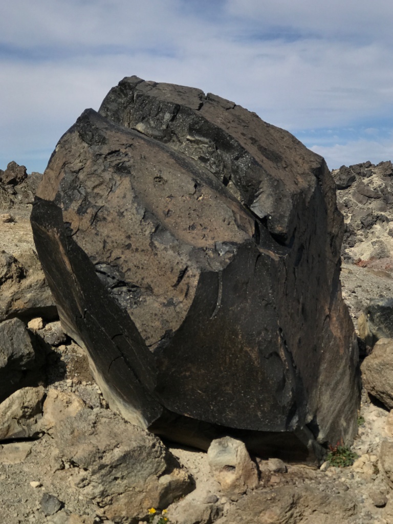
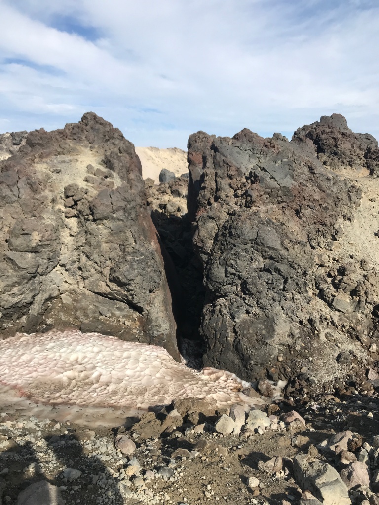


We enjoyed the rapid hike down, as Lassen Peak Trail has one of the nicest groomed paths of any on this adventure. Alpine chipmunks, ground squirrels and Clark’s Nutcrackers accompanied us all the way, and we met a steady stream of later morning hikers on their way up the mountain.
———————————————–
Today was another early start in the darkness, and only as we started out on our trek up the Cinder Cone Volcano in Lassen’s northeast corner did we notice that the fog/humid haze was heavier today than yesterday. What occupied us more fully was the struggle we had hiking through the deep cinder sand along the 1.5-mile approach to the cone. We’re not fans of walking on the shore in deep sand (one step forward, two steps back), but getting UP the slope in cinder cone sand was MUCH worse (more like one step forward, three steps back)!

It’s only a 600-foot ascent, but the grade on the cone is at least 30%, and it was gutting. 50 paces, then stop to catch breath. Another 100 paces of slogging, then stop again. Grueling! The thought of doing this in mid-day sun is nauseating. Thank goodness it was only 55 degrees when we ascended.
Got a couple of photos of Lassen Peak from the slope of Cinder Cone, then resumed the hike to the top. Reminiscent of our hike up Ubehebe Crater in Death Valley, this summit was symmetrical, even, orderly, and collapsed into a perfect well in the center. We chose not to descend into the inside, although there was a very nice path down to the bottom. Enough punishment for one day.


As we stood up top, the view of Lassen Peak in the distance became more and more obscured in haze. What’s going on, we wondered. As we later learned, more lightning strikes had occurred in the park and firefighters were fighting two blazes in the south and southeast park zones.
The descent from the summit was amazing, as it took us by a field of pumice hills called the Painted Dunes, which were dyed red, orange, yellow and green from oxidized minerals in the pumice. We also got up close to the dark basalt lava flows, which spewed from a vent at the cone’s base. This volcano last erupted over several decades around 1650, but it looked like last year’s eruption. Perhaps most fascinating for us were the lava bombs hurled from the top of the volcano. These are beachball to easy chair sized roundish blobs that were flaming when they flew. They landed and cooled in the cinder sand, and depending on the season of year, they either shattered from cooling suddenly, or exfoliated over a period of centuries to look like a peeled orange. Again, all manner of colors. What a great learning experience, even if we were exhausted by the hike!


We’re learning from Californian campers how to take fires in stride, so to speak. They live with this threat every summer, and they know what it means to see a pink, orange or yellow sky, colored either with flames from the ground or suspended ash from fires below. There are currently major fires near Sacramento, Red Bluff, Napa, Sonoma and Los Angeles. And in this park, there are two minor fires started by lightning.
We checked several times during the day with park authorities to see about the fires’ progress, and since there are 25 mph winds expected tonight, what might be expected about their spread. CalFire helicopters were flying overhead during the afternoon. As of 7:30pm, these latest blazes are now contained. But as one man told us, the campgrounds and the park itself have 80% more wood fuel available on the ground and in the branches of middle-aged trees to avoid destruction for long. We the public love our tree-filled parks and campsites. Natural fires should have long ago cleared out a lot of the trees, but they’ve been protected. There is a price to be paid.
————————————————————
After three demanding hiking days, we decided today to take it easier on our hiking bodies. A 6:30am start at the Manzanita Creek trail directly behind our campground promised interesting views and wonderful blooming meadows.
The gentle 6% grade upslope was a welcome change from yesterday, and the Ponderosas, Jeffries Pines and Pacific White Firs along the path were magnificent. They have been protected for years, since they’re so close to the camp and visitors’ center. But the amount of deadwood, dropped branches and burned trunks built up from the past 70 years is a frightening reminder that there could be a crown fire here that no amount of firefighting brigades could control.
We saw glimpses of Chaos Crags’ peaks, Loomis Peak and Lassen Peak through the tree branches as the sun rose higher in the morning sky. I have a thing for stony mountainsides bathed in either the rosy morning sun or late afternoon golden rays. Stunning.
Close to the trail’s end, we crossed into a grassy meadow full of yellow daisies, blue lupine and fuchsia fireweed. Then the trail sank into marshland and we had to ford streams via branch and log bridges. The moss was so thick, it seemed like carpet. But not so fast! I stepped on a moss patch, only to discover that it was floating on deep water underneath. Thank goodness for quick reactions, otherwise my boot would have been full of ice water.


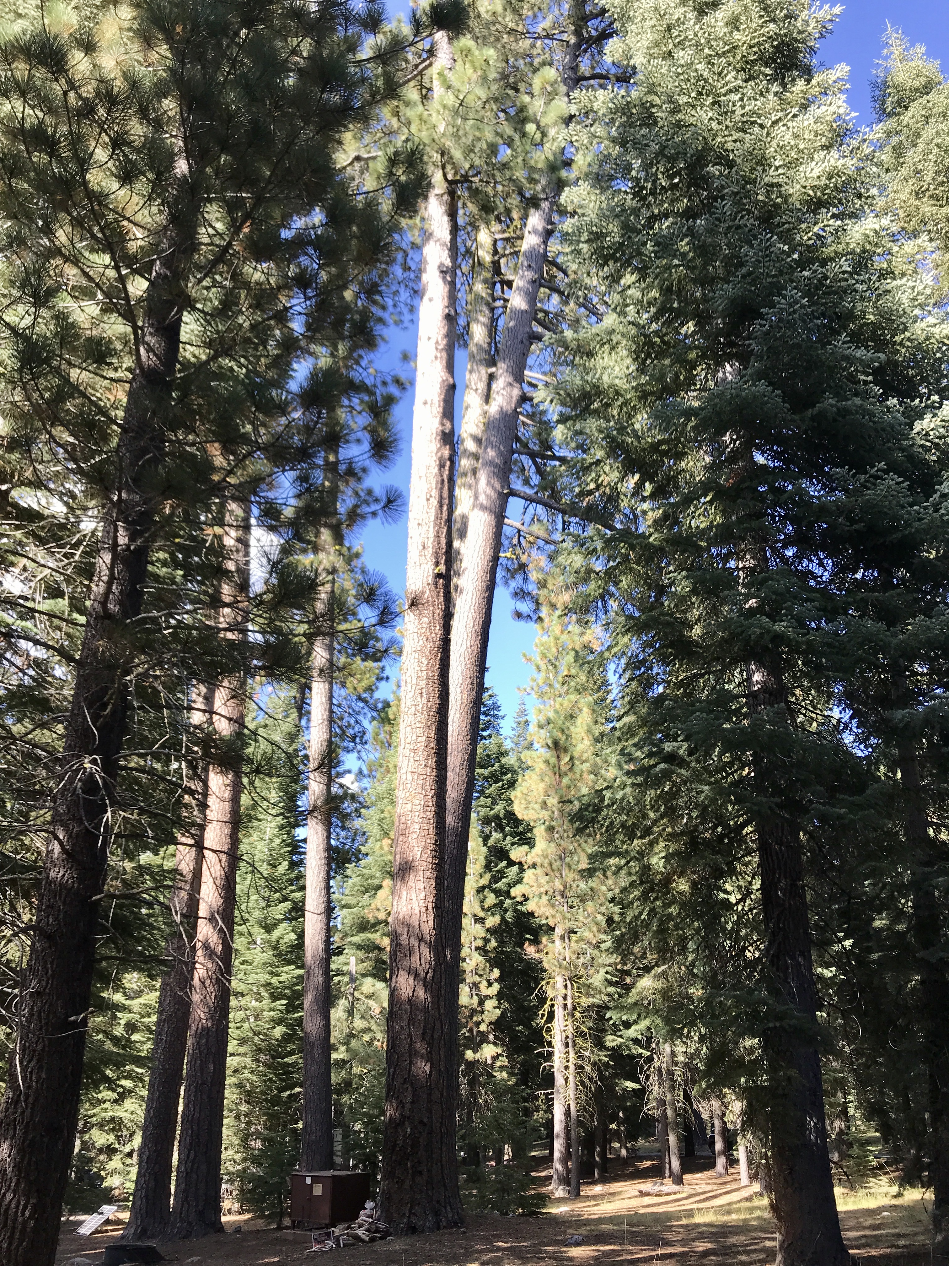


We spent 15 minutes or so marveling at the blossoms and bushes thriving in this box canyon at the end of the trail, before reversing course to return home. Three hours on a 7.3-mile trail, yeah, you can cover ground quickly when you’re not headed up a steep slope!
The rest of the day we spent cleaning house, prepping for departure day after tomorrow, and hiking down to the campground host to get updates on the fires. Sometimes that’s the routine on adventure. We hope for Mother Earth’s sake the fires are out soon.
—————————————————-
The fires around Lassen Volcanic National Park are not extinguished by a long shot, but those inside the park are. Nevertheless, smoke hangs thickly in the air. Yesterday at 4pm, it seemed like someone had turned the sun’s brightness down by half, and we still had four hours of light before sunset. The sky went pinkish brown and stayed that way until dark.
This morning we had overcast skies, but by the time we reached our last new trailhead, Kings’ Creek Falls, it was clear that the smoke, whitish-grey this time, was just as bad as last night. This is one of northern California’s worst summers for fires, and we are right in the middle of it.
Kings’ Creek Falls trail should really be called Manzanita trail for all of the low-lying red-branched green bushes that grace it. The terrain reminds us of the many trails in Great Smoky Mountains National Park we hiked four years ago. Rolling ups and downs, with occasional bald rock outcroppings. Instead of rhododendron and azalea bushes, though, this 5-mile trail has manzanita bushes, chinquapin, Mormon tea bushes and heather softening the stone facades.

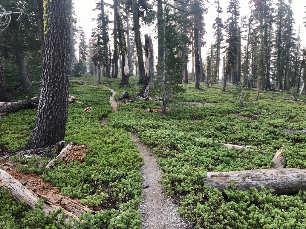
You would think, looking at the rocks and fragments on the slopes, that they are sedimentary, so many layers to behold. But they are igneous, in fact hundreds of layers of lava overlaid on one another, and the resulting rocks are not bound together tightly. Something in them makes the lava layers only weakly bonded to each other, so that weathering and the vertical drops when they separate from high cliffs and roll into the valleys — these forces cause them to split apart into a million shards, or to fragment into smaller rocks that still show their hundreds of layers. We have seen this before in shale and slate breaking down on a mountainside, but never in igneous rock. It’s quite fascinating.


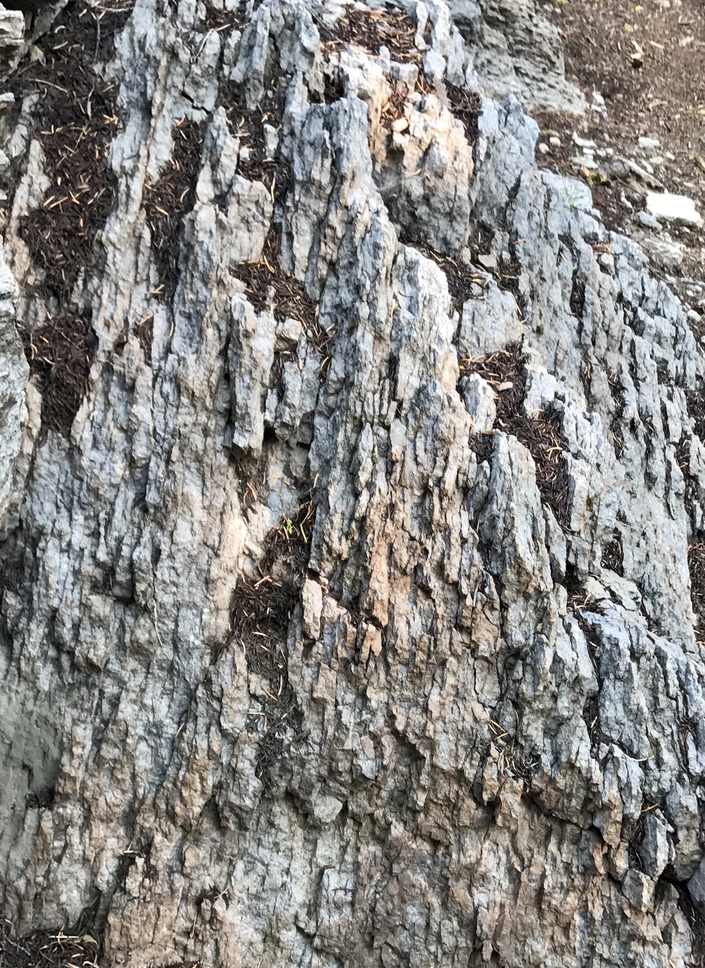


Kings’ Creek enjoys multiple significant drops in altitude, so that hikers see a number of falls along the path. It’s refreshing to feel the cool, oxygen-charged air and see the many plants and flowers that thrive in this moist microclimate. Toward trail’s end, George spied a young marmot enjoying a snack in a pile of twisted tree branches. We stood nearby and I got a couple of nice pix of him/her, as the marmot surveyed us and tried to decide whether to stay in its hide or flee for its life. We were happy to see this furry creature but know that marmots and pikas don’t have a long future in Lassen NP. It’s just getting too hot for them here.
Also spied a beautiful little Merlin falcon flying among the trees. Small hawks and falcons can be agile among the trees and lethal to the little chipmunks, songbirds, pikas and squirrels in the woods. But they surely are beautiful to watch.
So that’s it for Lassen hiking for us. Seven days here, every day a significant hike, 12 hikes in all, 41 miles, personal best in a single park. All memorable and treasurable experiences for us to savor. Tomorrow we move on.
——————————————————
In Verdi, NV, 15 miles north of Lake Tahoe. We’ll hike a bit tomorrow, then scout some winter ski places for our kids and cap off the day with a gourmet take-out dinner high above the lake.
It is so smoky today, from all of the fires west of I-5 blowing ash and soot toward the Sierras. It’s a pity because it’s impossible to see the mountains from lakeside and the lake from the mountainside. But we count ourselves lucky not to be in the midst of the flames. And to be able to grill a salmon and sweet potato dinner from our perch behind the casino!
——————————————————–
We have enjoyed three days north of Lake Tahoe. Hiking has taken a back seat to driving around and learning the ropes on eight ski resorts and how it all works here (quite different than the I-70 corridor of ski resorts in Colorado). It’s been fun to visit the towns scattered all around the lakeside, as well as our favorite, Truckee, CA. And to observe the differences between the Crystal Range (west side, gets more moisture, glaciated) and the Carson Range (east side, non-glaciated, rain-shadow side of the mountains)
Tahoe Rim Trail did lure us away from the resort hunt this morning, and it was just lovely. We kept the hike to six miles and wandered in and out of the woods to glimpse a clearing sky over Heavenly Mountain Resort southeast of the lake. Saw a rock outcropping where peregrines raised chicks this spring, and collected two specimens of coarse-grained (pegmatite) granite from the path.
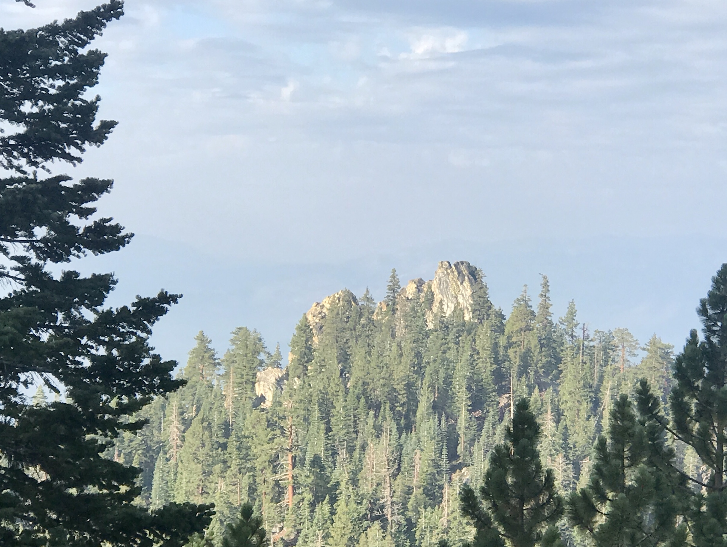


Tahoe is unlike other mountainous areas that are heavily populated winter playgrounds, in that it is heavily “boulderized.” This means that huge granite boulders have fallen off the mountains and outcroppings, and just as in Yosemite, grey granite slabs, round crowns and walls define the terrain. In summer, it looks a bit harsh if what you expect is green rolling hills, but we love it. Rock climbers’ paradise. Austere and angular. And you hope for a very good snow base for the skiiers, as the runs are right over the rocks.
We finally got a great view of the Lake from the double gondola up to Heavenly’s Tamarack Lodge and West basin. It is a very pleasing blue-green, and seemingly goes on forever.

Lake Tahoe has something for everyone. We do fear for its future, as the residential areas are ALL in among the Ponderosas and fir trees. And there is plenty of fuel on the forest floor. It would be horrific indeed if/when the California summer fires reach here. It is only a question of time. We must change our attitudes about living with prescribed burns, and/or manually clearing out the fuel. We have set the scene for a kindling-rich blaze right in our own backyards.
———————————————————-
We’re in our final hiking location now, Mammoth Lakes along the CA-NV border, just southeast of Yosemite National Park. We’ve wanted to visit here forever, to see Devil’s Postpile National Monument and to hike these granite and basalt peaks.
Today was the Postpile, and except for the crowds, it was spectacular. The lava flow that created these unique basalt formations ran 400 feet deep, and when the flow hardened, the basalt cracked into near-perfect hexagonal columns (creating columnar basalt). Subsequent glaciers (40,000 and 20,000 years ago) scraped away debris to reveal the standing columns. The Postpile is one of nature’s finest examples of this phenomenon worldwide.


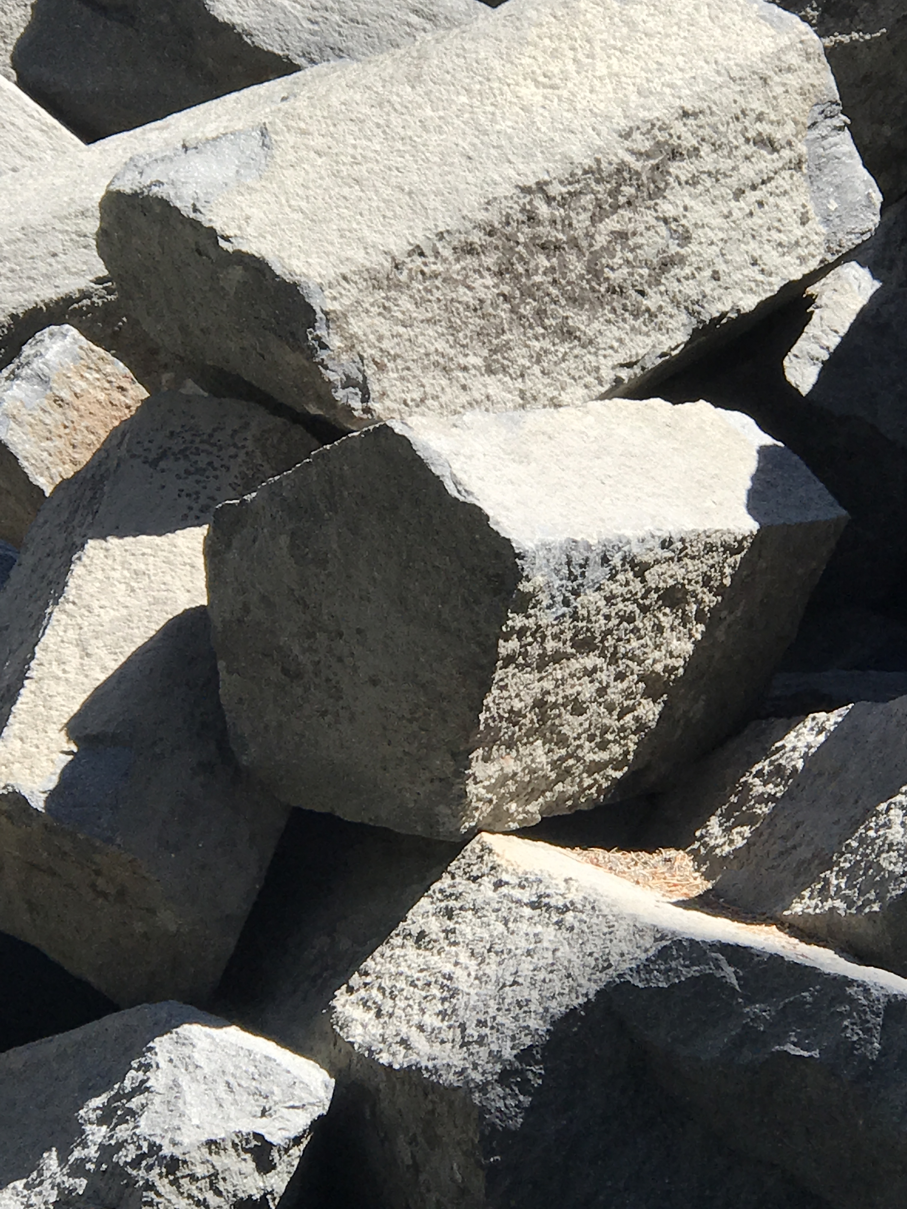
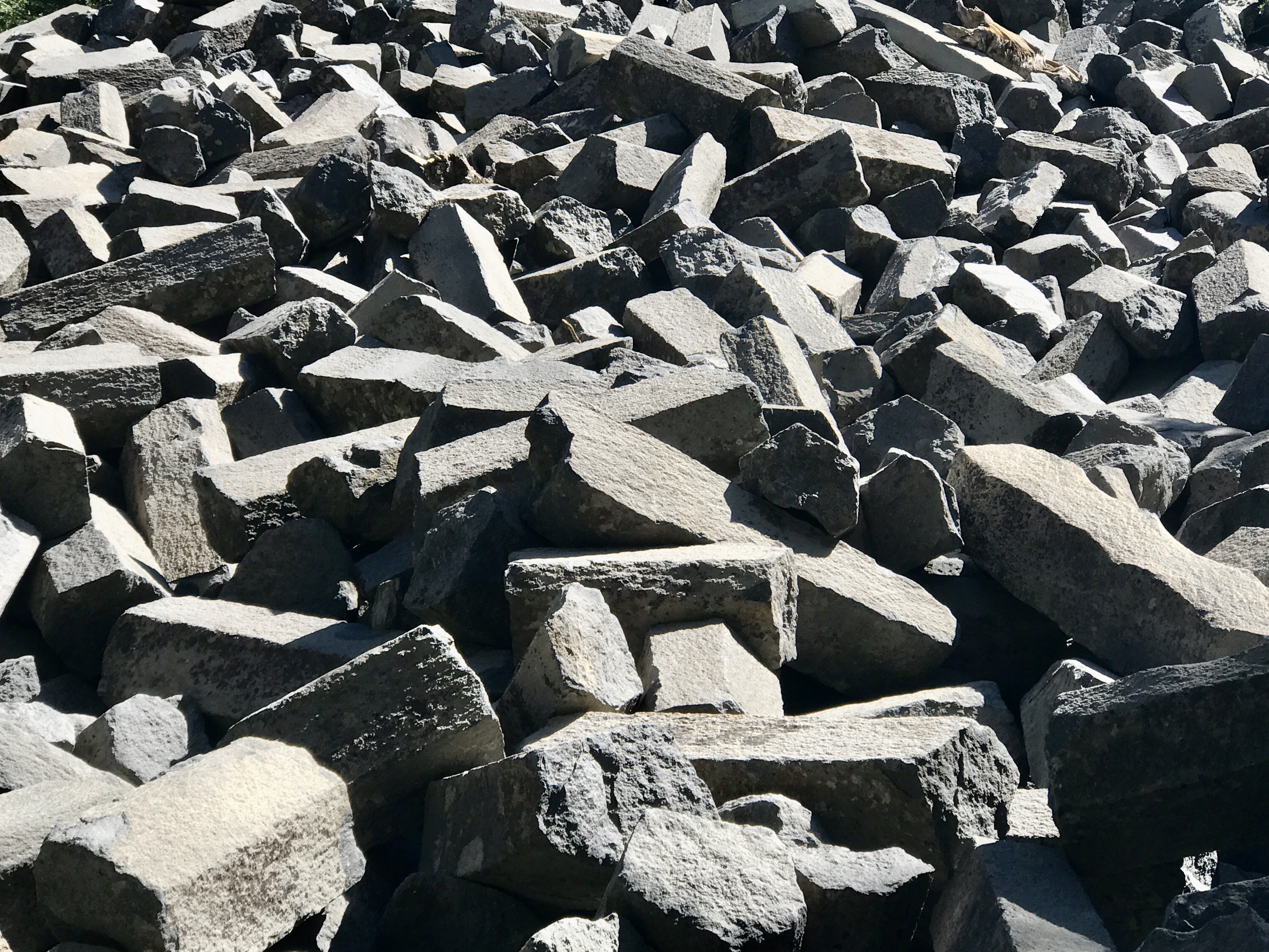
We also pulled off to view the Minarets, impressive and sharp granite peaks which resemble the Aréte on the Going-to-the-Sun road at Glacier National Park. And to see the 700-year-old fault line at the edge of the monument. For those of us Midwesterners who don’t often get to see an earthquake rift, this was cool.


Monument Mountain, the area’s largest ski resort, was jammed with people wanting to ride the gondolas upslope to its 10,000+-foot peak and mountain-bike-ride down into the valley.

Not much hiking was had, because of crowds and because we got a late start on the day. We’ll remedy that tomorrow!
———————————————————–
We’ve both been suffering from a bit of intestinal flu and trying to work it out of our systems. Yuck. Hope it’s on its way out of town!
This morning we headed out to Rock Creek Road, just south of Crowley Lake where we’re staying. This 10-mile stretch of road reaches way back into a wondrous box canyon that contains just about the most gorgeous granite paradise you can imagine. We drove upslope to the road’s end, where the parking lot was FULL of folks headed out for back country camping (4, 5, 6-day tent camps) in the John Muir Wilderness, as we came to know from chatting with them.
The trailhead is already at 10,200’, and it ascends 1600’ to Mono Pass, so right away you know it’s going to be a challenge. Air is well-cleared of smoke today, but we still have a bit of raw throats from the past week of breathing in airborne ash.


The trail started out easy at 7% grade, leading to both Morgan and Mono Pass along the beautiful snow melt-fed Rock Creek and the start of Many Lakes Trail. As soon as the switchbacks started, the grade changed to 12% and the true climbing began, over stones and steps. Trees are all rugged white bark pine up there, so we saw plenty of Clark’s Nutcrackers along the way. The lakes were jewel-like, especially the stunning Ruby Lake, which we towered above as we neared the pass.
The real stars of this hike were the granite peaks, the ever-present granite and gabbro scree (ranging from small stones to house-sized boulders) and the glacially-ground walls of the canyon. We deduced that the mammoth scree piles on the south side of the canyon could be a lateral moraine containing what the glaciers eroded from the north side of the canyon. We have no other explanation for why one side is a long series of rounded rock surfaces and the other side looks like glacial till. The granite along the north side where we hiked is mostly large-grained (pegmatite), vertically faulted all to heck, with particularly large crystals of potassium feldspar protruding from the eroded surfaces. Really unusual.


One of the sharp-peaked slopes that appears untouched by glacial erosion looks from a distance like the cathedral at the Air Force Academy — very sharp, long shards of blazing white granite, thrust straight up to the sky. Outstandingly beautiful.

Just as we were approaching Mono Pass, I had a strange problem with my breathing and decided that I would go no further. 12,000’ is quite enough elevation for this flatlander chickie. But my intrepid husband knew how disappointed I was, and he agreed to scramble up another 100’ to see if the view was worth it. Whatta guy! Short answer: no, it’s not worth it. We would have had to hike another mile or three to get to an outlook worthy of the effort. Even so, the Pioneer Lake Basin is not so compelling that I wanted to risk not being able to breathe, so we lunched just short of the Pass and headed back down.


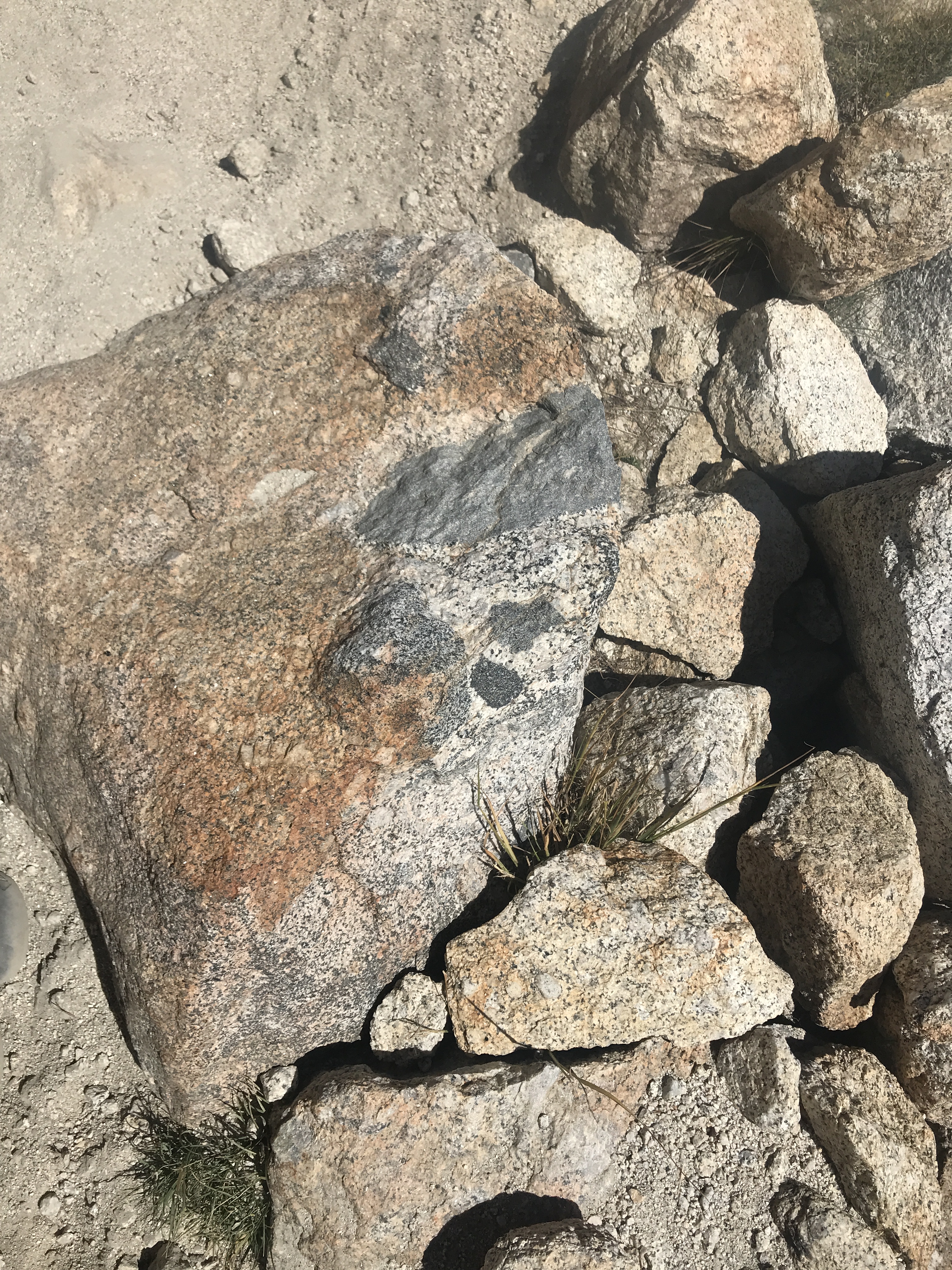


As it was, the most breathtaking views on the hike were all short of the pass. We had a great seven miles in the Sierra Nevadas, and we’re thrilled with this epic hike!!
————————————————————-
Today we strike out for our final upper altitude hike starting from the town of Bishop, CA. The trail is called the Lake Sabrina Basin, and it should be somewhat similar to yesterday, with more lakes!!! Winds have shifted, though, and the air is very smoky.
Today the trailhead was at 9,135’, and we launched into what George calls a Rock Hike. Huge steps, rocks and tree roots lined most of the path, and we spent lots more time ON the granite than yesterday. Good flexure for the knees and ankles. Ascent was 1400’ over 3.5 miles, up to Blue Lake. The trail goes on from there to dozens of high alpine lakes, but we are tuckered out, and done for now.


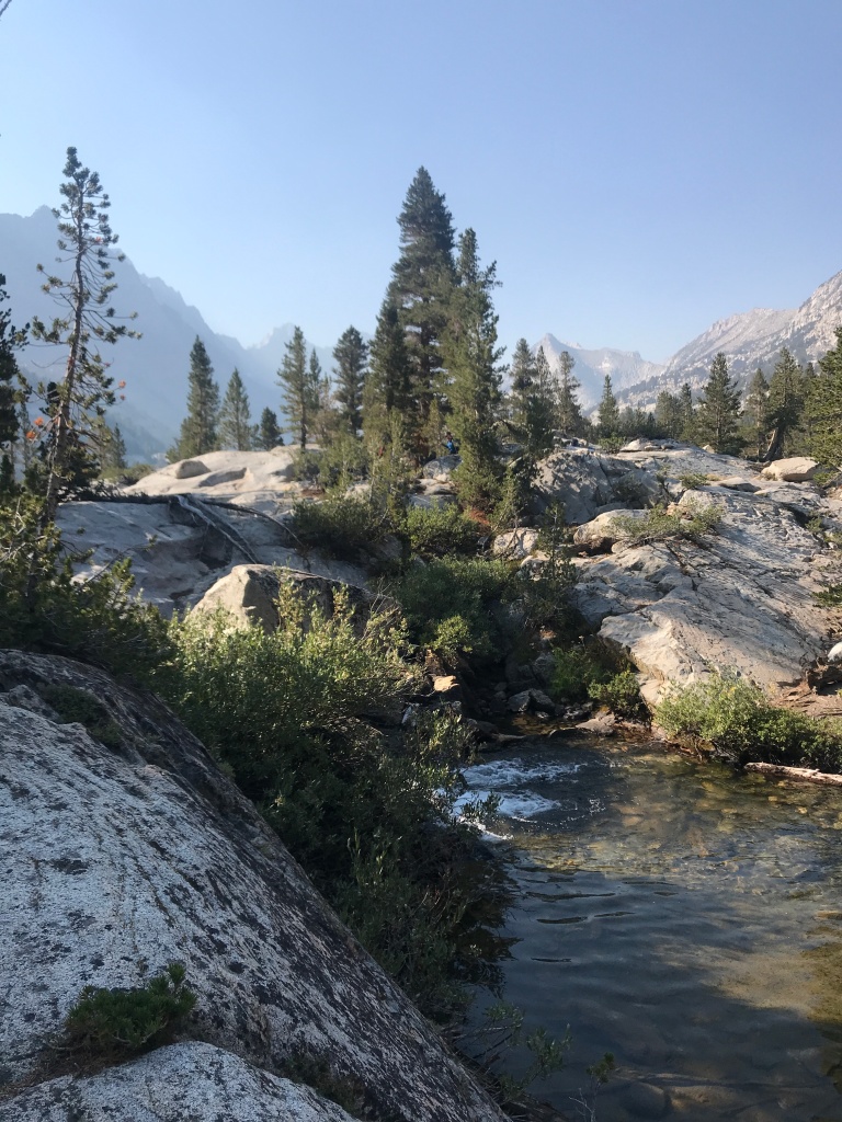
Our joys for the day include seeing a great deal of pink potassium feldspar, which was so lovely to look at. It resembles rosy pink saltwater taffy. Briefly meeting other masked hikers along the way – what a diversity of folks on the path! Seeing enormous granite peaks all around us, including the red rocks of the Piute Crags, as we plodded up and down the valley. Ogling a string of beautiful pack mules coming upslope to deliver five fishermen’s food and supplies for a multi-day fishing trip at 10,000’. Marveling over the blue waters of the Sierra Nevada mountains, then scanning upwards to see a bald eagle barely 25 feet from us in a snag, eyeing trout in the lake. Finding our bliss in the mountains one last time on this trip.
Our feet are sore, as well as our backs and arms from poling, but we are supremely happy and at peace. We’ve hiked 200 miles this trip, ascended a total of 38,218’, and consider ourselves now first and foremost upland hikers in search of great outlooks, great nature and great health in mind and body. We’re in the zone.
——————————————————————
In Sacramento, California’s state capitol, for housecleaning and Mojo prep before storing her and heading back home. We thought a city walk would do nicely for this morning.
Lots of commercial buildings are boarded up against looting downtown, which is a shame, but this is the state of the nation at the moment. We understand the rage, if not the provocation from outside groups.
Lots of homeless in Sac-Town, because the weather stays pretty mild for three seasons before becoming positively tropical in the summer. Fire smog is very thick.
Historic preservation is alive and well here, and there are hundreds of residences and business buildings from the 19thcentury when California was in the midst of the Gold Rush. Of course, John Sutter is immortalized for his land development, but fortunately California is also honoring its Latino/a leaders and indigenous tribes who were so influential in the state’s history.


We finished off with a stroll around the Capitol grounds, admiring the stunning and varied gigantic trees towering over the government buildings. Montezuma Cypress, Incense Cedar, Tulip, Palm and giant Magnolias. Truly a stately combination.
We’ll fly back to MN tomorrow to celebrate the birthdays of our daughter and grandson, for some doctors’ appointments and to vote absentee in the Presidential election. All fingers and toes crossed (with on-the-road campaigning activities to come!) for this country to get off the fascist track and to return to democracy as we know and cherish it. Back for Adventure 12 in one month!!!
