
————————————————————-
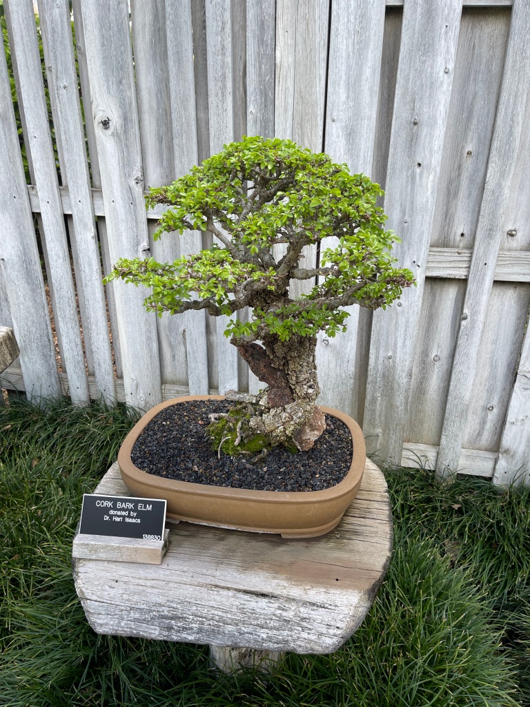
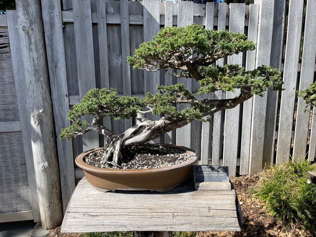
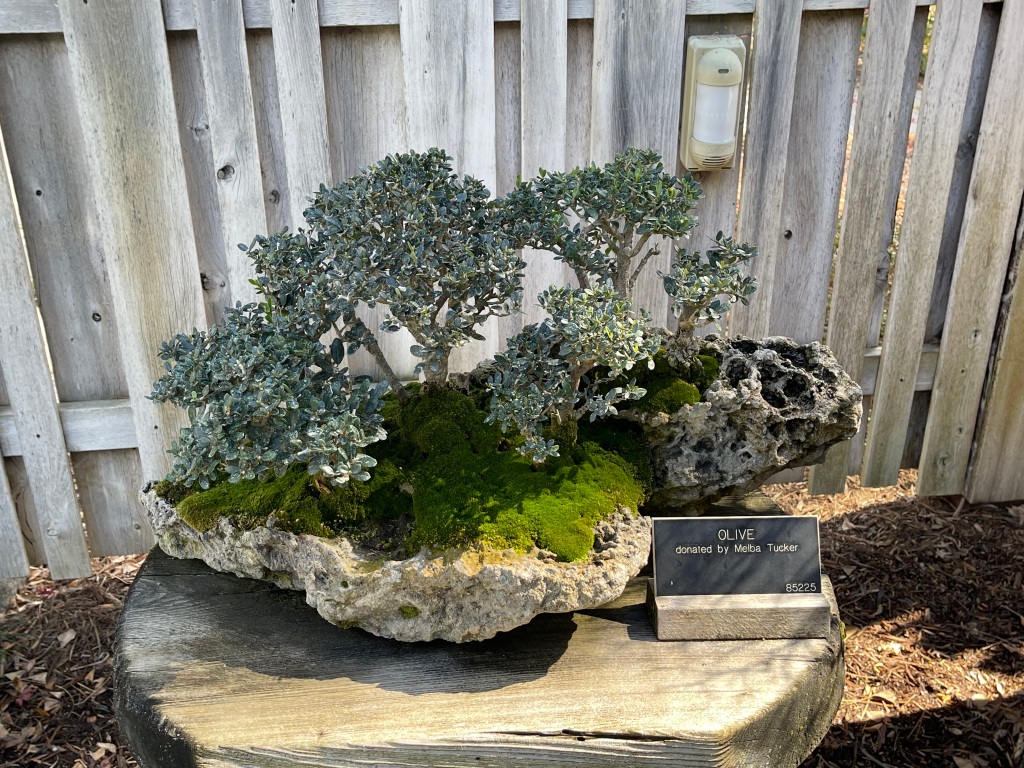
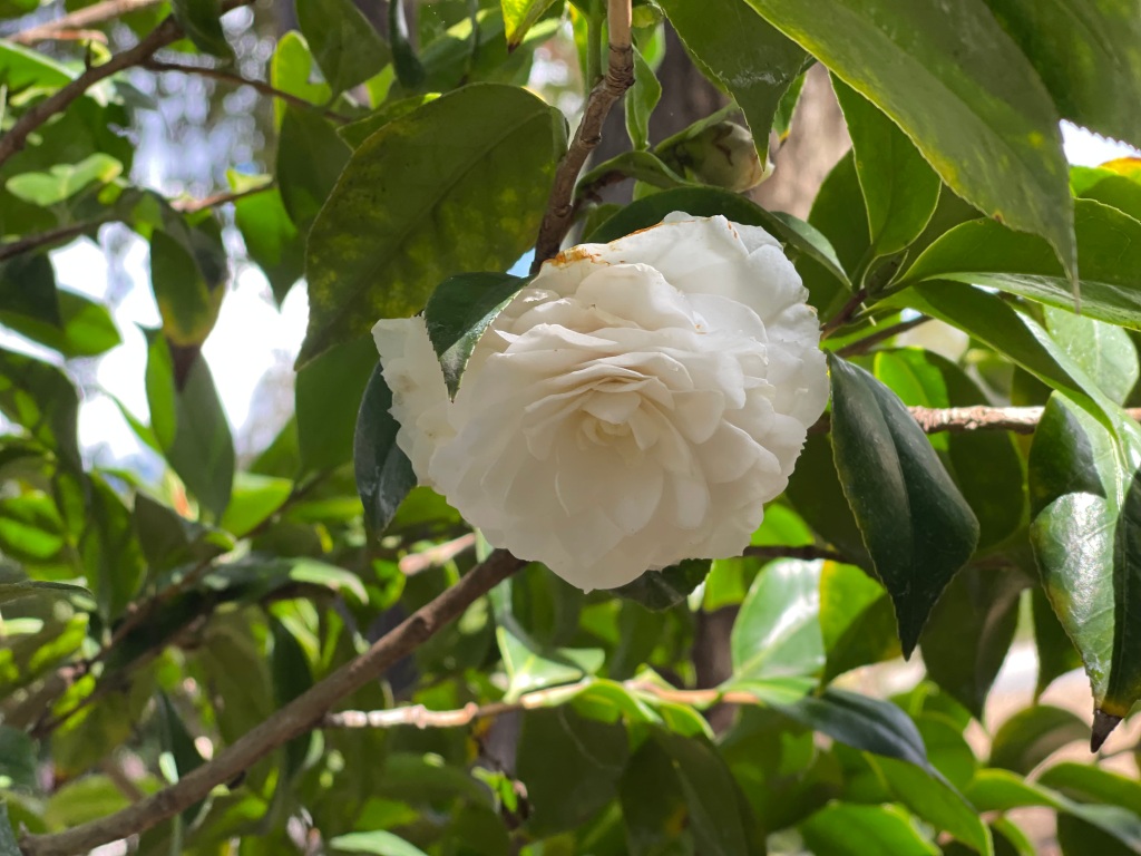
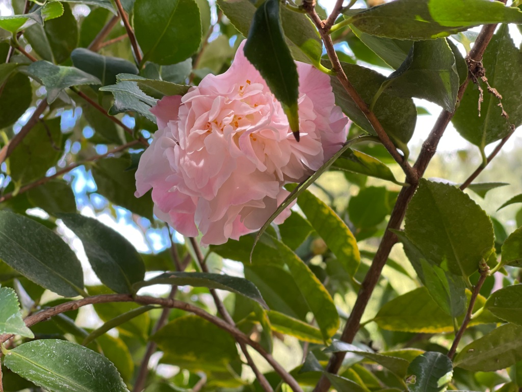
After a runaround yesterday filled with errands, we scored a perfectly wonderful agenda of events today. Starting with the Huntington Gardens in Pasadena, we went straight to the Japanese Garden section this morning where we soaked up the unexpectedly large Camelia Garden as well as the impressive Bonsai Collection. The Huntington has John Naka’s Goshin III forest bonsai, which for thousands of Bonsai enthusiasts is the sine qua non of bonsai design. Simply sublime.
In contrast to the Oakland Lake Merritt bonsai collection viewed several weeks ago, the Huntington’s collection lacks Korean Hornbeams, Live Oaks and Japanese Maple exemplars. It is rich in Chinese Elms, Chinese, California and Japanese Junipers, Sweetgum, Olive, Myrtle and the ultra-rugged Black Pine. Breathtaking specimens.


The Huntington’s hundreds of camelias in all possible shades and aromas were a delight to see. They belong to the broad family of flowering shrubs that also produce tea leaves and were a special favorite of my dad’s. They remind me of old-fashioned English roses, the kind still grown by David Austin in Texas and the UK. And the fragrance is unforgettable. Camelia gardens are a rare treat.


Next, we drove to Glendale for a hike up the Beaudry Loop to Tongva Peak, a memorable 5.5 mile trail with demanding 9, 10 and 12% grade sections and a 1,500’ elevation gain. Views were spectacular throughout, showing us the LA-surrounding cities and the San Gabriel mountains, where snow fell last night.
Halfway up to the summit, I thought I saw a drone in mid-air, then it seemed to be a kite or a flag stuck on a cable. At last I recognized it as a red-shouldered hawk poised in mid-air, absolutely still on a thermal. He/she was scanning for lunch, but absolutely still, suspended by the wind. Amazing.


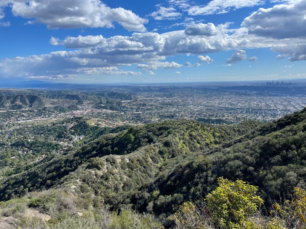


We got to see downtown LA and the Pacific Ocean way in the distance again. Would have seen the Rose Bowl if Flint Peak hadn’t been in the way. The Jet Propulsion Lab was viewable from above, as well. BTW, temps were chilly (50 degrees with spotty sun and high wind gusts) and we kept our moving speed up to stay warm.
The north side of the LA basin reminds us of Phoenix (or four Phoenixes!) in terms of mountain peaks that emerge out of the populated lowlands and foothills. Just like Camelback rises from Scottsdale, so too do the Simi Hills, the Verdugo Mountains, the Puente, Peralta and Chino Hills stick up from Pasadena, Altadena, Glendale, Pomona and Whittier. It makes for difficult building environments, but for those with funds to build in the hills, they’ll pay for the views.
To finish out the day we made a trip to a small bonsai designer in La Crescentia to secure a 12-year-old Juniper bonsai of our own, which may perhaps someday be a cascading specimen. Lastly, we stopped at the Altadena Farmer’s Market for more beautiful vegetables, picked-ripe strawberries and dinner from food trucks (Chinese dumplings and Colombian Arepas).


Days like these are so extraordinary, they qualify as Peak Experiences!!

————————————————————-
We didn’t want to hope for another Peak Experience today (doesn’t pay to be greedy!), but we had a pretty darn good day.
Started driving to our targeted hike this morning: Potato Mountain from Claremont Wilderness Park. Upon arrival I noticed that we had just crossed the Mount Baldy access highway (had hoped to hike around the Mtn area, but we were warned off by pictures of icy trails). So we thought, well, why not drive up there?
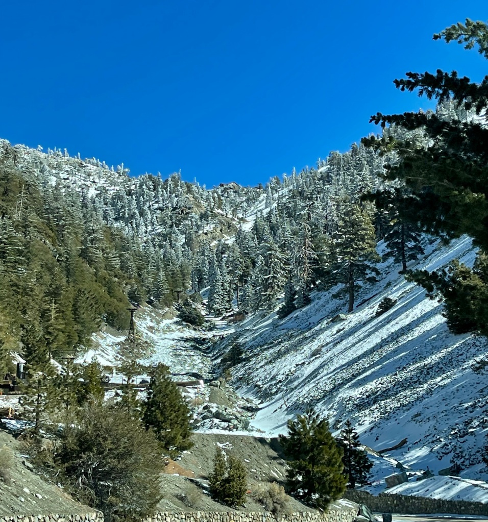
So off we headed to Mt. Baldy, at 10,064’. The ski resort makes a good destination. What a beautiful drive, and we passed LOTS of Angelenos up there with their kids, showing them what snow is like. The mountain looks as sharp and unforgiving as the terrain around the Donner Pass. Still, it’s a very beautiful setting and one that is considerably less crowded at this time of year than in summer when everyone and their dog are trying to get up to elevation where it’s cooler. Snow on the roadsides, just having fallen yesterday, definitely looks like spring snow.


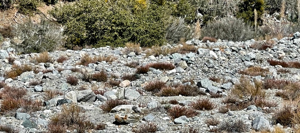
On the way down, we parked and hiked a bit in the dry seasonal riverbed that carries snowmelt away from the mountains. It was thrilling to see the gigantic metamorphic boulders in the channel, and we were able to collect some small rocks to take home for our collection. San Gabriels’ geology is fascinating.
Afterward we returned to Claremont and did our hike, not up to Potato Mountain but up the Cobal Canyon and back down Burbank Canyon. A very nice loop, 5 miles and nearly 1000’ elevation. We were excited to see all the way to the San Gorgonio and San Jacinto Mountains near Palm Springs, nearly 90 miles away!! The San Gorgonio area is now the Sand-to-Snow National Monument, established in 2016 by President Obama. Gotta get there someday soon!
A bit tuckered, we returned to our Moho base camp, had homemade lattes and ate fresh-picked strawberries. Life is great!!!
————————————————————-
Four hours on LA freeways today. I can’t believe it. Too many people drive out here, and still not enough are driving electric or hybrid cars.
We drove downtown to visit Koreatown, have lunch, visit what was billed as a Korean market, and get our laptop keyboards replaced via Apple’s recall.
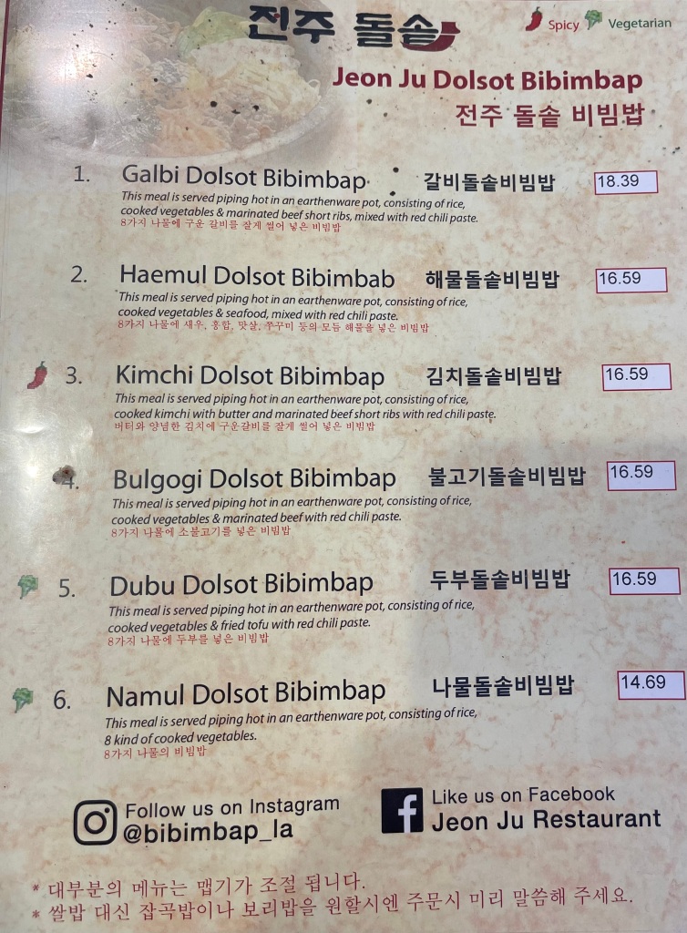
Koreatown was a blast, and lunch at Jeon Ju Bibimbap Restaurant (one of the highest rated in K-town) was totally scrumptious. Dolsot Bibimbap is a mainstream Korean dinner entrée in a hot stone bowl. The hot bowl scorches cooked rice until crispy on the edges, and atop the rice is a wonderful mix of vegetables and either meat, seafood or tofu along with a fried egg, to which you apply the hot red pepper sauce, Gojujiang, to your taste. Totally YUMMY!!


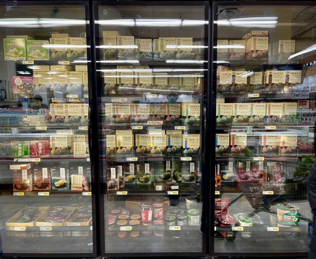
The Korean market turned out to be a massive grocery store, not a hall full of fresh markets, but we loaded up on Korean cookies for our Grands anyway, and marveled at the supersized containers of Gojujiang paste as well as an entire freezer case of frozen mochi. Got George’s laptop in for keyboard repair at a downtown Apple store, but mine will have to wait until we get to Phoenix as they only had parts for one of our two machines.


A tactical mistake was thinking we could drive down Sunset Blvd on the way to our freeway home. While it was mildly interesting to see landmarks in Hollywood,


that did not compensate for sitting on the I-10 for three hours afterward. OMG, how on earth do people here stand it? BTW, there are so many billboards in LA promoting the Oscar nominated films and actors, you can’t help but remember that movies are a dominant industry here.
We‘ve had intermittent good luck with LA’s freeways, mostly at the noon hour, but if you have to drive between 6 and 9am, or between 2 and 6pm, it’s ridiculous. And by Friday, the sky stinks of pollution. Badly. Having had many, many slowdowns here due to accidents, I also feel that Angelinos are worse accident gawkers than Michiganders or Minnesotans!!
We have to go back to the Apple Store tomorrow and hope we can hit the mid-day traffic for our trip back to camp.
————————————————————-
Well, we were not so lucky as to miss the stop and go traffic on the way back today, but it’s ok, no one can predict when a car is going to catch fire on the freeway, right?
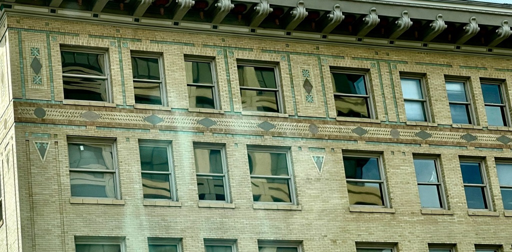
So, we got in to pick up the laptop, toured around downtown Pasadena on the way home (so many gorgeous Art Deco buildings),


and got our provisions for the next 2 weeks of boondocking in Death Valley NP and camping away from grocery stores in Grand Canyon South Rim. We’re good now. And now you know what’s up next, starting tomorrow!
Closing event for LA: had wine around a campfire with two adorable couples from Inglewood (South Central LA). Such great people. The world is small and precious when you meet folks who are like soulmates. They hosted us for dinner, and we swapped cookies and drinks. Doesn’t get any better.
————————————————————-
Turns out a whirlwind five days in LA can tucker a person out. We drove the 288 miles to Death Valley, settled in and asked ourselves why we’re so tired tonight. Hunh. Guess we’ll rest up tonight.
The drive over here was long but filled with topo changes every hour or so. I-15 north goes right over the San Gabriels, from the rainy side to the rain shadow side. The difference in climate is stark. You could almost say that the desert starts in Victorville (just north of the mountains) and just rolls into the Mohave seamlessly, with the sand building up gradually.
Once we got to Baker and headed north, the landscape started looking more and more like Death Valley, with beautiful, colorful sandstone and claystone formations looking like a preview to Artist’s Palette in the park. Then we started seeing volcanic ejecta, then the Amargosa Opera House in Death Valley Junction, and boom, we had arrived. This, the ancestral home of the Shoshone and Timbisha Shoshone, is one of our very favorite NPs.


The next 7 days will be a dry-camp week, with no sewer, water or electric hookups. It’s just fine, we’re prepared. But also next to no internet or cell connectivity. No distractions from hiking, reading, relaxing, blogging. Yay!! No Indian Tacos either, as the reservation cafe is still closed due to COVID.
————————————————————-
Wow, another Peak Experience day!! We did Kaleidoscope Canyon for the third time, and lest you think this was needless repetition of ground already hiked (2019), we pushed farther than before and saw more. Kaleidoscope is definitely one of our top ten, maybe even in the top five hikes we’ve done to date.
The reasons why include spectacular geology, lyrically beautiful dry falls, and diversity of rock types we hardly see in any other hikes. And it’s a challenging climb. Grade is 10% and Death Valley is almost always hot, so that takes a toll. Distance is only 5.7 miles out and back, but it’s on shifty cobblestone gravel and sand, so not the hard smooth “desert pavement” surface that makes for fast, efficient movement.


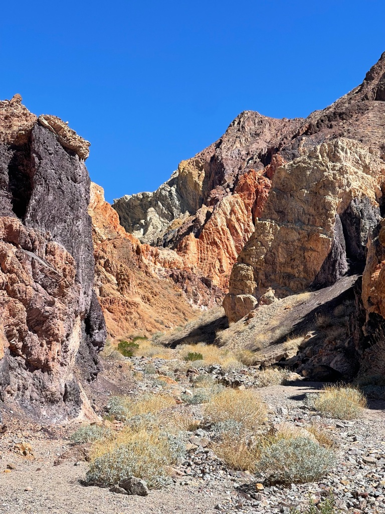
KC has such a remarkable range of colors on display, from smoky plum to charcoal, dark and milk chocolate, amber, deep rust, shockingly vivid orange, dark wine red, seafoam green and milky coral blue, white, hematite silver, and a color combo George and I can only attribute to multicolored flint. Great towering columns of what looks like cemented ash rise from the walls of the narrow canyon, and uplifted sedimentary plates appear at angles that make them look like spear points poised for battle. I would not be surprised to learn that there are heavy metals and toxic chemicals like cinnabar or cadmium in the soils, how else are these vivid colors possible?

We were thrilled to be able to scramble up five dry falls in the canyon. Admittedly, this brought us only ¼ mile further than last time, but this meant we got to see huge specimens of the flint and quartzite rocks with slickensides that we missed in 2019, and up to what is referred to as the White Rock Beacon landmark that can be seen for miles as hikers approach the canyon. It was awesome!
Resting in the shadows every 15-30 minutes during ascent meant that we completed the hike in 77-degree weather without collapsing! Drinking electrolyte replenishers, eating power bars and wearing a wet neck gaiter also helped immensely. I hope the remaining Death Valley hikes can measure up to this amazing canyon!
As a side note, it is so impressive to see all of the hard-core cyclists (solo and in pelotons) running the roads in Death Valley. Respect. How they do this in 90-degree weather is a mystery, but their dedication to the sport is unquestionable.
————————————————————-
Titus Canyon was on the menu today, and that always means a l-o-n-g drive on a bumpy, winding 27-mile dirt road to get to the good stuff. But it is worth it to see those spellbinding mountainscapes that bring into focus what tectonic forces can do to a landscape.
All of Death Valley has been subjected to squeezing, shifting, pulling apart, uplifting, volcanic forces, water erosion and submersion undersea multiple times over the past 2.5 billion years. And all of it is on display in Titus Canyon.
You see slate and claystone rocks that have recorded ocean waves in their surfaces, as well as algae and coral imprints. 5,000 linear feet (nearly a mile) of sedimentary rock that has been upended (uplifted) to now occupy only 600 feet along its horizontal surface. The 5,000 feet go straight up to the sky. You can see miles of narrow canyons whose sides have been scraped and polished by torrential river flows yearly for millions of years – they now gleam in the sunshine.
Titus Canyon shows how disorganized Death Valley’s mountains are. They run into each other, lean against one another, and the sedimentary “stacks” look like the ruins of a library after an earthquake, with stacks of books lying everywhere. Fully ½ of the 27 miles display these riotous piles of rock, while the other 1/2, the first part of the drive, shows the wide-open amphi-theatres of mountains ringing the lowlands, and all of the switchbacks you drove to get to the midpoint of the drive.


We had an IOU open to Titus Canyon. Last visit, we’d planned to hike Thimble Peak, a nearly 6,400’ isolated mountain, but bad weather forced us off the mountain just after we’d started. This year instead of 32 degrees, flurries and driving winds we had 65 degrees, mild breezes and sunshine. Perfect conditions. Or so we thought.
Our guidebook leaves a little to be desired. The grade up to Thimble Peak is a relentless 15%, just about the limit we will tackle…not mentioned in the guidebook. After battling gravity for 1 mile to gain 800’ in altitude, the recommended path asks the hiker to descend 400’ and re-ascend 400’ and another 200’+ to reach the summit. Multiply by two for the privilege of getting back down to where it’s another mile back to the starting point.
To summit Thimble Peak, one really needs mountaineering equipment, it’s that steep at the final 75’. Also not mentioned in the book.
I’m not sorry to say that we made the Promontory overlooking the final approach to Thimble Peak our turnaround point. Sometimes you just have to know when a hardcore hike is more than your boots, sticks and intestinal fortitude can handle. But our reward for that call was to see a Golden Eagle hunting for breakfast!

————————————————————-
