
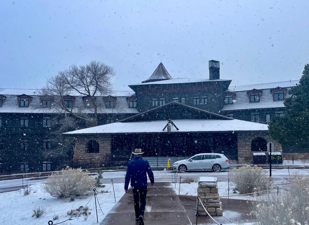
Today’s been one long episode of snow for 90 min., sun for 30 min, repeat. Lots of folks are trying to make the best of it out on trails, but we kept to plan and did breakfast at the Lodge, a 4-mile flat hike at the Rim again, and most of the rest of the day in the Moho.
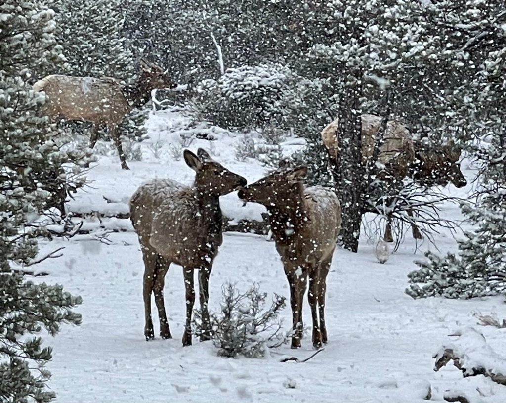
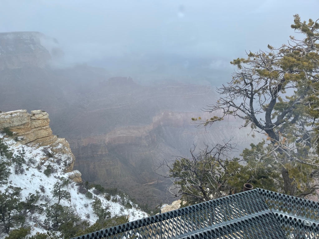
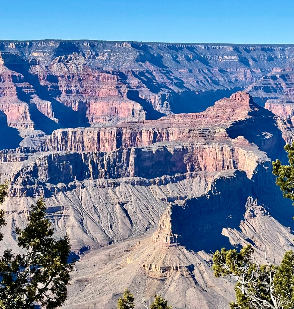
As pix from the Rim this am attest, visibility was scant until the sun broke through. As with most huge natural wonders, GC has its own weather. Snow, cloud banks that went below the rim, rain and sleet in the canyon proper. We nearly collided with a slow-moving herd of 12 elk who said, “Meh, this happens all the time here” with their eyes. We happened upon and helped a poor young woman who fell not once, but twice on the icy pavement from her cabin to the restaurant. Brutal to fall on the ice.


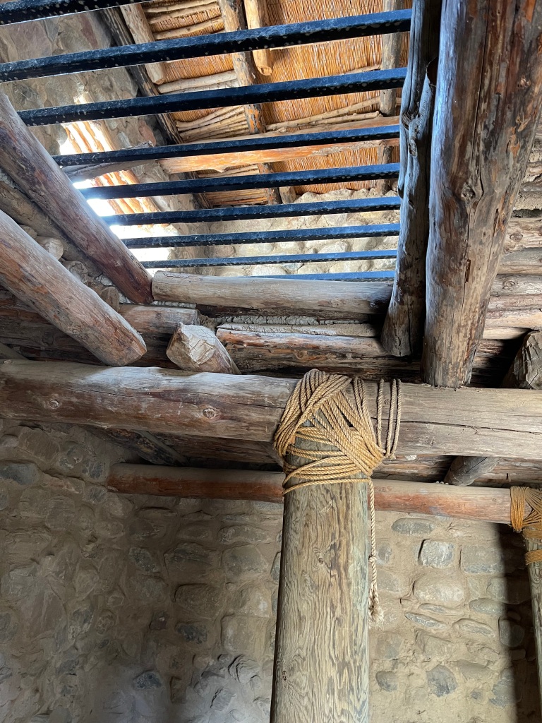
Stopped at Yavapai Point Geology Museum for great details on how the GC was formed, and at the Kolb Brothers Studio for background on those crazy entrepreneurial photographer bros’ who produced some of the earliest and most memorable photos for the park. For many years they also charged a toll for those wanting to hike Bright Angel Trail, and it made them very well-off indeed.


Great laundromat 1 mile from our camp slot helped us get laundry done in record time. Thereafter we checked online reviews for all the trails we hope to do and resolved that we probably do need crampons (ice spikes for our boots), so George chased down one GC store after another to finally find some at the Bright Angel Gift Shop. He’s nearly frozen from running around in the sleet and will be back at the campground any minute now for his hot tea. Keeps life exciting!
————————————————————-
Phooey!! Not every highly rated hike is our cup of delight.
Hermit’s Rest Trail turned out to be quite disappointing, and we only hiked 3.2 miles on it, having resolved that it wasn’t worth the considerable effort to get to Dripping Springs (end goal).
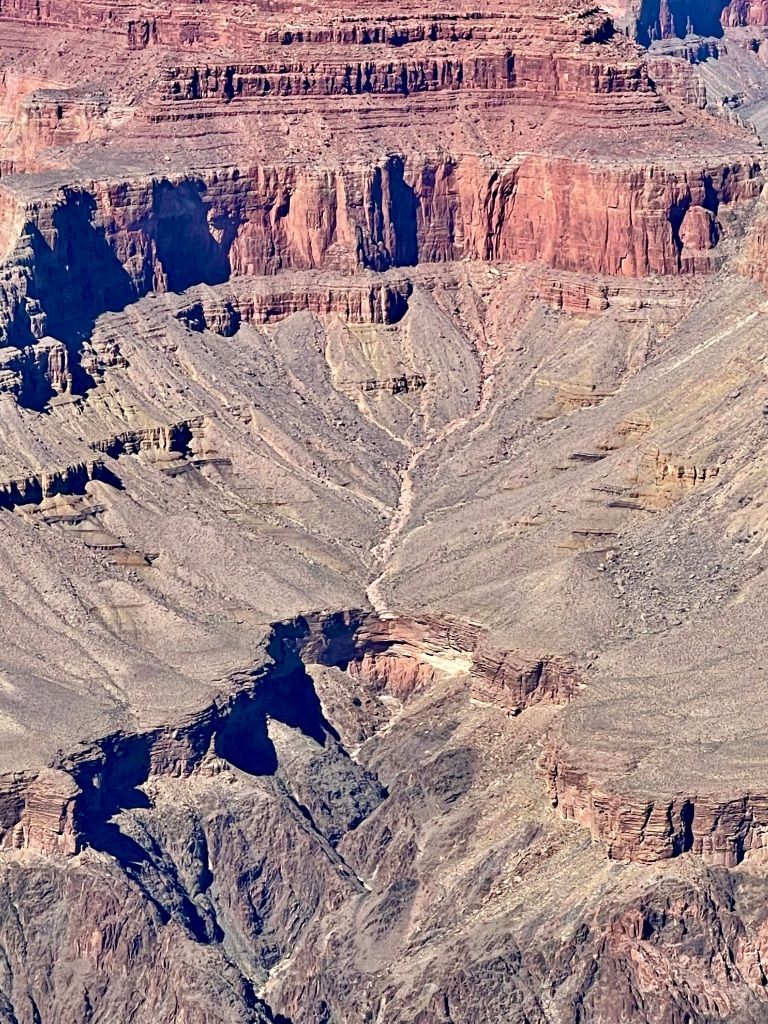
The hike down consisted of huge stairsteps of native stone (12-18” risers!) and sort of a plank road made with split stone, as well as bedrock shale slabs that mostly angled off at about a 30-degree angle toward the cliffs. The trail is not one of the top three maintained by the Park Service, and it has giant boulders in the trail which have fallen from the top over the years…they will never be cleared.
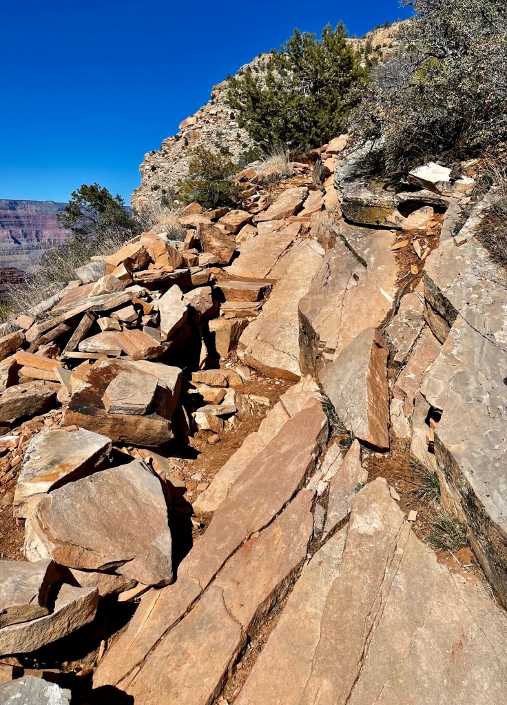


Very hard to make any time on the down hike, which made our decision to turn around shortly after the first junction at the bottom an easy one. Once you reach the bottom of a 1,400-foot drop in elevation, you’ve done half of the hard work. Then eat an energy bar, drink a bottle of electrolyte fluids, and climb back up, on a 16% grade! The views were not very remarkable, which is a shame in the Grand Canyon – I really didn’t think that was possible!
We’ll try to find a hike more to our style and liking tomorrow. Most of the snow from yesterday’s 3 inches is now gone, and we should have a high of 50 tomorrow. Yay!
————————————————————-
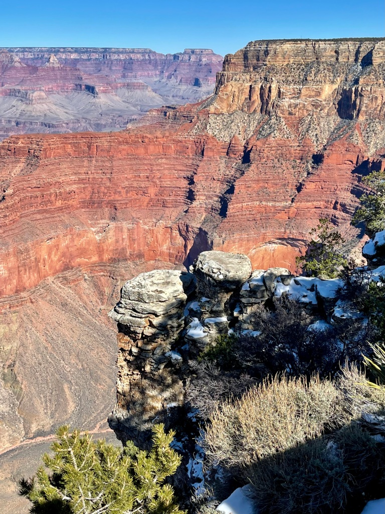
Eight miles on the western Rim Trail was a BLAST today!! We’ve now done the entire Rim Trail except the mile between Pima Point and Hermit’s Rest. There’s a vantage point for photos just about every 500 feet, so LOTs of eye candy.
Our nephews are hiking Bright Angel Trail in May, and we hope to do part of it tomorrow, so we took lots of photos of the trail from the steep descent at the beginning to the flat plateau that leads out to Plateau Point or down to the river. It is quite cool to realize that the North Kaibab Trail we hiked two years ago actually meets up with (and becomes) Bright Angel at Phantom Ranch. If we only had the stamina to do these trails all the way to the river, and the ability to camp at the bottom, we might try a rim-to-rim. But alas, the time for that was probably at least 30 years ago!! But we did see two Golden Eagles today, so there’s that!


Numerous rim viewpoints enable viewing of the Colorado River from above, and because of our intense interest in geology, we never tired of seeing the dozens of layers visible from above. They are so distinct and tell the history of the place so well. We hadn’t realized that the canyon has been flooded numerous times in geologic past, up to the bottom of the red wall, due to lava flows that blocked the river’s exit. That could explain the gentleness of the alluvial flows from the high walls, because the lake probably redistributed some of that rockfall/soil. Also had not realized that the Colorado River rapids are always changing, because of mudslides/rockslides down the canyons during torrential rains (the last big one occurring in 1984).
There are so many fascinating details about GCNP, we learn lots every time we come. MANY families were out on the Rim Trail today because it’s weekend, but we’re so happy to be here during the off-season, because it’s so much more crowded in the spring and summer seasons. We’ll catch breakfast again at the El Tovar Hotel before our descent tomorrow at 8am.
We’ll close today with pix of the glorious sunset against the Canyon walls visible at Pipe Creek.

————————————————————-
Wow. Just wow, wow, wow. What a glorious day it has been.
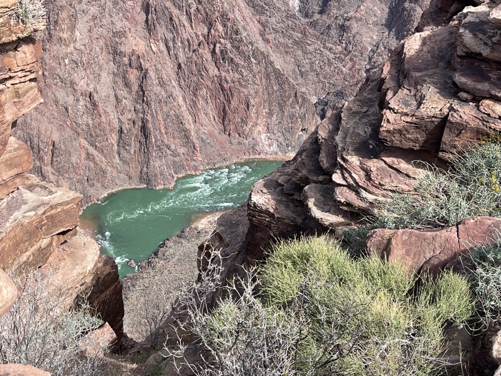
Against all expectations, we made it down 6.5 miles of Bright Angel Trail. And of course, that means we also hiked the 6.5 miles back up, making our hike today a whopping 13.12 miles. Total elevation gain was 3,278 feet (which is 62% of a mile), and hiking time was 7 hours 20 minutes. Grade when not on flat ground: 12%. Ice and snow for first 1.5 miles, necessitating crampons.
When we shake down the numbers, this hike was our personal best EVER!!!! And we are so geeked about it, because we didn’t think we could do it all in one day!!! Already thinking about the next visit to the Grand Canyon, and what we will try for then!!!
A few highlights of the day:
- We beat many hikers half our age re. distance and speed hiked
- We went all the way to the river from the rim, although our end point was on a bluff several hundred feet above the water (Plateau Point)
- Our speed was an amazing 1.8 MPH for the whole hike, and we made it up the 3,278’ at the same speed as our descent
- Started at 32 degrees, temp probably 65 at river edge, back up top 50 degrees and windy


So darn proud of our accomplishment!! At 67 and 69 years old, not too shabby. We’re calling it our version of rim-to-rim because we started and finished at the South Rim, with 13.12 miles in between!


Geology in Bright Angel, like everywhere in GCNP, was spectacular. Along with the usual sedimentary, igneous and metamorphic rocks always highlighted in the books, we saw white and turquoise marble, lots of turquoise (or oxidized copper, if you prefer)-flecked and stained rocks, gigantic cabin-sized rocks that looked like Jadeite, and so very many fossils of pre-Cambrian origin (corals, worms, sponges, early seafloor). And a condor at the rim. Superlative eye candy!


It seemed as if every third person we spoke to on the trail was born outside the US, confirming our longstanding belief that US national parks attract high numbers of visitors from all over the world. Met families from the Czech Republic and Slovakia, who are very worried about developments in the Ukraine, as are we. Hikers are some of the nicest people!!


It will be exceedingly tough to top this hike. We are blissed out tonight, feeling extraordinarily fortunate, and will be ready for another challenging trail….in a couple of days. Grand Canyon National Park is one of the best-managed national parks, and we’ll be back soon.
————————————————————-
In Phoenix now for a week, and we’ve decided not to return to the 55+ RV resorts that have been home for us in Phoenix and Tucson for the past couple of years. Now that our kids are joining us for a week in Tucson, we’ve inquired about pool times for children’s use, and found they are not allowed in the pools, activity rooms or sporting facilities at all!!! Good heavens, that’s just sad. We can understand some limitations, but how do the grandparents who stay at these parks host their grands on Spring Break?
We’ve been lucky to rebook at an open KOA in Tucson so that the grands can play unrestricted – whew!!! That was a CLOSE call. Never even occurred to us that they wouldn’t welcome kids elsewhere.


Had a wonderful hike up Massacre Falls Trail NE of Mesa this morning. 5.4 miles and 1,014’ elevation gain gave us a great outlook over the north face of the Superstition Mountains and lots of desert foliage eye candy. And NO rattlesnakes! Always a bonus.
By mid-March, we aim to be out on the trail in Central/Southern AZ just after daybreak and hit the summit by 9:30am. Otherwise we’re still on the upslope when the temperature hits 70, and that is NO GOOD. We were the first hikers on the trail today, and the birds gave us a terrific serenade all the way. An Anna’s Hummingbird (all-pink iridescent head) buzzed us on our turnaround break. Flowers blooming everywhere. Especially love the Pink Fairy Dusters and Brittle Bush Daisies.
FYI Maskadores Taco Shop is the Real Deal in AZ.
————————————————————-
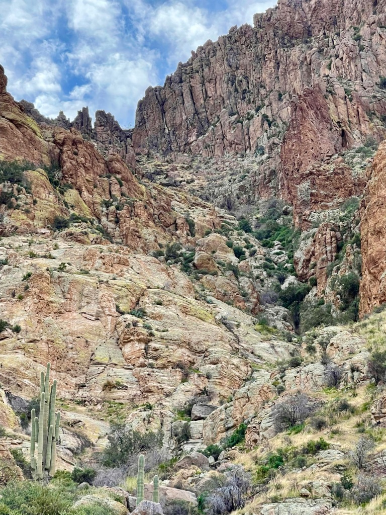
Today’s hike was in Peralta Canyon – we wanted to see Weaver’s Needle in the southern canyons of the Superstition Mountains again and have always loved that area. Turns out that Phoenix will be building a new regional park in the Peralta area, and I think we know why. Dry camping/boondocking/trespass camping is out of control out there, and it’s killing the desert. Suspect it’s an outgrowth of the pandemic, more people camping and there being no place for them at a decent price. But compared to the last time we were here the trails are crowded even mid-week and there are RVs everywhere.


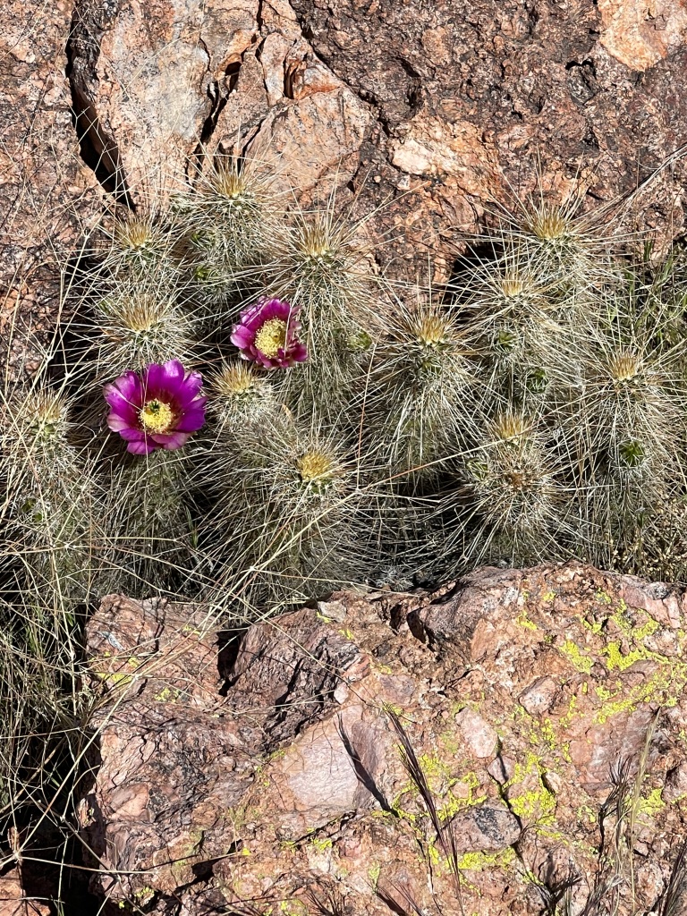
Peralta Canyon via Route 102 was great, and we made it out to the Weaver’s Needle in good time. On the trail an hour earlier than yesterday. We needed the early start, because we got lost off-trail looking for Route 233 (Bluff Spring) as our return. Ended up hiking down slickrock/whalebacks that were about a 50% grade downhill for half an hour, one of our more terrifying hikes back to the parking lot. Eventually made it to the real trail, which was a huge relief, but by then temp was 77 degrees, and we were gassed. Flowers along the way were fantastic (claret cup blossoms on hedgehog cactus, blue phacelia, Mojave asters, desert star, sand verbena, apricot mallows).


————————————————————-
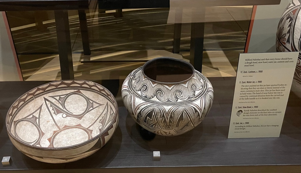
Today was all about a long-delayed reconnection to the cultures of the Phoenix area: our fourth visit to the world-famous Heard Museum of Indian culture and art in central Phoenix, and lunch at Taqueria de Jalisco, for one of the best meals of our trip, possibly a top ten meals of life itself.
There is so much to see at the Heard, we decided our focus today would be on “Away from Home: Indian Boarding School Stories”, and on the heritage of southwestern Indian pottery.
Discovery of what really happened at the Indian Boarding Schools in the US and Canada has exploded across the media in the past two years. The Heard Exhibit documents the purpose and personalities that drove these maniacal places, as well as the destructive transformation worked on Indian children who were stripped of their hair, clothing, foodways and language as well as their families from the 1870s to the late 1960s. Today’s tribes call it the “Hiroshima of Indian education” for its genocidal and deculturization effects. The photos and personal narratives are very difficult to witness, but so important to learn about. The memory of 250,000 Indian children demands that we know what occurred.

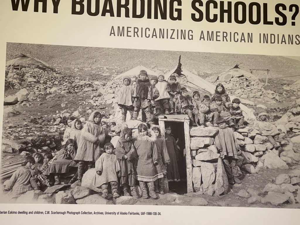


In some ways, this exhibit is a milder portrayal than what one would expect. The systemic sexual abuse of children at these institutions was downplayed, as was the devastating effect upon the adult parents of the children taken. 357 schools operated in 29 states, largely fashioned after the military academy model, and mortality figures were hideously high for new arrivals, resulting in nearly 50% of students dying in their first years at the schools.
It is incomprehensible how such brutality was tolerated until we acknowledge that the US policy was to Kill the Indian to Save the Child. In addition to harsh schooling, behavioral restrictions and corporal punishment for rule-breaking and running away, students were “checked out” of the schools, much like a library book, by unvetted adults in order to put them to work on local farms and enterprises. What abuses they faced there can only be imagined.
It is amazing to realize that 160 of these schools are still in operation today, as they function as the only centers of learning that some reservations have accessible in their areas. And as is the case in places like Santa Fe, New Mexico, some schools were converted in the early 1900’s to tribally run centers of cultural and artistic learning and development, which exerted a largely positive effect upon the children. Why the rest of the schools could not have taken on this model remains a tragic mystery. One hopes that in the day and age of Secretary of the Interior Deb Haalund (Laguna Tribe, NM), any remaining harms of the Indian Boarding Schools will be completely removed, funding will increase and tribal educators/curriculum will be the norm.
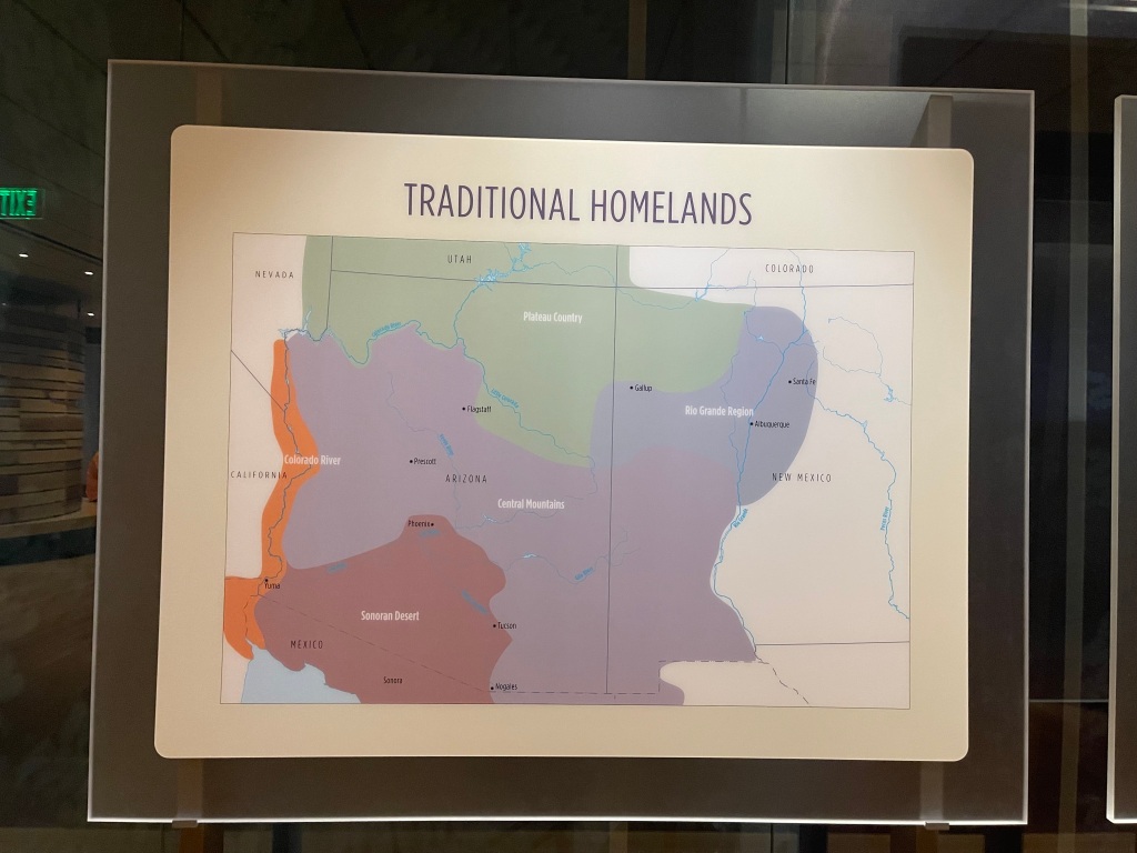
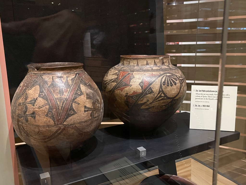
Our visit concluded with a short tour of the “Home: Native Peoples in the Southwest” exhibit, focused on historic and recent pottery art. As the Heard focuses primarily on the five dominant tribes of Arizona/New Mexico, we saw mostly works from the Pima, Diné (Navajo), Hopi, Apache and Pueblo peoples, from 1300 CE to the 1990s. This was an excellent primer for our upcoming stops in New Mexico at the five Pueblos we will visit and at the Hopi Mesas. The hand-built pottery which rivals the world’s top wheel-throwing artists’ work, the incised carving, glazes, micaceous clay and intricate painting of these preeminent works of art…one never tires of seeing them and doing honor to the traditions they represent.


This visit was both sobering and uplifting, and we are grateful that the Heard Museum endures.
Now on to the food:
Our authentic Mexican palates are in still their infancy, as we have really only sampled (and loved!) Oaxacan and Norteño foods. Today’s lunch came at a tiny hole-in-the-wall (best kind) tacqueria on the east side of Phoenix in one of the area’s Mexican neighborhoods. Taqueria de Jalisco serves the food of the district around Guadalajara, Mexico, but with such loving care and homemade goodness, it nearly brought tears to our eyes.
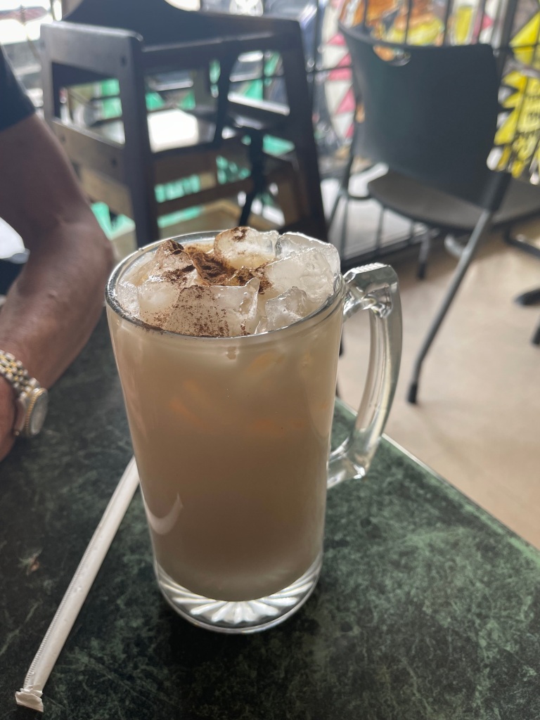
George had the Beef Cheeks Taco and the Taco Al Pastor, while I had the Quesadilla Birria (invented in Jalisco). OMG, such tender and juicy meats, served with condiments and braising broth in a cup. Best. Tacos. EVER!!!!! The proprietor assembles them in 5 minutes, as all the meats are slow cooked in the morning and ready to go. No rice, no beans, just street tacos and a gigantic icy mug of Horchata. We made mmm sounds all the while we were eating. Heaven.

————————————————————-
Some hikers love to go for the summit, for them it’s all about the vertical gain. Some like hand-over-hand climbing or boulder scrambling, where the focus is the sheerness of the ascent. Some like the long haul, like through-climbers who do the Appalachian, Pacific Coast, Continental Divide or other multi-state marathon; for them, it’s the thrill of the longitudinal distance covered.
We met a few of each kind on our hike in the Tonto National Forest today. Had intended to summit the magnificent Picketpost Mountain, as we really do like to get up in the air and check out the views. And there were practiced hand-over-hand climbers ahead of us on the trail at 6:30am. But we were also behind two newbies who took 15 minutes mid-trail to decide which strategy for getting up the next 30 feet. We just weren’t feeling it, so we backtracked after 2 miles and went instead along the Arizona Trail section of the hiking options. And had a WONDERFUL time. Trail was up and down, roly-poly along 3 miles of the Alamo Canyon, and we got eyefuls of the phyllite, slate and iron-stained quartz hills that line the trail. Got to see many different cholla cactus types and almost as many Saguaro cacti as are in the national park down in Tucson. 7 miles total, 1,000’+ in elevation gain.


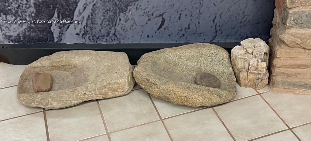
Drove over to Globe, AZ to take in the Besh Ba Gowa archaeological site there. Arizona State University has excavated an early (1250-1400 CE) community in that area, belonging to Hohokam and Puebloan tribes who banded together; archaeologists named them the Salado people. They constructed 200 stone masonry rooms there, some two story and a few three story, and left behind a rich trove of decorated food serving and storage containers as well as baskets, obsidian projectile points, tools, metates and jewelry. Scientists believe they left the area over inter-tribal disagreements at a time of resource scarcity. Later on, area Apache nomads settled in these buildings.


We’d like to spend more time in the Tonto National Forest area, as it appears there are many great hills and mountains to explore there, as well as the Tonto National Monument, which is where there are cliff dwellings where some of the Salado fled after 1400.


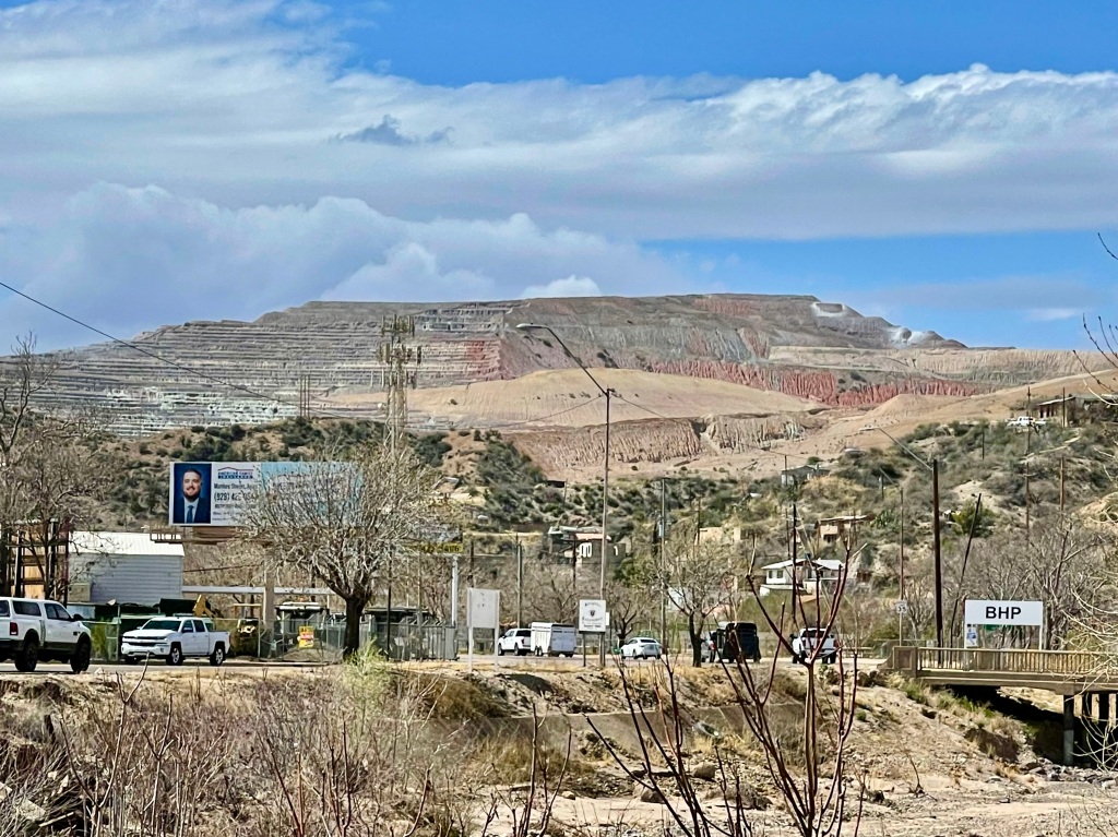
The Queen Creek area is particularly intriguing for hiking. But we’ll stay away from the Miami-Globe area, as it is home to at least five enormous pit and mountainside copper mines which have disfigured all the surrounding topology. This is one of the biggest copper deposits in the US, and numerous global extraction companies are there. Mining is the county’s dominant industry. Unsightly and probably toxic, but a reliable source of employment.


Final activity for the day: another tacqueria! Our favorite from yesterday was closed this afternoon, so we found another Tacos de Jalisco and gave it a try. Not bad. Bit too much spicy salsa on top, and meat wasn’t as succulent as yesterday, but still tasty. Need to do more research!!


————————————————————-
