Wending our Way Home

Mostly focused on racking up the miles, we are bee-lining it to Wisconsin for a meetup at Kalahari Water Resort in the Wisconsin Dells with our kids and grandkids. But along the way, we made time for a quick stop at Teribithia Goat Dairy in Paola, KS, where Vince and Becky Thorpe have a lovely herd of about 35 Oberhaslis, including 12 milking does. We are so lonesome for our goats, who always kidded about this time every year. We fed the Teribithian does apples, cooed and cuddled with them for about 30 min before getting back on the road!

One thing is for certain: after nearly seven weeks of communing with nature, forests and mountains, we are shell-shocked to reenter civilization. It’s more disorienting than the process of leaving civilization…more fatigue, more anxiety, less inner peace, and I miss the trees and rocks and scaled quail talking to us. We’ll be counting the days until we take off for adventure #Three!

Continuing to Learn about Indigenous North American Peoples

This adventure has included many opportunities to see history through native eyes. We saw some of it in San Antonio, Big Bend National Park, Fort Davis, El Paso, Guadelupe Mountains, Palo Duro, TX and Lawton, OK. Yesterday’s visit encompassed the Comanche Museum and Cultural Center in Lawton, where the 15,000 remaining members of the Comanche Tribe live. This is our third visit to a museum dedicated to one tribe alone (the others being the Eastern Cherokee and the OK Chickasaw Tribes. We’ve also seen the outstanding Heard Museum in Phoenix).

It is deeply engaging to see the artifacts and art, to hear the stories and meet people who are focused on their people’s history and culture. The pride is always evident, especially when a special role was played in American history (e.g., 17 Comanche Code Talkers were instrumental in WWII European Defenses and D-Day).

It is also interesting to hear how the telling of history differs, depending on the teller. Anglo Texans shade the stories in a way that stands apart from the Indian way of telling facts. Perhaps this is to be expected. Old animosities and boundaries endure. On a future venture through OK, we’re going to the “Five Civilized (i.e., assimilated) Tribes” Museum in Muskogee and to the Gilcrease Museum in Tulsa, one of the largest collections of all tribes’ art and artifacts. Trying to view the dynamic and the details from all sides.

Last Rock-Geek Post of this Trip!

Our visit to Alibates Flint Quarry National Monument took us to a singular place on earth: the mountains where dolomite rock was turned into super-hard agate rock by silica ash particles from a volcanic eruption in Yellowstone 280 million years ago!! Nowhere else on earth has this occurred in a similar fashion, and it is eye-poppingly gorgeous. Have a look.

The public can only access these ancient quarries, which have been mined by indigenous peoples for at least 13,000 years, by getting in on a once-weekly 2-hour tour given by volunteers and rangers. There are over 700 quarry digs done by paleo Indians, antelope canyon Indians, Apache and Comanche Indians across the eras.  The site is VERY remote, and visitors CANNOT keep any of the fantastic rocks to be seen. But just knowing/seeing such beauty is a pretty cool thing, in and of itself. We’re happy campers.

On the way home to our MoHo, we saw many Swainson’s Hawks. They are as ubiquitous here as our Red-Tailed Hawks are at home. Big, burly and super-swoopy. Gorgeous raptors.

Heaven for Hikers, Bikers and Birders beneath the Spanish Skirts

Ok, first, “Spanish Skirts” is a reference to the conical, flared rock and soil formations at the bottom of the Palo Duro Canyon. Easy to visualize what is meant when you actually see them, right?

Screen Shot 2017-03-06 at 4.12.56 PM.png

We had another wonderful 8.4-mile hike on the GSL Trail today. Since I have been ITCHING to get down into the intense red earth, I was delighted to discover that the entire path ran on soft red clay. Such a treat for the eyes to get up close and ogle the rock formations, and since the earthen path was so soft, it was like hiking on foam rubber!

Screen Shot 2017-03-06 at 4.07.43 PM.png

GSL is a multi-use trail, so we had ample opportunities to cross paths with bikers, joggers, birders and other hikers. Since we have hiked 7 of the last 8 days, it was a relief to have the entire trail running mostly on level ground and not at elevation. Time for a rest from the climbing! We’ve clocked nearly 50 miles, much of it with substantial climbs in elevation.Screen Shot 2017-03-06 at 4.06.00 PM.png

The Palo Duro Canyon runs much further than the borders of the park. We wanted to drive somewhere that was not on park property, to stop at road cuts and collect interesting rocks.

Ranger Jeff pointed us in the direction of Farm Road 207, so we took off after lunch for prospecting. Got a lovely cross-section of specimens, including dark red claystone and satin spar gypsum. Yay!! Our granddaughter is gonna love them, to say nothing of our rock-hounding friends!


The Grand Canyon of Texas

Several months ago, Palo Duro State Park was plunked into the itinerary, with no clear idea of the majesty on display here. It was just a convenient TX state park on the way to Amarillo. Turns out it is one of the best hiking parks in the state, a rainbow of many-colored rocks on display across 250 million years of erosion. Ochre, burgundy, verdigris green, carrot orange, deep chestnut brown, lavender, burnt umber, charcoal black, and smoky white rocks and packed earth delight the eyes. The canyon is composed of claystone, gypsum, mudstone, sand, silt and caliche (a calcium carbonate rock), with tumbled quartz, selenite, celestite, malachite and agates thrown in for good measure. No rock-harvesting allowed, though, and it’s a good thing. The beauty is left for viewing by generations to come.

We hiked about seven miles today through the Rock Garden Trail, at the rim and deep down through the canyon. Can’t get enough of the views, and we have to admit, late afternoon is our favorite time for views, when the light is golden and the shadows are long. Unforgettable. But once again, the WINDS blowing in west Texas are crazy!! The memories of grit in our teeth will stay with us forever.

Finally, Guadelupe Mountains National Park!

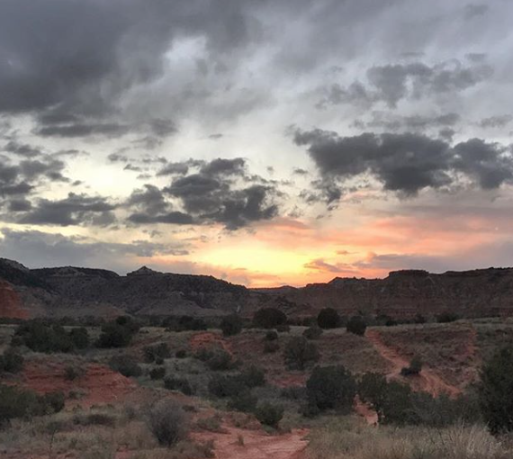
The stalling and delays have gone on long enough! We pulled out of El Paso today and barreled eastward across the Chihuahuan desert to Guadelupe Mtns NP, which by now has neither snow nor sub-freezing temperatures. And since the furnace is now fixed, we don’t have to worry as much about the nights being cold.

Screen Shot 2017-03-06 at 2.31.28 PM.png

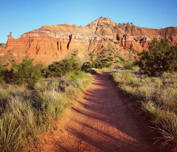
The first hike, to a destination called the Devil’s Hall, was an exhilarating and slightly hazardous 4-mile scramble through boulder-strewn washes and up into a limestone slot canyon – simply magnificent.

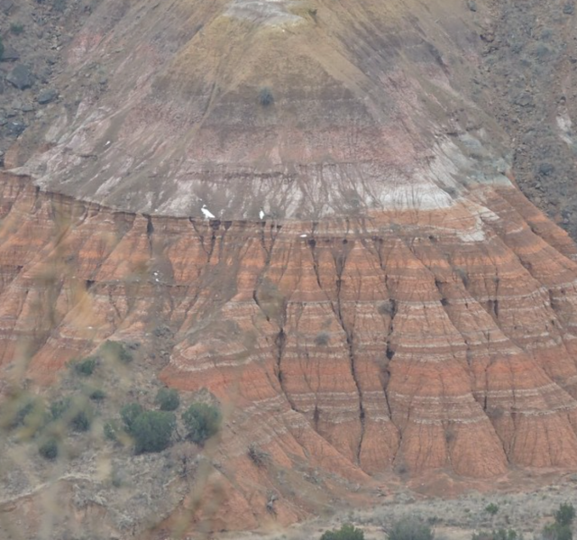
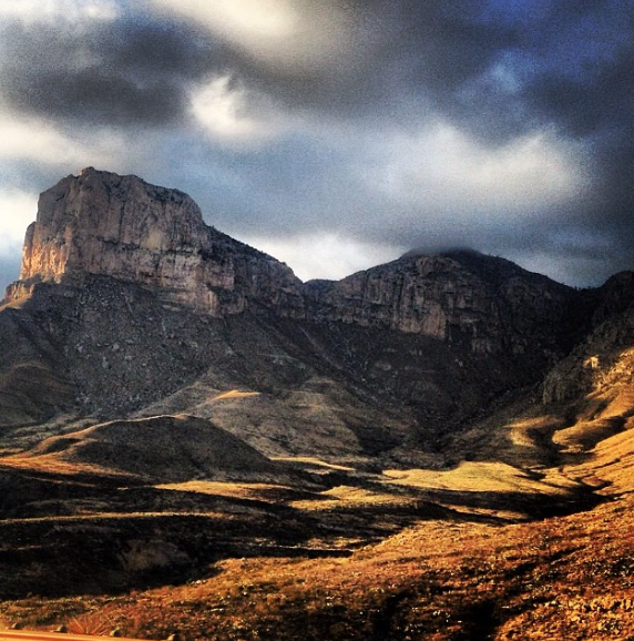
The second hike had been anticipated for weeks: a 2.2-mile hike up to the top of a 1400-foot limestone reef!! The Guadelupe Mountains are part of what was once a large marine reef arc, submerged in a vast inland salt sea some 260 million years ago. The reef was uplifted by tectonic forces about 50 million years ago, the sea dried up and what you now see is a series of limestone and dolomite mountains which encase billions of fossilized animal and plant remnants, life in the former reef.

As we rose through the higher elevations, the path led between the main mountain and a tall piece of not-quite broken-away limestone (as big as a semi-truck on end). What remained between was a curious and luxurious little microclimate: an Eden protected from wind and the worst of the mountain’s weather, it sheltered trees, shrubs, cacti, grasses and ferns. After 150 steps, it was gone and we were back to wind-whipped rock along the arid path.

Every section of the trail reveals a view of fossils that were once either sponges, one-celled marine creatures, clam-like brachiopods, coral and algal remains, fusulinids (shell-housed amoebas), ammonoids (like the multi-chambered nautilus), sea fans and stromatolites (some of the very first intertidal communities to exist) embedded in the rock.

The hike was totally fascinating to both of us…except for the 45-mph winds which nearly blew us off the mountain. Only two other hikers braved the weather, so we nearly had the mountains to ourselves. We hiked to the very top layer, and looked out through a saddle gap to see the hills and valleys around us.

The Permian Reef era is so significant that Permian is actually a named slice of geologic time, similar to triassic or jurassic. As is Guadelupe. I know, I’m geeking out now. Back to pix!

The following two days included two splendid hikes, one of which was a peak experience for us – up to the 8,700 ft.-high Guadelupe Peak. Over the course of seven hours we hiked 8.4 miles with an elevation gain of 3,000 feet, into the stratosphere. This mountain is the highest in Texas, and on a clear day (which we had!) you can see hundreds of miles, south to Mexico, North to White Sands and the Sandia Mountains (snow-covered), east across the vast flatlands of west Texas. We had a picnic lunch on the summit, and were dive-bombed by peregrine falcons hunting for songbirds to eat. Nearly as many fossils to see as on the previous Reef trail, along with huge outcroppings of selenite and calcite. Glorious, and like nowhere else we’ve ever been!

El Paso Conspires to Keep us in Town

We wandered west to El Paso as a brief waystation to Carlsbad Caverns and some other New Mexico sites that are warmer than Guadelupe Mountains, which had been reported to be seeing snow and sub-freezing temps (for that, we could be in Michigan!).

But fate took a hand, and we ended up “stuck” here for four days while our Moho furnace was being fixed. Making the most of this delay entails sightseeing in the city’s historic district,

hiking in the Franklin Mountains State Park,

and taking in the Archaeology and Art Museums downtown.

Saw a fascinating National Monument called Chamizal, commemorating a land dispute between the US and Mexico that was settled amicably…after 100 years of conflict over 600 acres of river bottom land.

We also scooted up to Truth or Consequences, NM for their lovely hot springs baths,

and over to White Sands National Monument for a 4.5-mile hike over the sands and alkali flats. White Sands offers sand dune surfing, but we opted for the walk instead. From the sands you can see all the way to the snow covered peak of Sierra Blanca near Ruidoso, NM (20 miles away).

The El Paso Art Museum’s featured an historic grouping of African American artists’ works on paper, which was marvelous. Then we made a trip to one of the only rock shops in the city, where George bought my Valentine’s Day gift: two beautiful cabochons, one of mookaite jasper and one of sarape jasper. The first is from Australia, the second from Chihuahua, MX. We seriously considered going into Juarez for an afternoon, but called it off as an underprepared jaunt…maybe next time. All in all, we were taken with El Paso, which has the nation’s most beautiful urban freeway, the Transmountain Highway up across the Franklin Mountains on the edge of the urban zone.

Seriously? A full moon NOW?

Heading up to Fort Davis, TX from the Big Bend area makes sense if you have reservations for starwatching at the McDonald Observatory (a campus of the University of Texas at Austin), which we did. But it seemed very bad luck to get there at the same time the moon reached its full phase. Until we got there.

Screen Shot 2017-03-06 at 3.04.17 PM.png

Upon arriving for McDonald’s “Star Party,” we and over 100 other guests were ushered into a one-hour informative theatre discussion about all things Lunar, which was great fun. A humorously-gifted researcher led the conversation on topics like “Why is it we only see one side – the lit surface with the familiar craters and ‘seas’ — of the moon’s surface, never the Dark Side?” (because the moon is in synchronous orbit with earth and always turns her lit side to us), and “What are the relative ages of the moon’s various ‘seas’ and craters?” (they range from one to four and a half billion years old. This confirms that the moon is almost the same age as the earth, having been formed from a large space object that collided with earth and combined with some of its fragments to form the moon we know). We now know a lot more about the moon’s Seas of Tranquility, Serenity and Crises, and the craters Tycho and Langrenus than before, and why the Apollo Moon Missions landed where they did.


Screen Shot 2017-03-06 at 3.02.23 PM.png

At 7pm, the crowd went outside for a brief presentation about the constellations in the night sky. The moon had not risen yet, so the clarity of the stars was brilliant and not yet dimmed by lunar light. Even the Milky Way was visible. For those of us who can never find Cassiopeia, Pegasus or Orion up there, we had some mental Aha’s and think we can now find them when we are home on the farm. After the moon rose, we moved on to the telescopes, which number into the dozens at MacDonald. We got to see the Nebula in Orion’s Sword, Venus in her brightest phase, and several open-star clusters whose images are so far away that we were viewing what state they were in, some 1438 years ago (they’re 380 trillion miles away). We skipped the close-up of the moon’s surface, as the line to see it was about 50 people long and the temperature outside had sunk into the high 40’s.

Screen Shot 2017-03-06 at 3.07.35 PM

It’s hard to keep a perspective on how large the cosmos is, but the rate of change is quite like the geologic calendar. Several of the stars visible in the sky have an orange cast, meaning that they are Red Giants (a star in decay, getting ready to explode and disappear). Our own sun will turn into a Red Giant in approx. five billion years. If earth and humans survive that long, we’ll have to find somewhere else in another galaxy to live by then, as our own galaxy will be annihilated by the explosion when the sun goes. So, earth is just about halfway through her life cycle. Fascinating.

Hanging out, Rim-side


So, a confession: although it seems redundant to visit Big Bend Ranch State Park, right next to Big Bend National Park, we wanted to see something extraordinary at the former that was unavailable at the latter: a 36-million-year-old caldera. Its 10-mile diameter was not even recognized until technology allowed it to be seen and photographed from 10,000 feet above.

To get to the rim, we braved the worst road we’ve ever traveled: 35 miles of grinding gravel, ruts, gouge-outs, rubbled washes and generally just abominable boulder-strewn dirt paths. Had hiker’s lunch at Fresno Canyon, just outside the crater itself.

The canyon was far, far more beautiful than the caldera, another 5-mile hike over basalt and rhyolite rocks. We then drove to within ½ mile of the crater rim. The road went no further.

As we’d already had our hike and the temps were 85+ degrees with NO shade, it was decided to look up the images inside the caldera on Google Images and let it go at that! As you can see, though, the raw power of nature is fully evident and awesome! Ten hours for the entire excursion, and we stumbled back into a darkened camp with huge thanks for no mechanical or human mishaps along the way.

What a treat to see four adult wild burros and a baby standing in the dusk-lit dirt path about halfway home. We also saw a magnificent fully antlered (12 points, at least) mule buck guarding his harem while the ladies grazed, two red-tailed hawks taking dinner back to their nest to share, a jack rabbit, a cottontail and 20 scaled quail on our drive/hike. We always see Roadrunners out here, so they are getting to be as ordinary as the doves in the skies. But always fun….they look like nature’s prankster.

Floating the Rio Grande

Yesterday was a day off from hiking. We hired a river guide in Terlingua who drove us and four other people into Big Bend Ranch State Park, to catch about nine miles of the gently rolling Rio Grande and a float through Dark Canyon (so named because of the dark rhyolite and basalt rock that makes up its 1,000 vertical walls). The guide had us laughing uproariously at his tall tales and corny jokes, and he was vintage Terlingua – a laid-back 40-something outdoorsman with a very liberal attitude toward life, politics and rules. We’ve spent quite a bit of time in and around the Rio Grande, and wish we could see her when the water is running at whitewater levels. As it is, Colorado and Mexico upstream take so much water out of her tributaries that the only way she is full of water, rapids and vigor is after a deluge rainstorm, when she swells her banks and floods everything in the vicinity to a height of five feet.

We also rock-hunted yesterday for rhyolite, tuff, and anything else interesting that we could find in road cuts and non-park public land. Collected some nice specimens, along with a section of quartz veining in limestone that our granddaughter is just going to love. It is hard, but we abide strictly by the rules in the parks: no taking of artifacts on park land, including stones of any kind.

Here’s a glimpse of Terlingua, a nutty little artists’ and musicians’ colony on the edge of Big Bend.

One last look at the beautiful Rio Grande by sunset:

20170203_180155

Tomorrow we leave for camping and hiking next door in the Big Bend Ranch State Park. A big surprise awaits!